Mt Cook National Park is home to New Zealand’s highest mountains and largest glaciers. It’s signature mountain, Mt Cook, is the highest mountain in New Zealand, reaching 12,218 feet. The park is located in the middle of the South Island, in the heart of the Southern Alps.
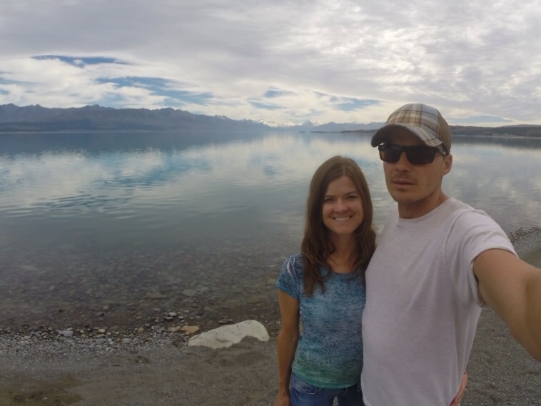
On our way to the park, we made stops at Lake Tekapo and Lake Pukaki. Lake Tekapo is known for its brilliant turquoise blue color. The brilliant color comes through when the sun shines on fine particles of rock dust brought down from glaciers in the headwaters. It was too cloudy the day we were there for the color to really come out, but the waters were still brilliantly clear and beautiful.
at lake tekapo
crystal clear waters
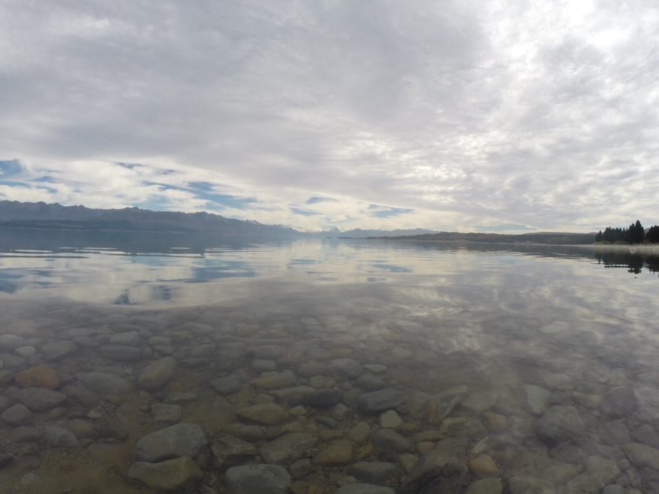
church of the good shepherd which overlooks the lake
About 30 minutes down the road from Lake Tekapo is Lake Pukaki, which sits along the turnoff to Mt Cook National Park. From the southern shores of Lake Pukaki are fantastic views of Mt Cook and its surrounding peaks.
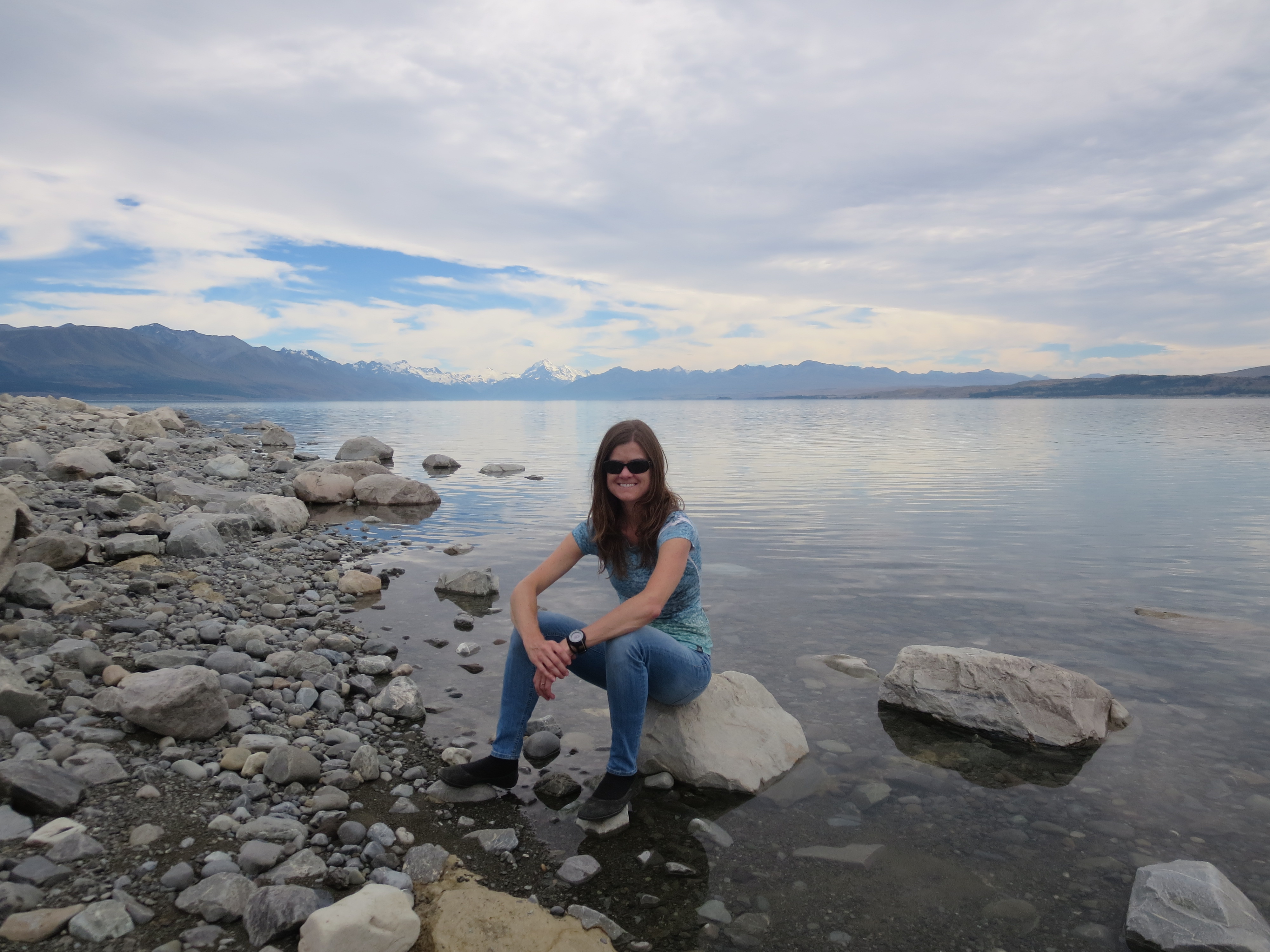
at lake pukaki
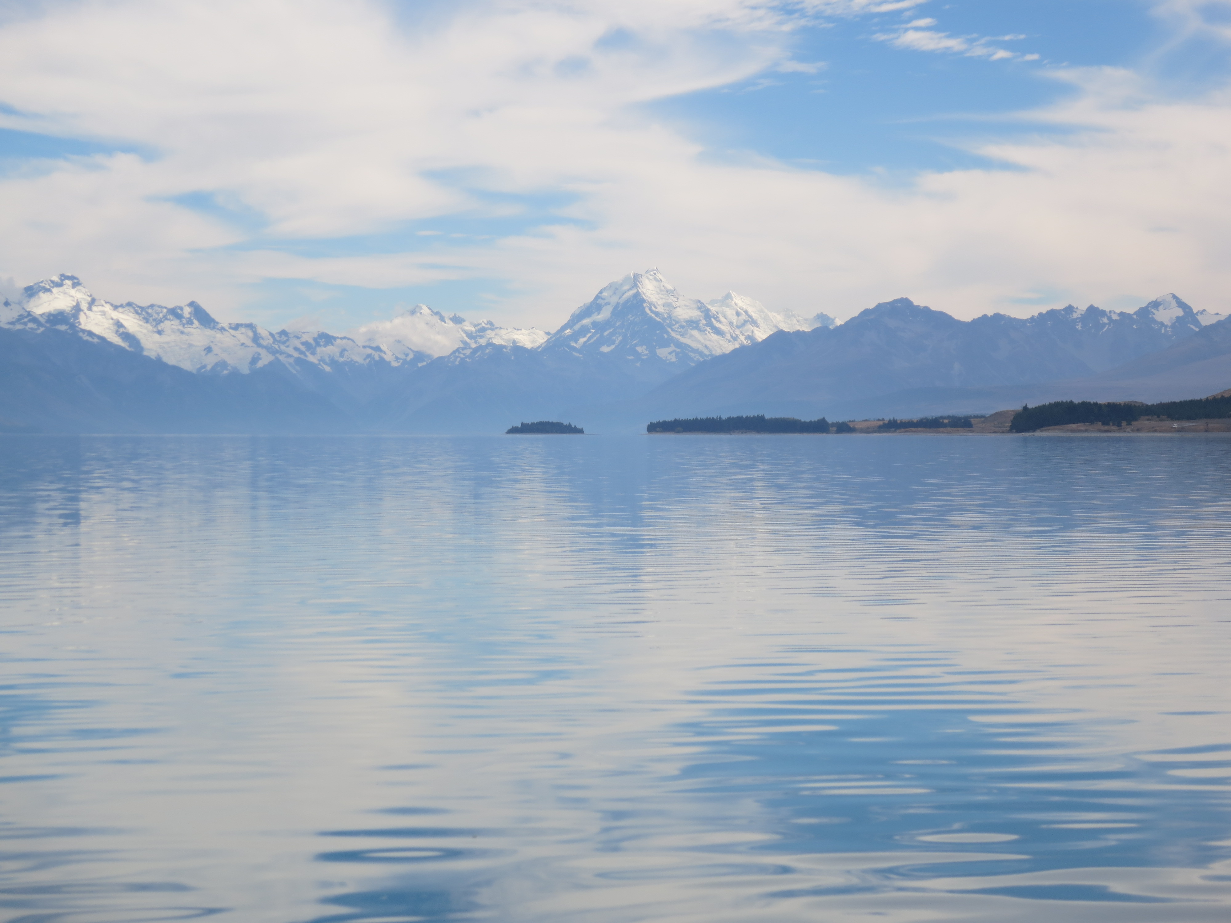
picture-perfect views from the lake
Next, we followed the road along Lake Pukaki to Mt Cook National Park. The scenery was spectacular.
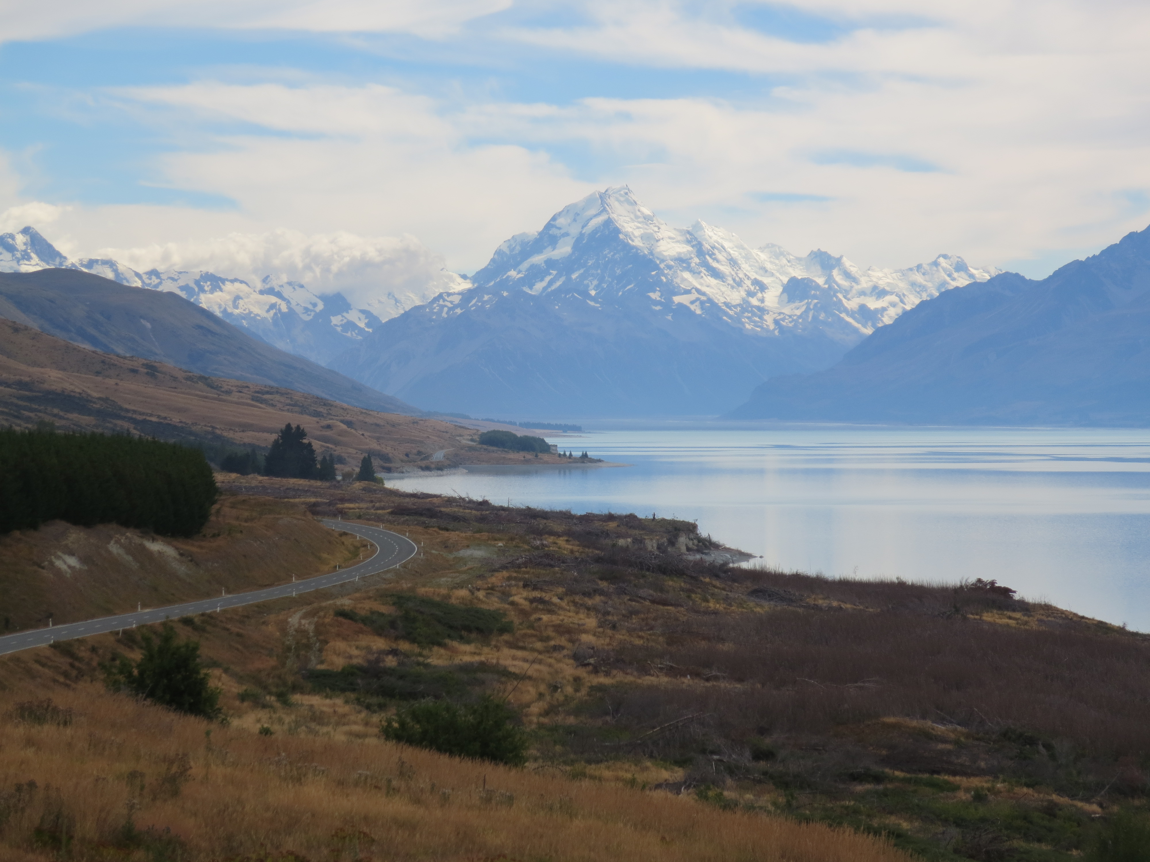
now this is what I call a scenic drive!
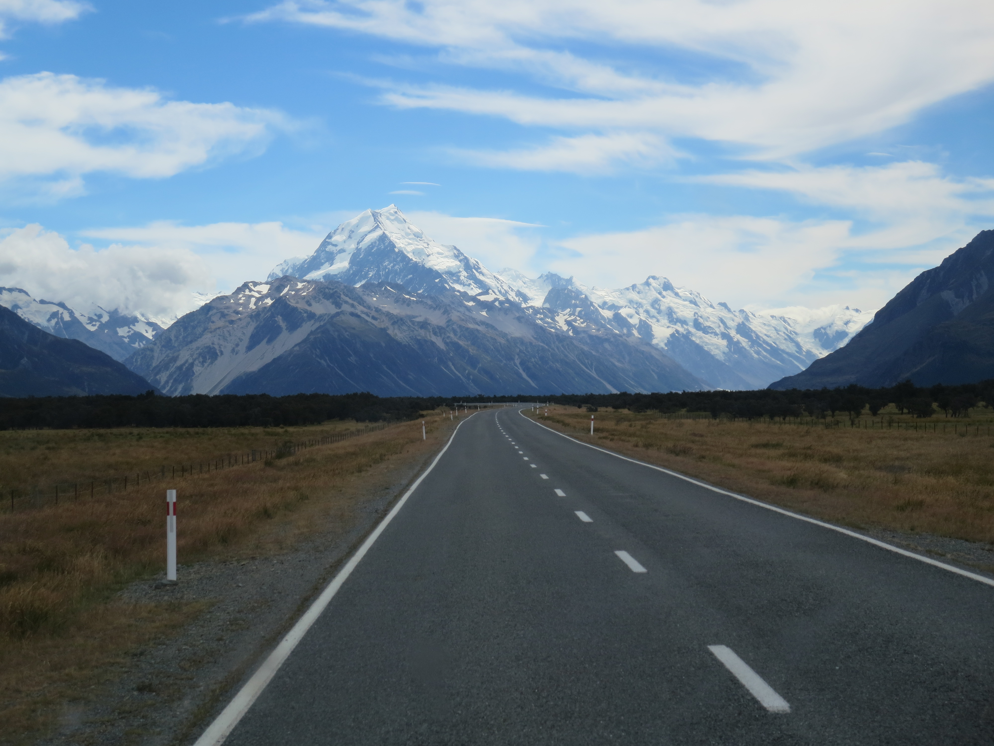
soaking in the views as we make our way to the park
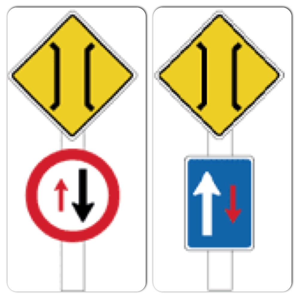
As we made our way to the park, we crossed a number of one-way bridges. Most of the roads in New Zealand are two-lane and become one-lane (one-way) where bridges are necessary. We’ve encountered countless one-way bridges during our travels around NZ. Thankfully, we were warned about them beforehand. At each one-way bridge a sign is posted, indicating which driver has the right of way. The red circle sign means you must give way; the blue rectangle sign means the other driver must give way.
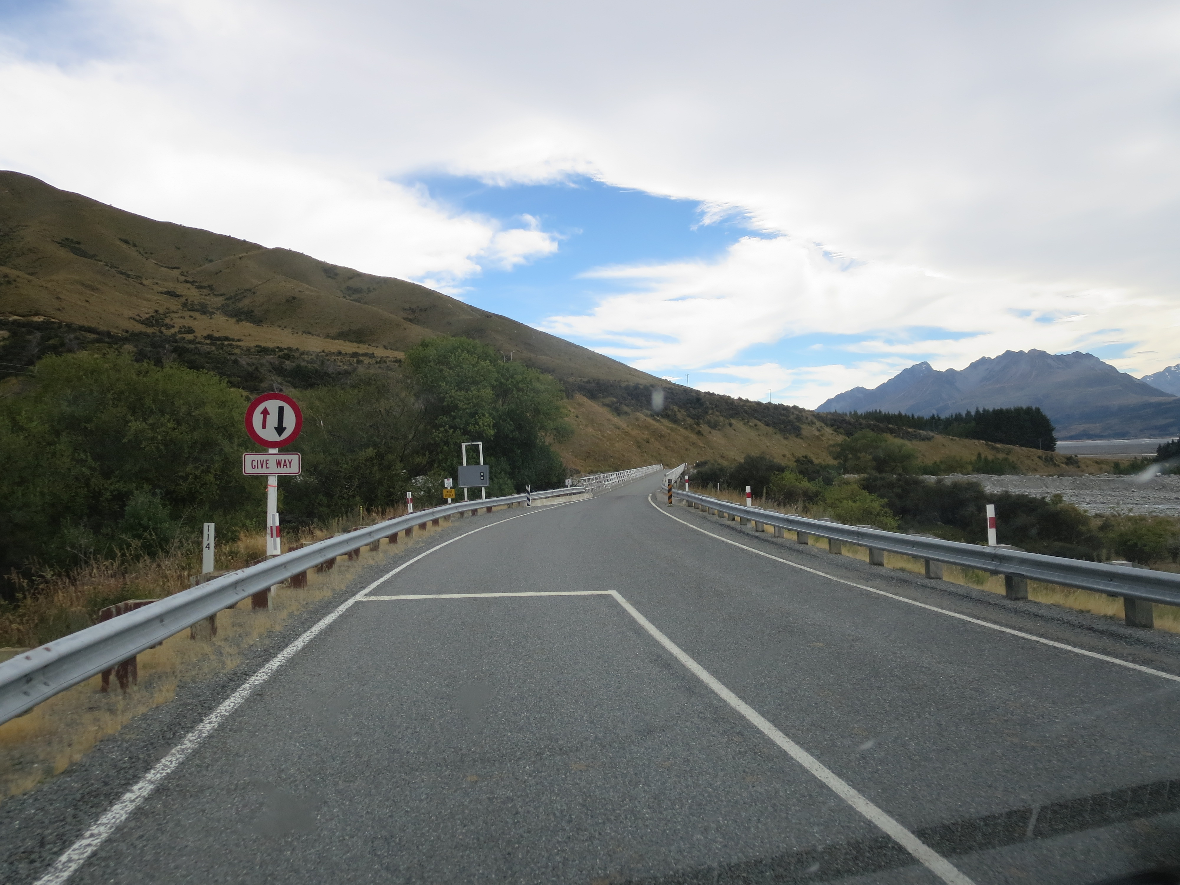
approaching a one-way bridge
The one-way bridges didn’t seem to bother Jay much; roundabouts, however, are a different story. Those are everywhere too, and when you’re driving on the opposite side of the road from what you’re accustomed to, roundabouts can get really confusing.
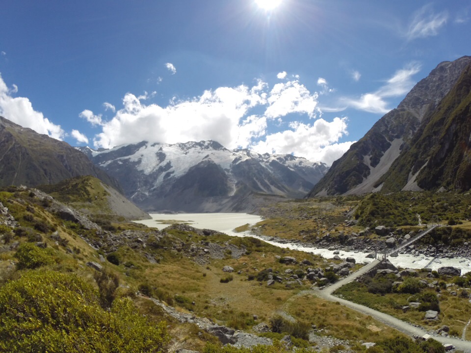
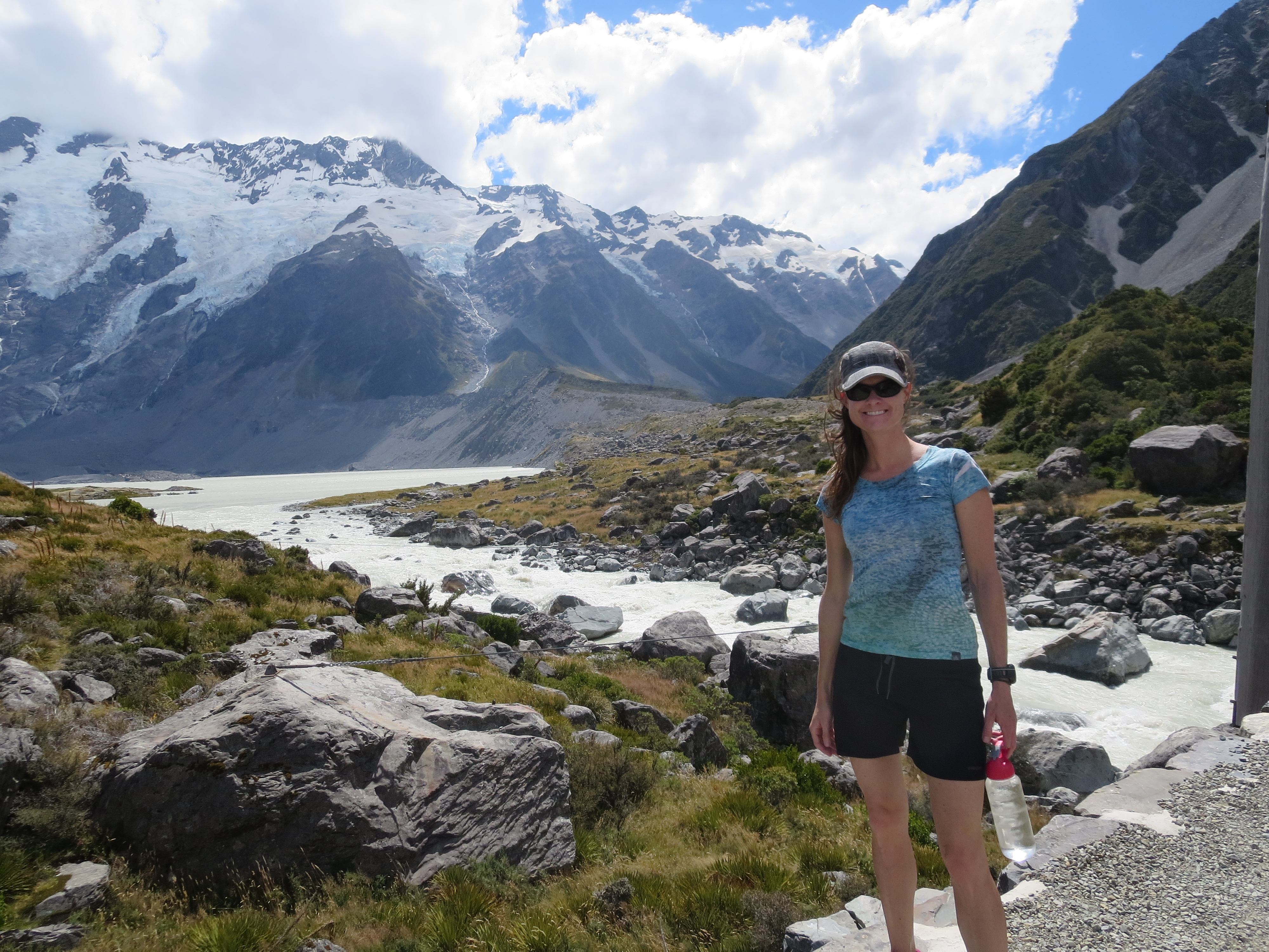
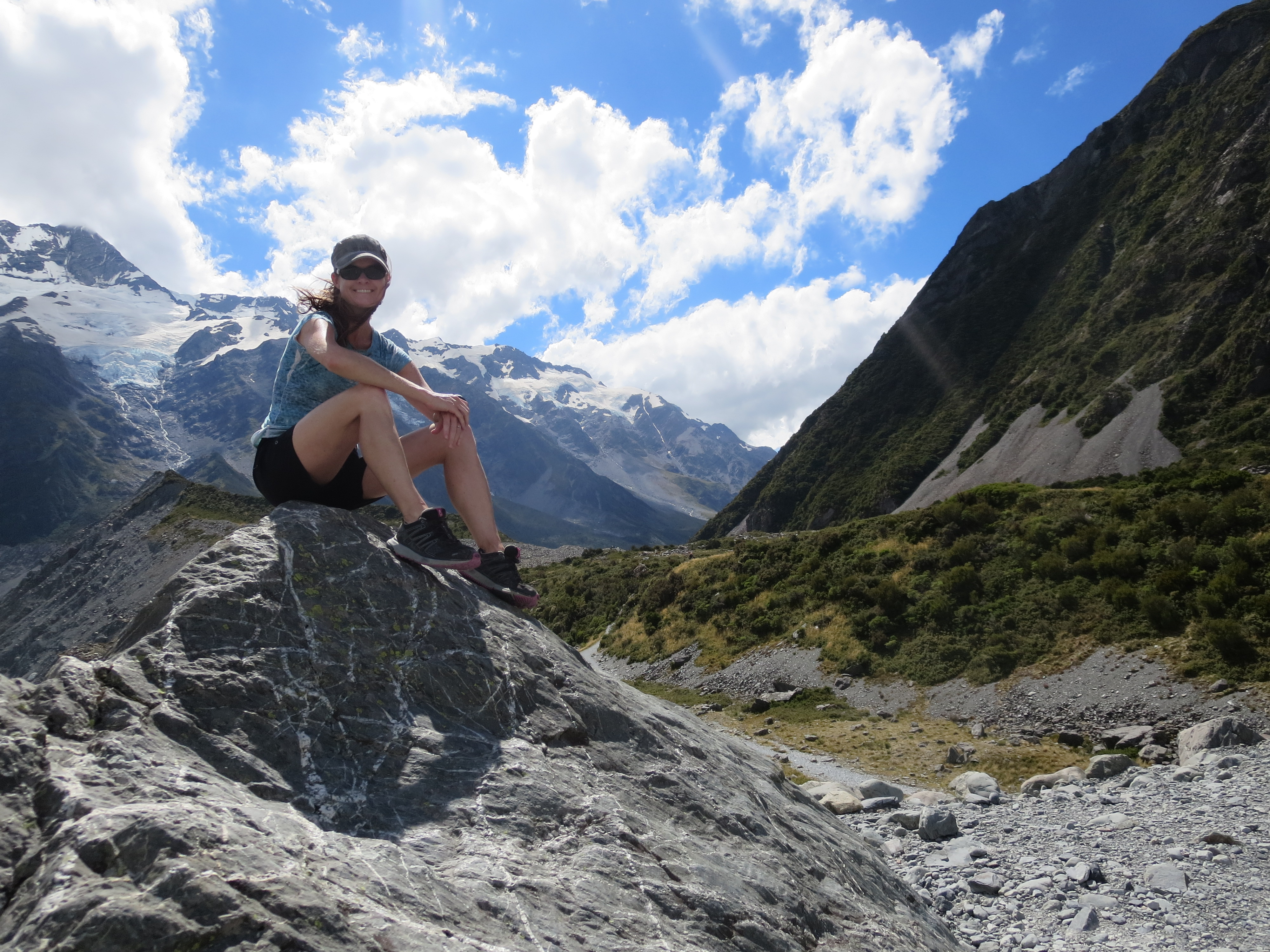
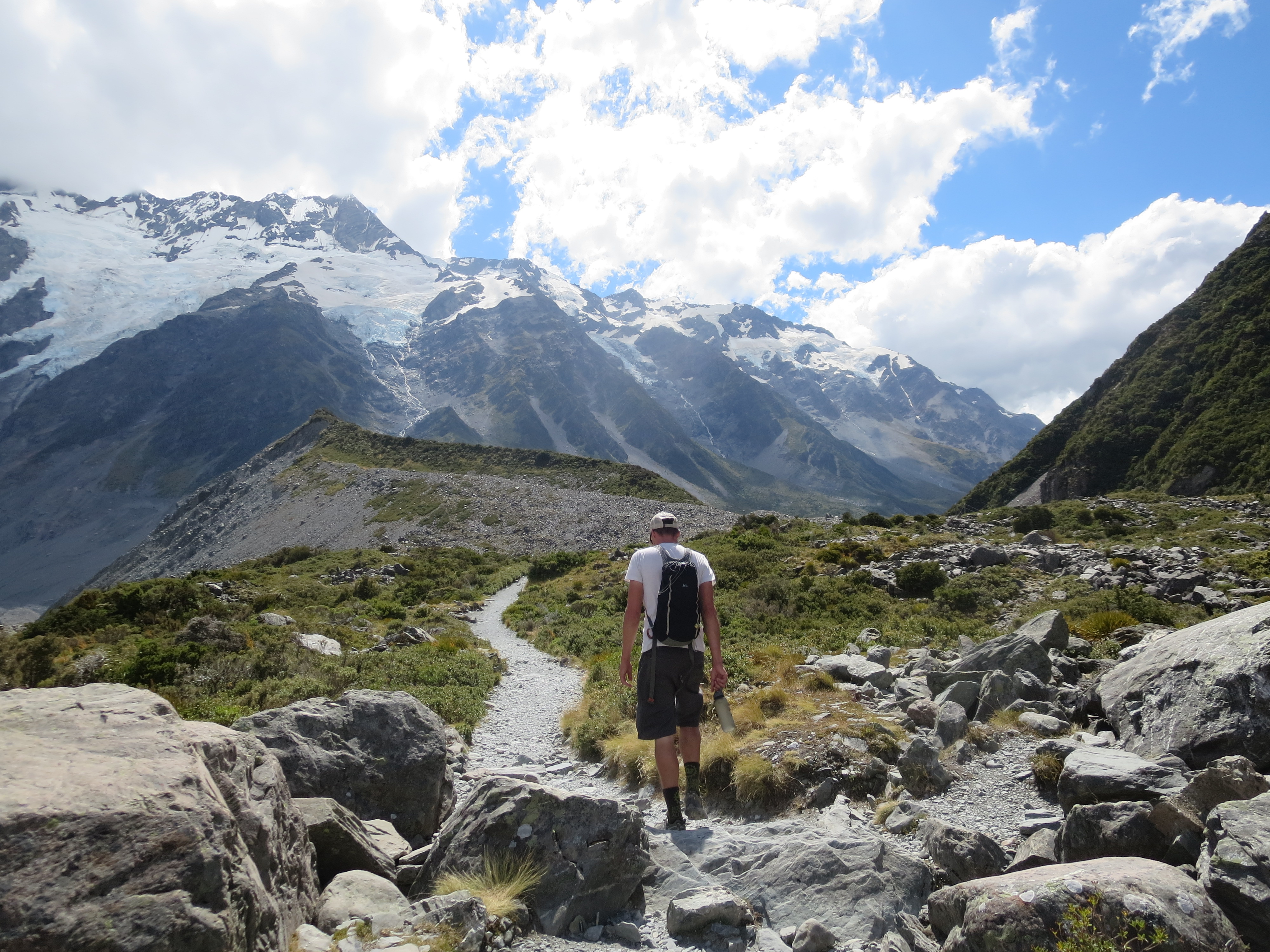
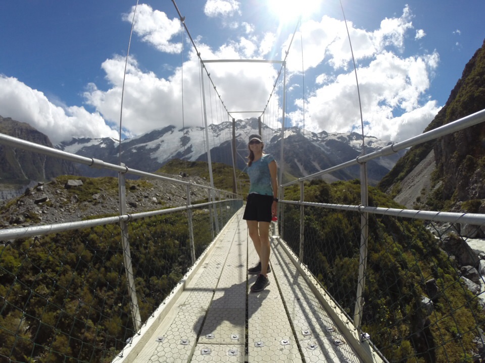
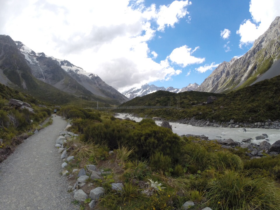
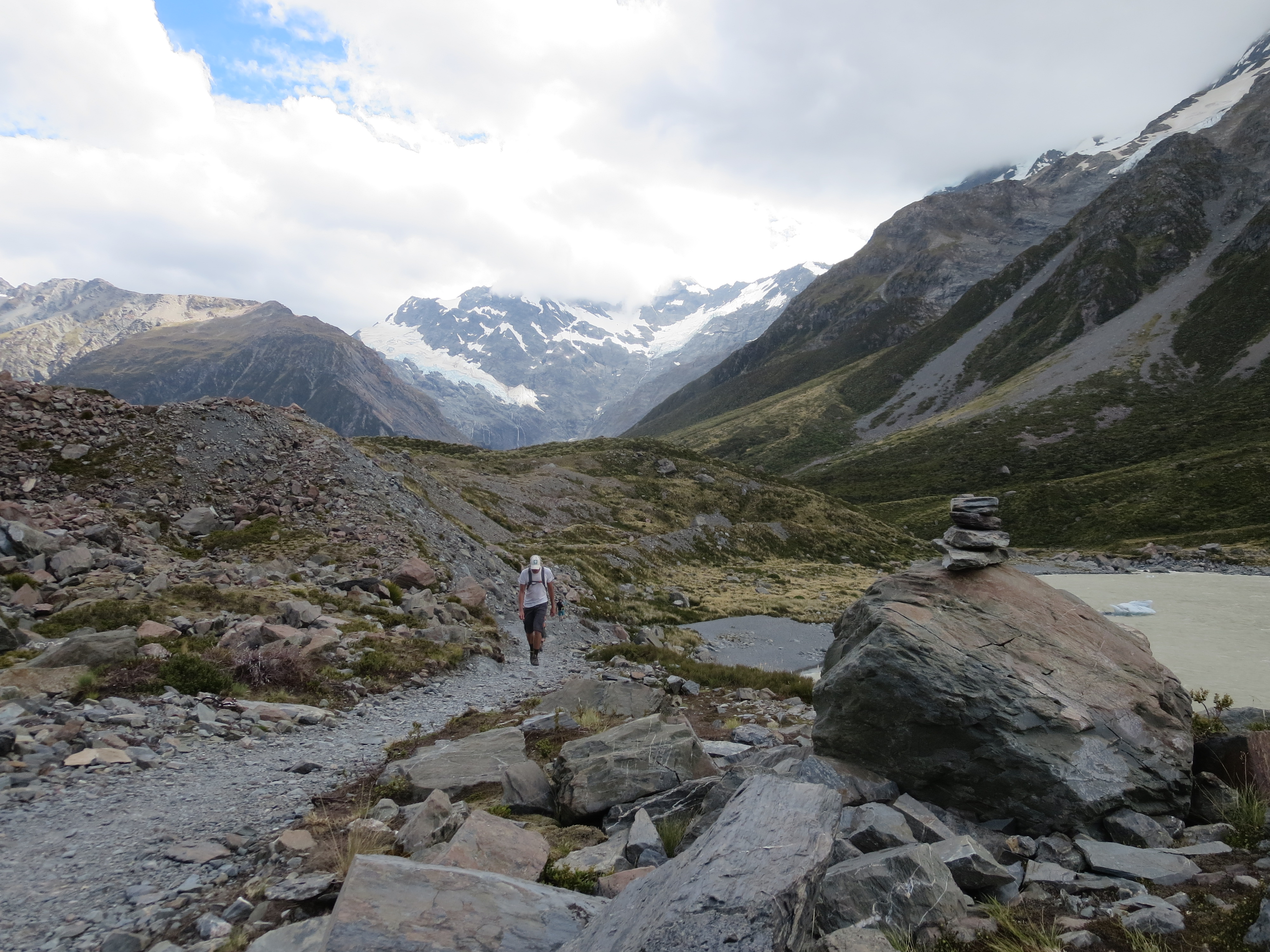
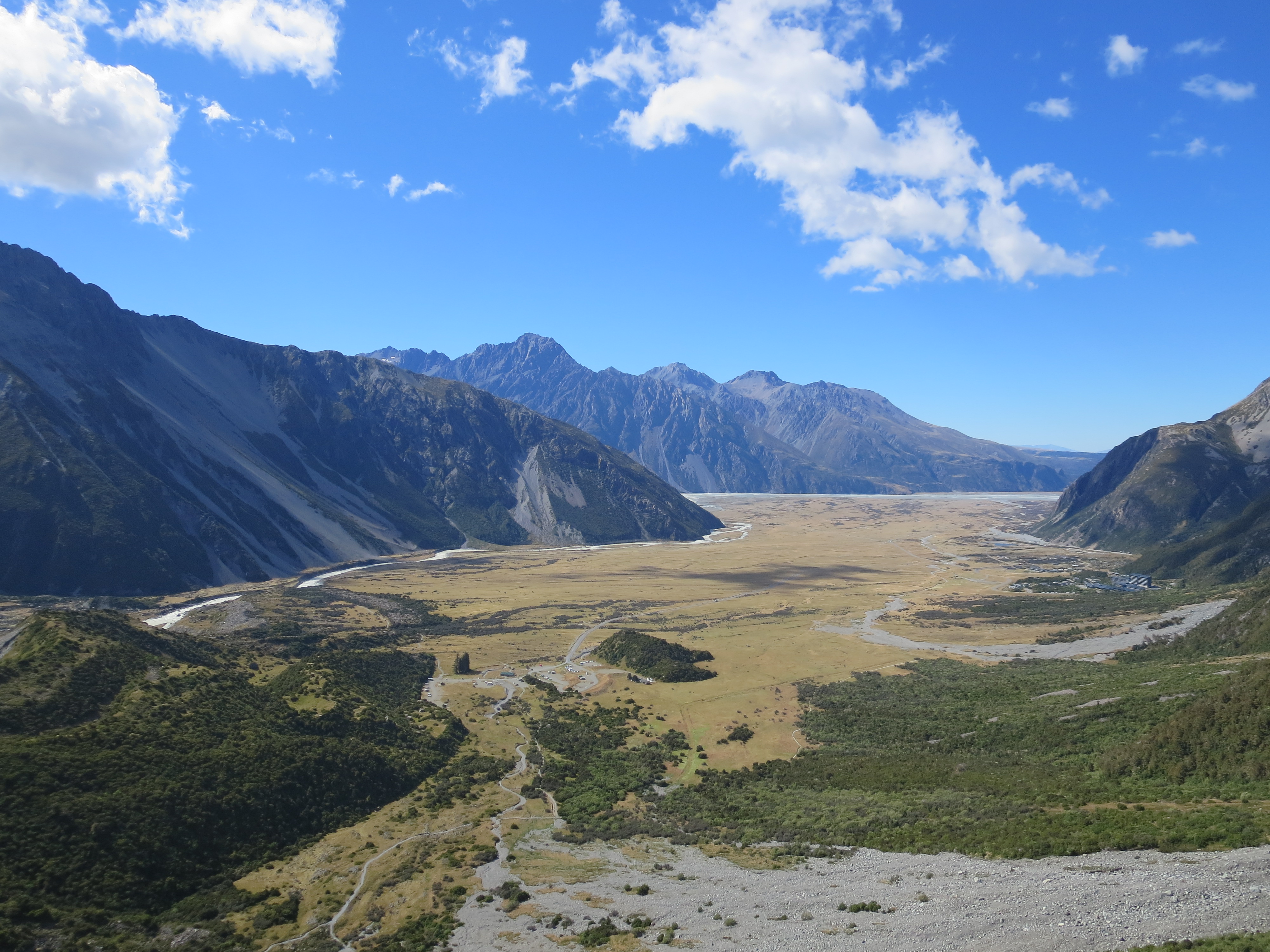
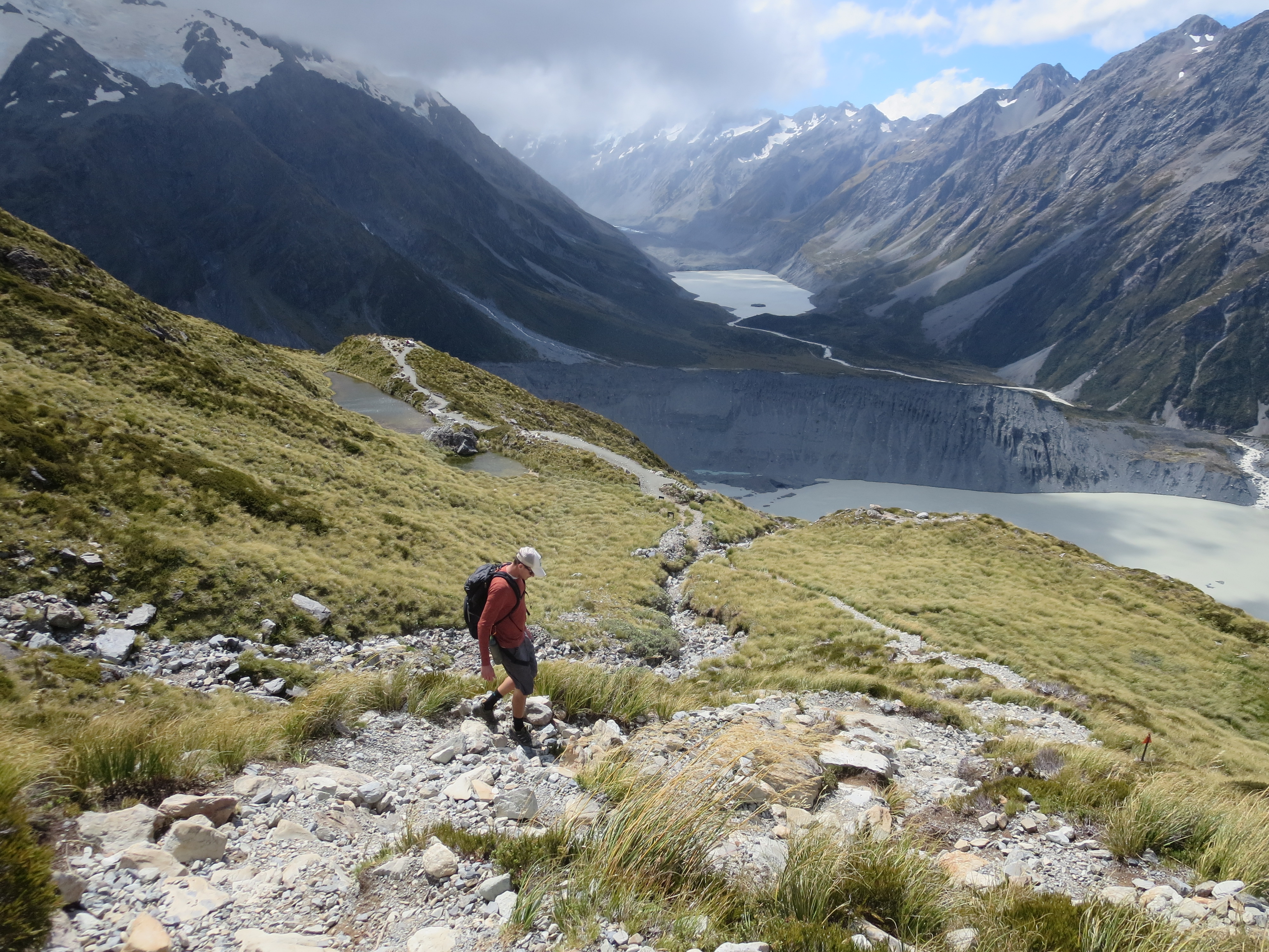
When we arrived at the park, it was warm and sunny, but a storm was just starting to blow in. Not wanting to waste any time while the weather was still nice, we quickly set off to hike the Hooker Valley Track. The track leads up Hooker Valley towards Mt Cook. One hundred years ago, the entire valley was a glacier; now, you hike three miles through the valley before you see the edge of Hooker Glacier. It’s a beautiful hike; I’d consider it a “must-do” if you visit the park. From the campground trailhead, the hike takes about three hours round-trip. The trail is pretty flat, so easy on the legs, yet the views are sensational. As an added bonus, the trail crosses over three suspension bridges (called swing bridges in NZ).
at the start of the hike, windy but warm
and we’re off
the view as we make our way to the first suspension bridge
about to cross the bridge
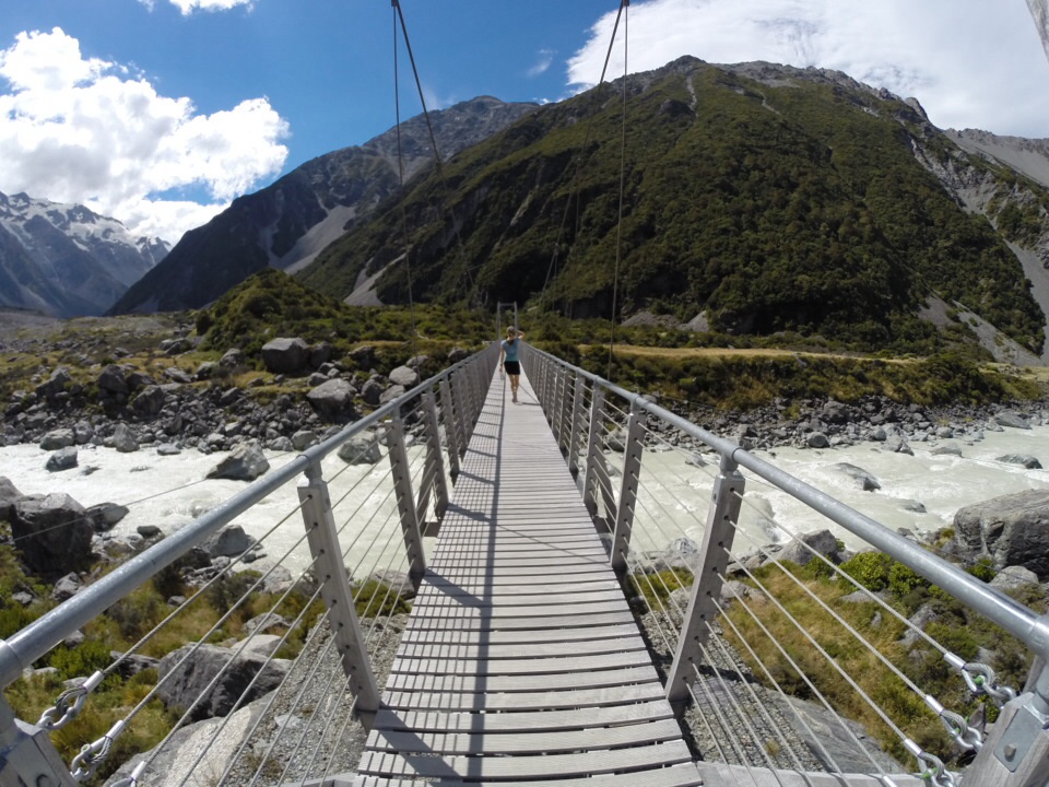
crossing the first suspension bridge, over the hooker river
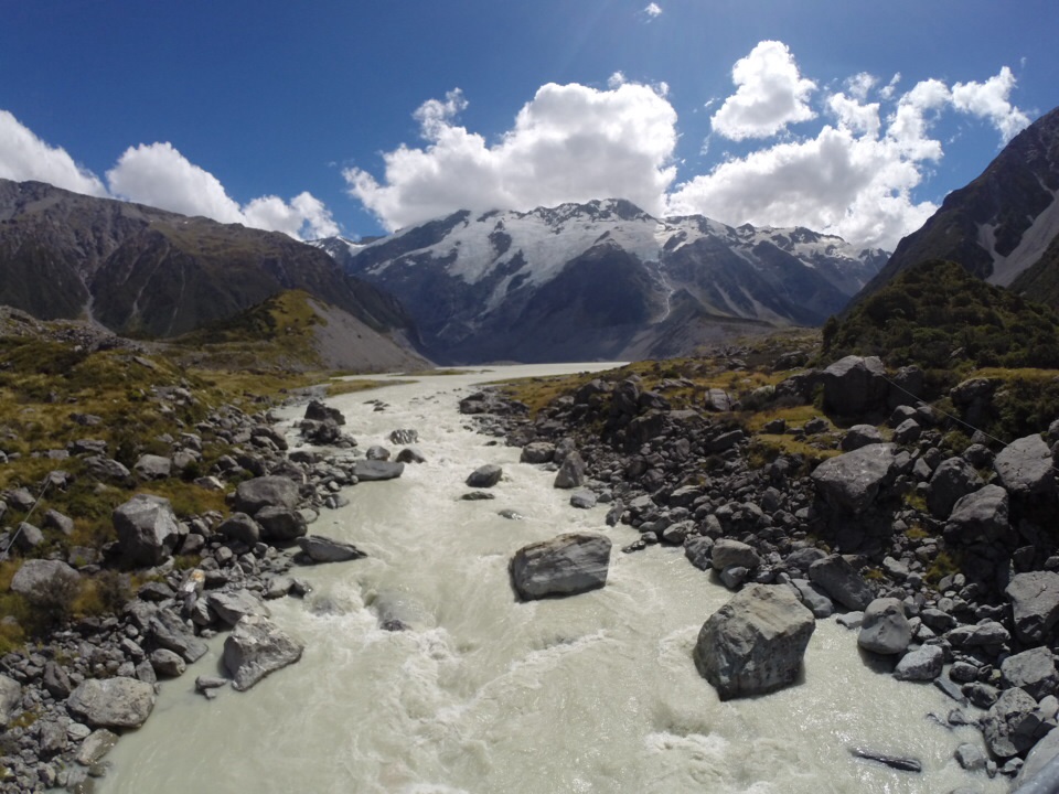
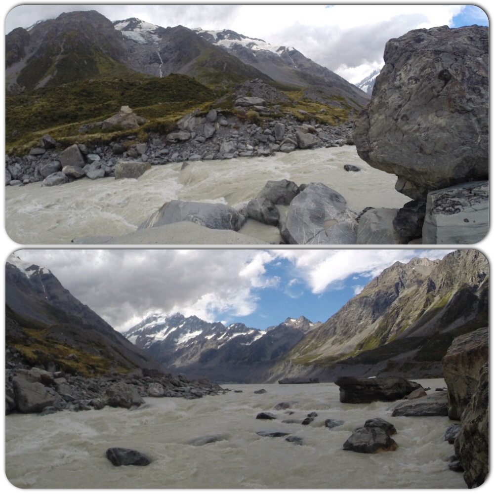
glacier waters of the hooker river
picture spot
non-stop views

headed toward the second suspension bridge
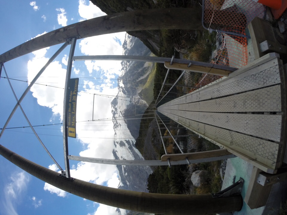
the hooker bluff bridge
on the bridge
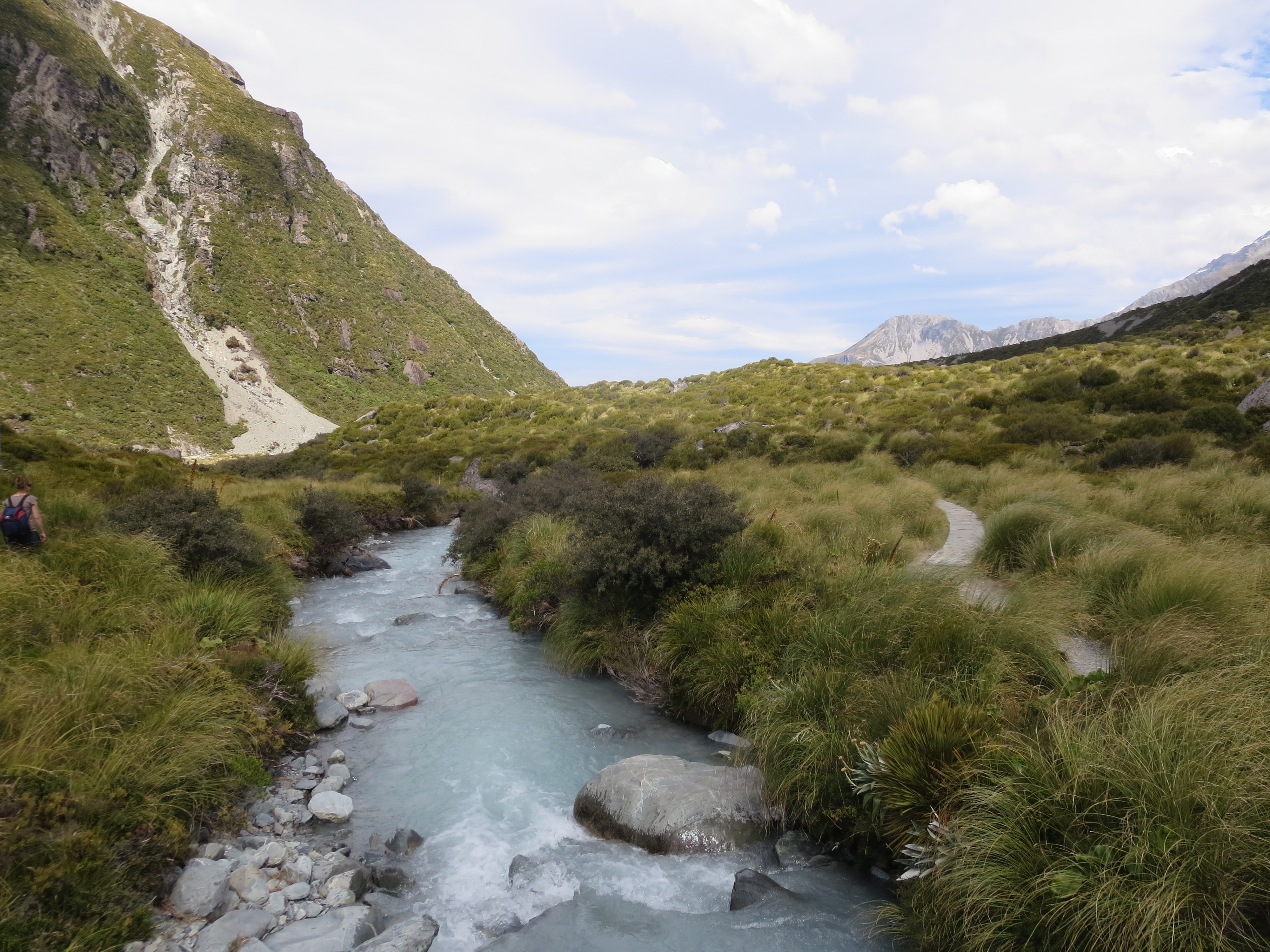
stocking stream – check out the color of that water!
we see the third bridge ahead
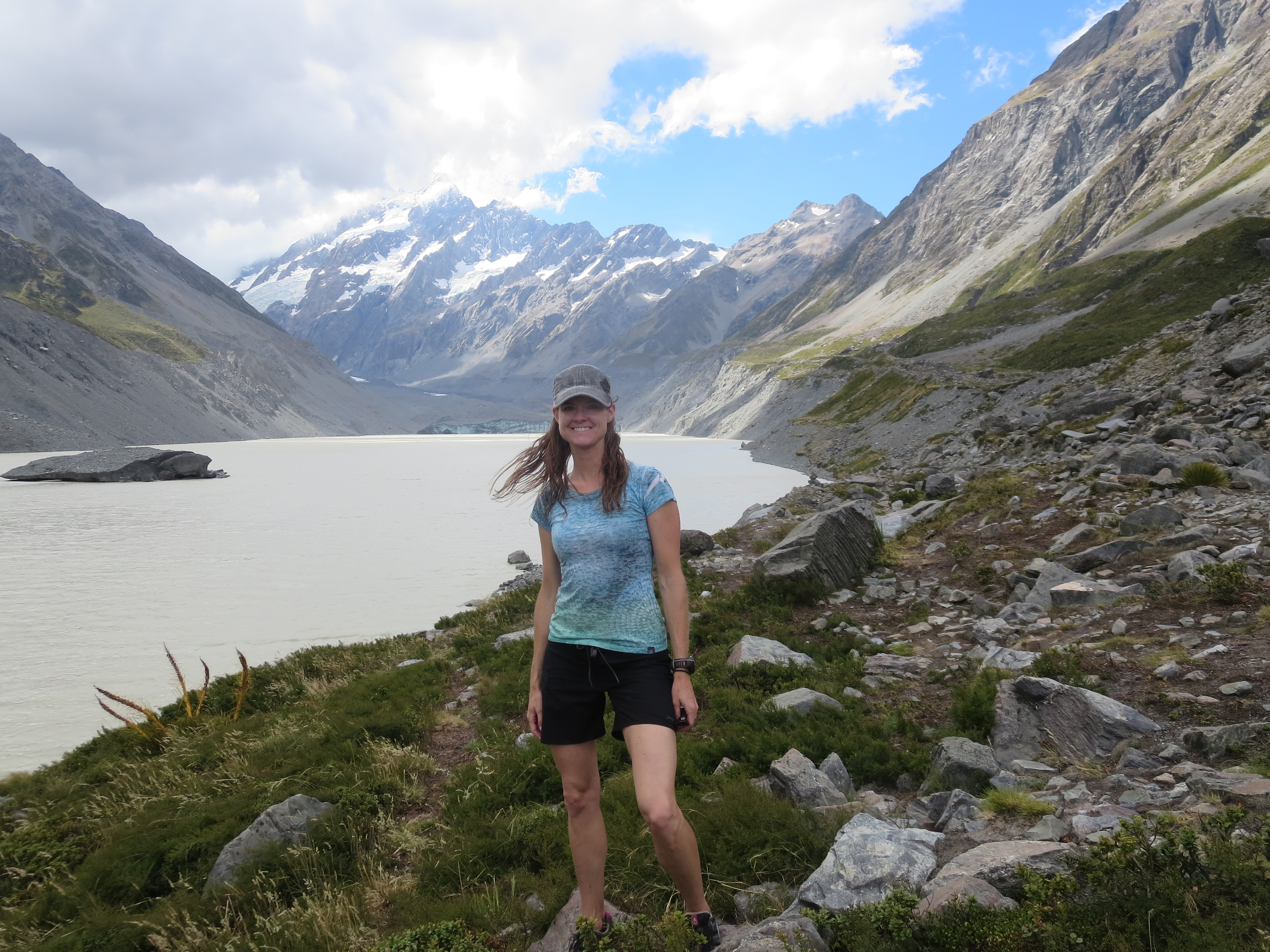
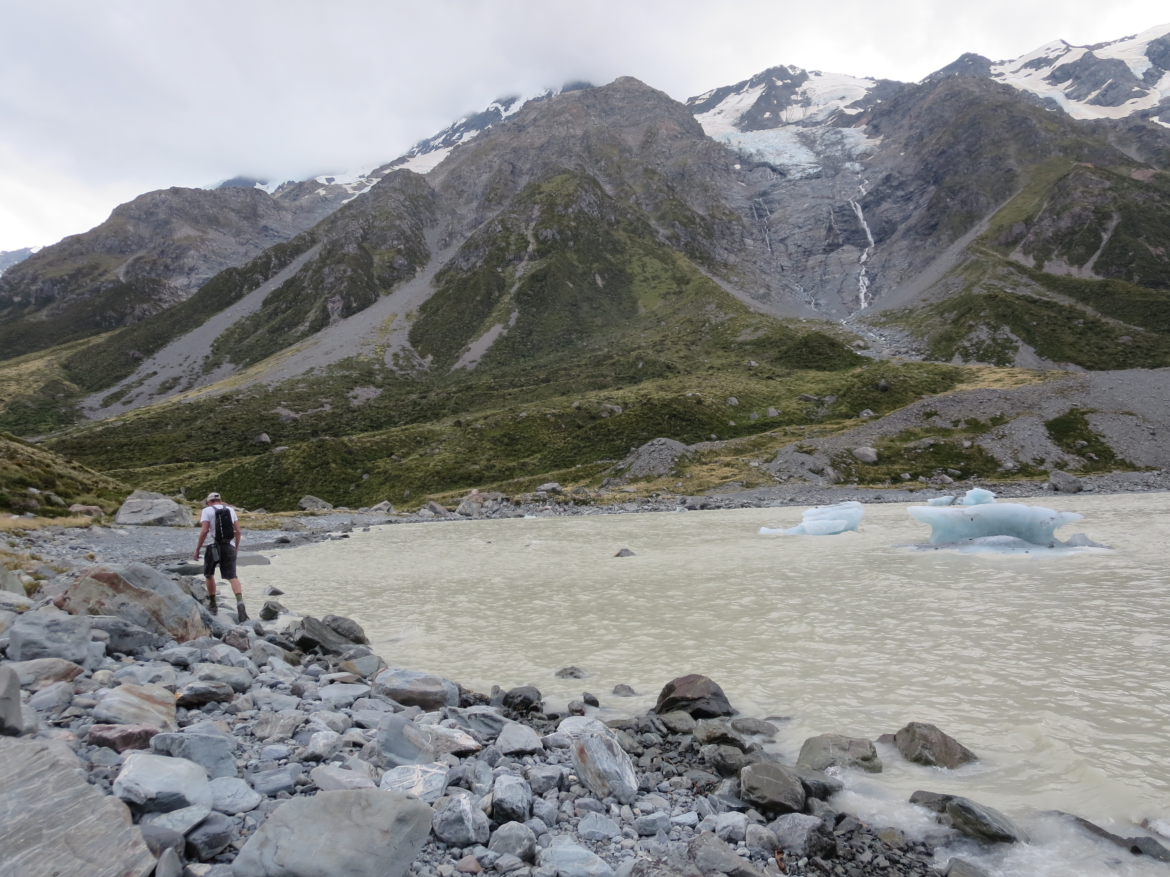
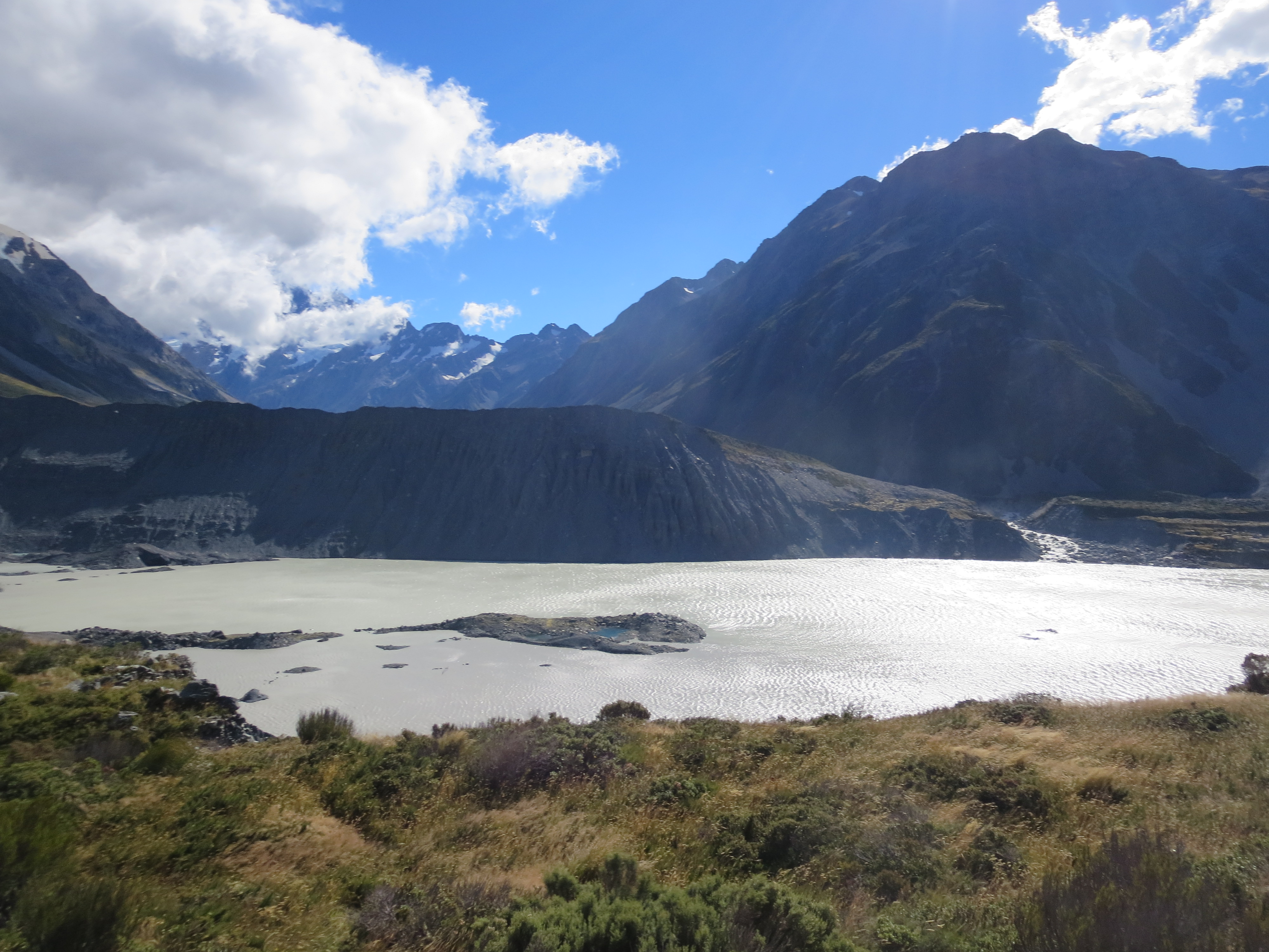
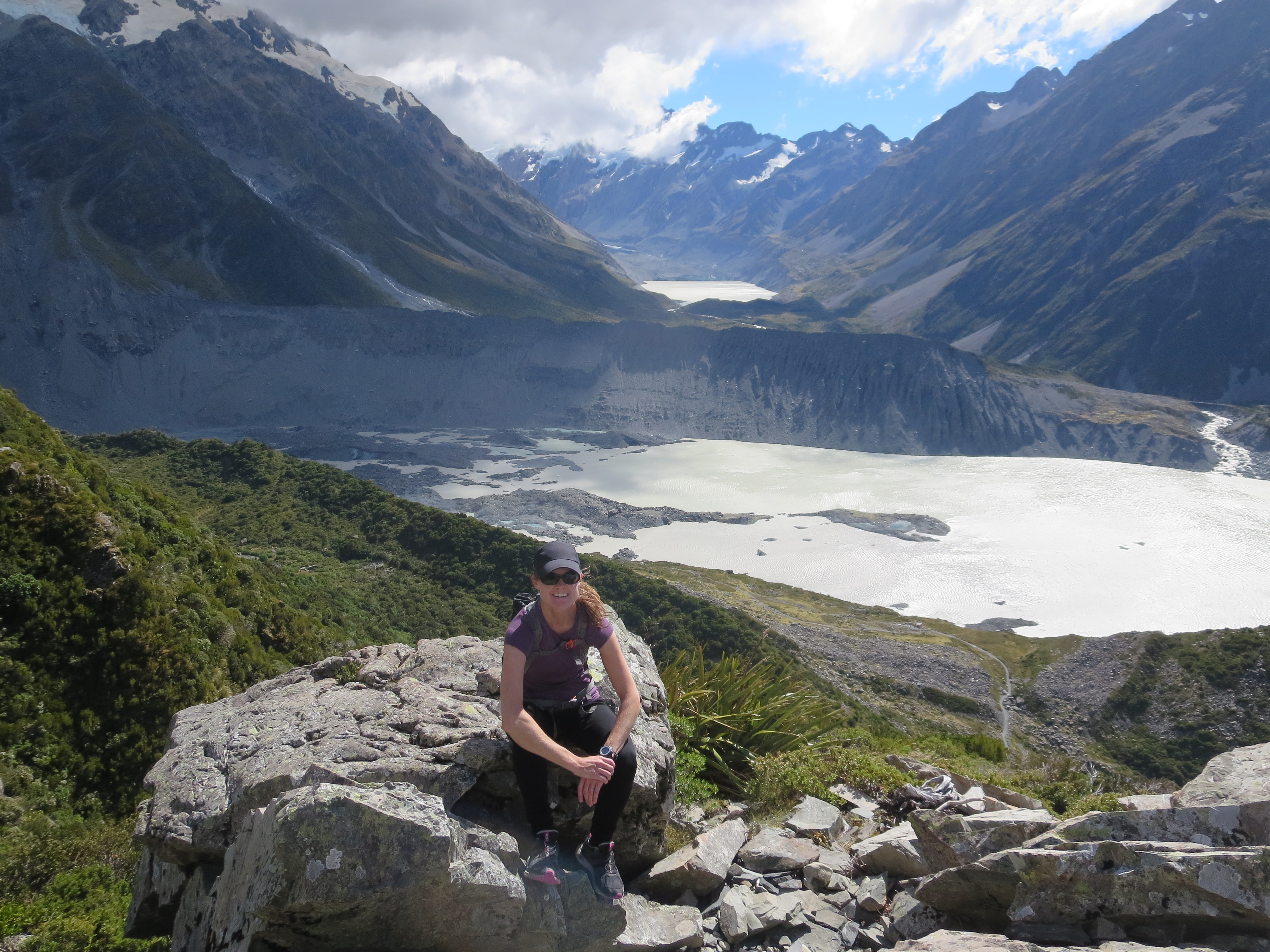
after just over an hour, we make it to hooker glacier lake
walking along the water’s edge
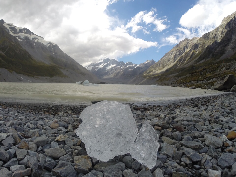
glacier ice
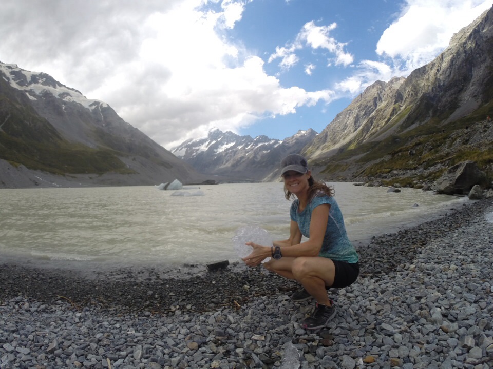
just had to pick up a piece, it was cold!
hooker glacier lake
making our way back
On the way back, I stopped at the Alpine Memorial. It stands in memory of three people who died in an avalanche after ascending Mt Cook. In reading the sign, I realized that the following day would mark exactly 100 years ago from this tragic event.
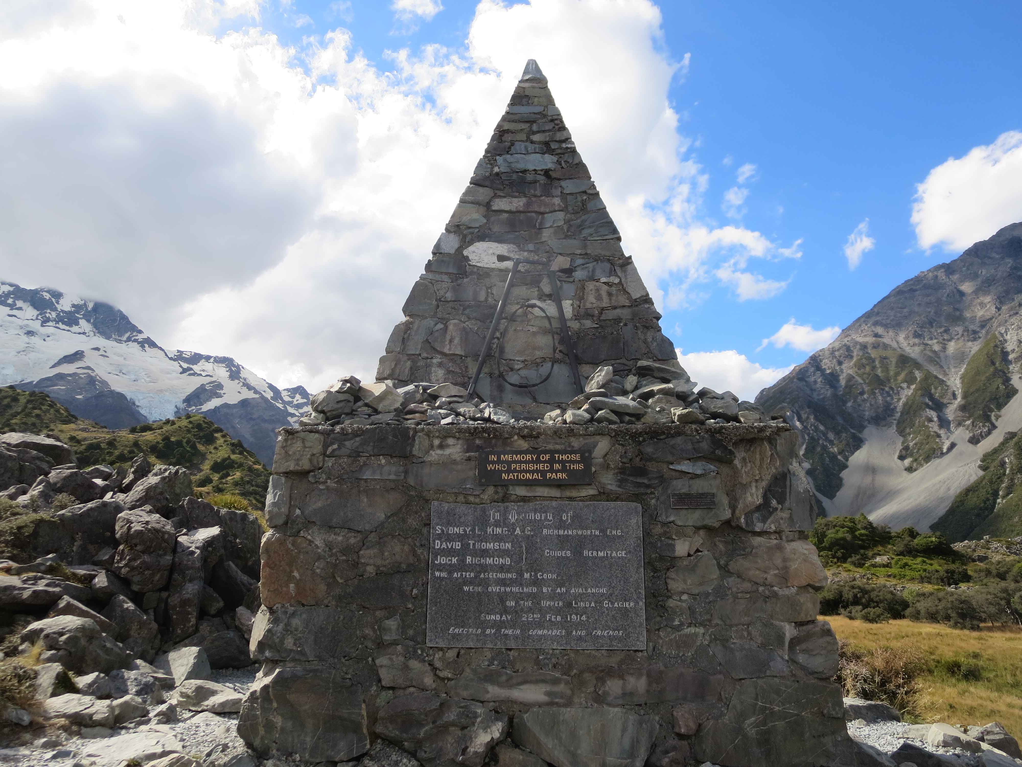
alpine memorial
After the hike, we got settled into our campsite at the White Horse Hill campground. It was a beautiful spot, situated right next to the trailheads for the two hikes we did at the park.

white horse hill campground
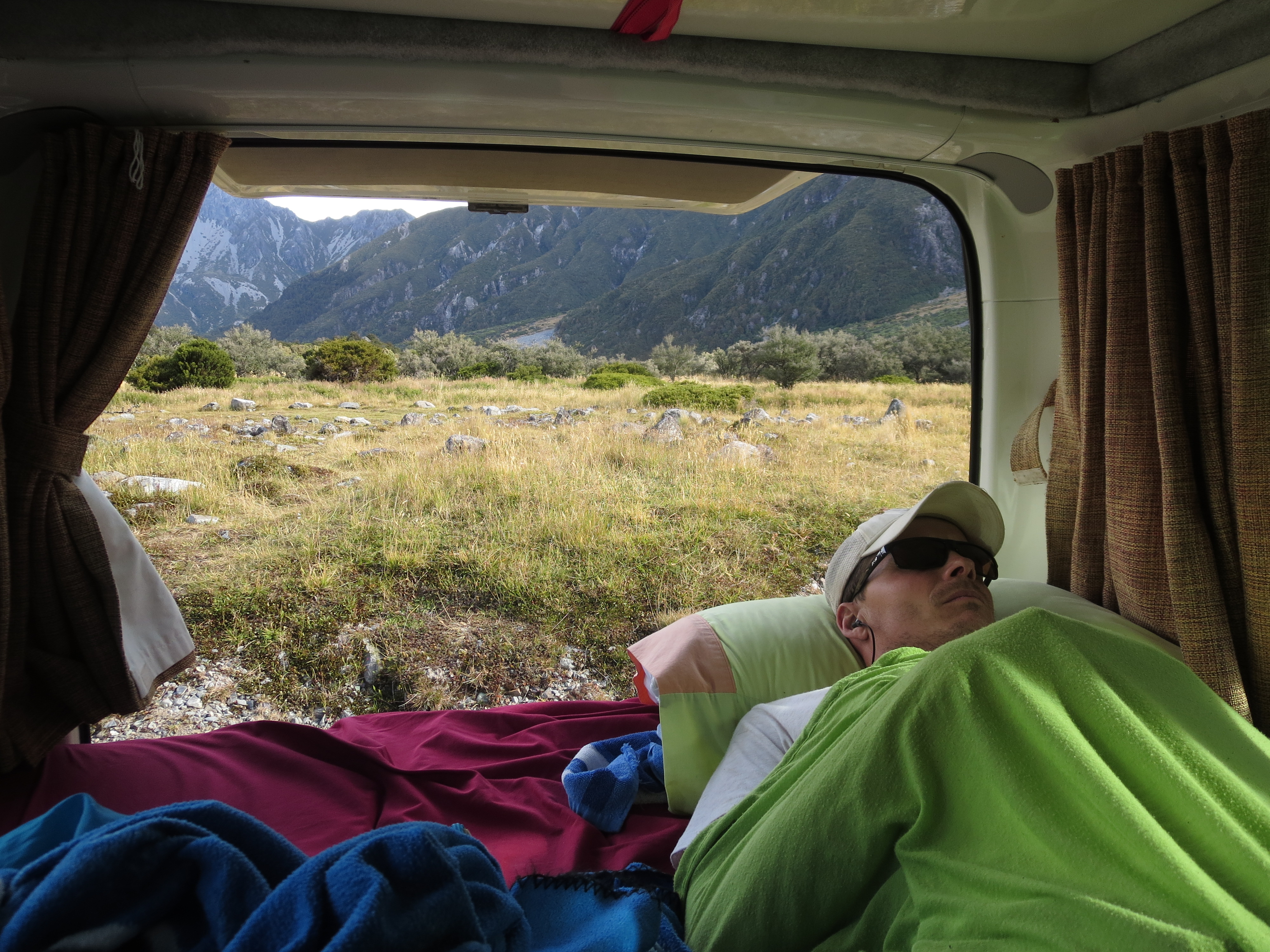
a room with a view (yes, jay gave me permission to use this photo)
That evening, a powerful storm rolled in. It started raining about 6pm and continued raining until the next morning. The winds were so strong, our campervan was rocking back and forth most of the night. I was so thankful to be sleeping in a campervan and not in a tent!
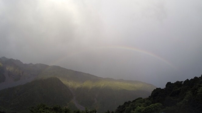
a rainbow at the start of the storm
The following morning, we had planned to hike the Mueller Hut Route. The track climbs up to the divide on top of the Sealy Range. It’s a steep, 3,000 foot climb. We could see that the storm which came in overnight had left a little fresh snow at the top. I was a little apprehensive about trying to tackle this route given the weather. Although the rain had stopped, there were still 50 mph wind gusts. In the end, we decided we would give it a try and turn around if things got bad. We packed extra stuff in our packs, and I made sure I had everything I might need in mine, just in case I wanted to turn around and Jay wanted to keep going.
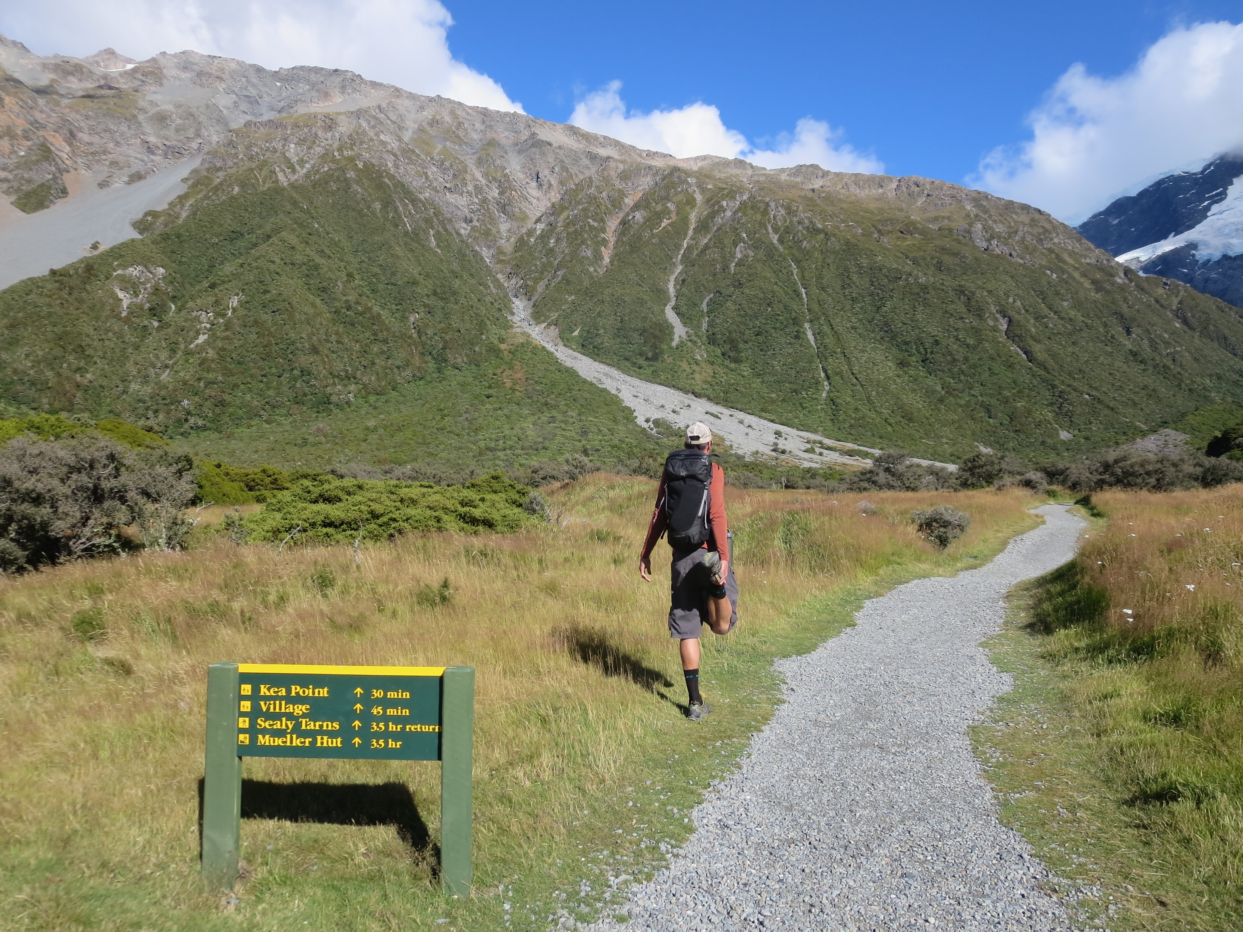
stretching the legs out before we start the mueller hut route
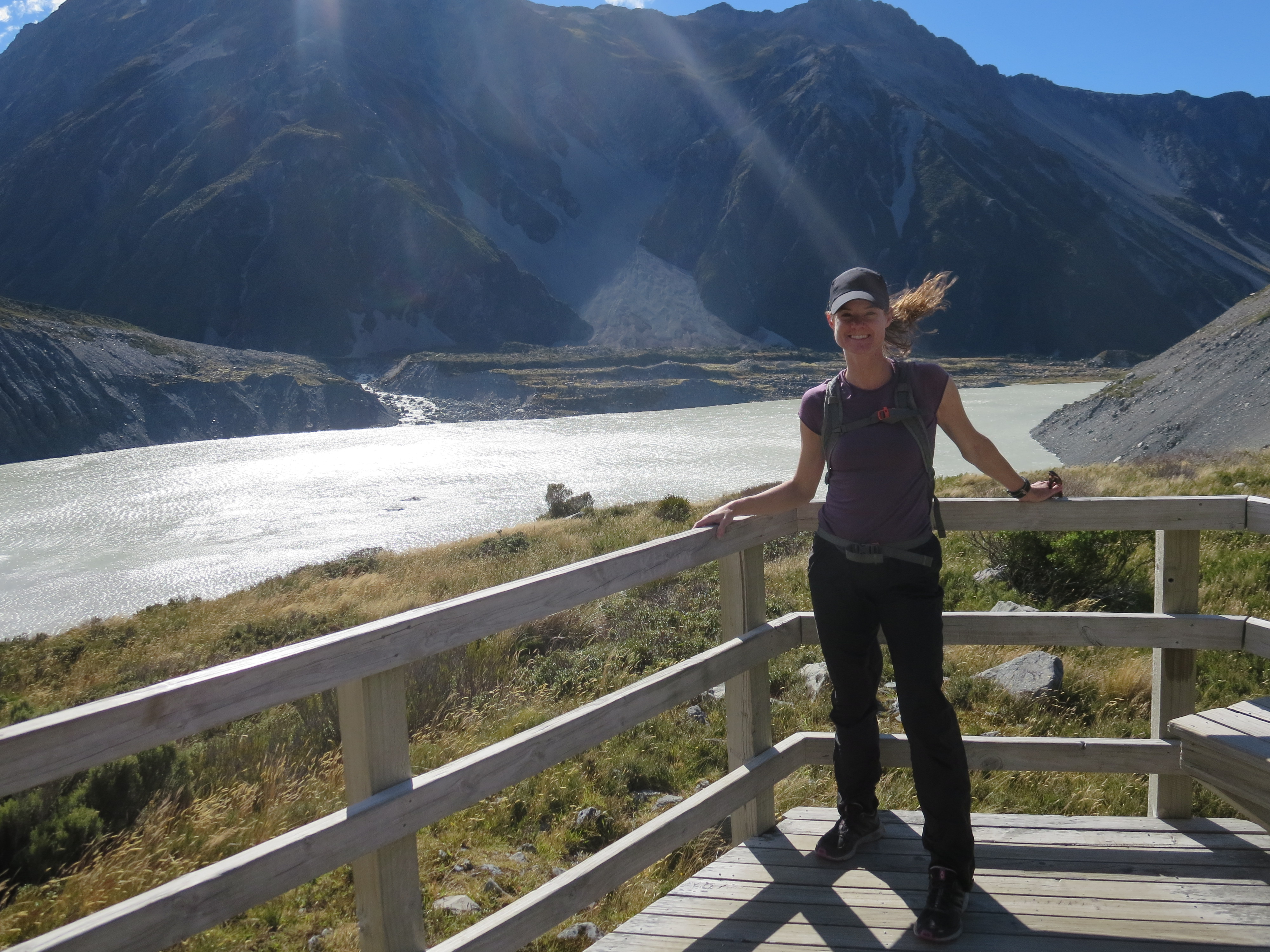
at the kea point lookout (can you tell how windy it is from my hair?)
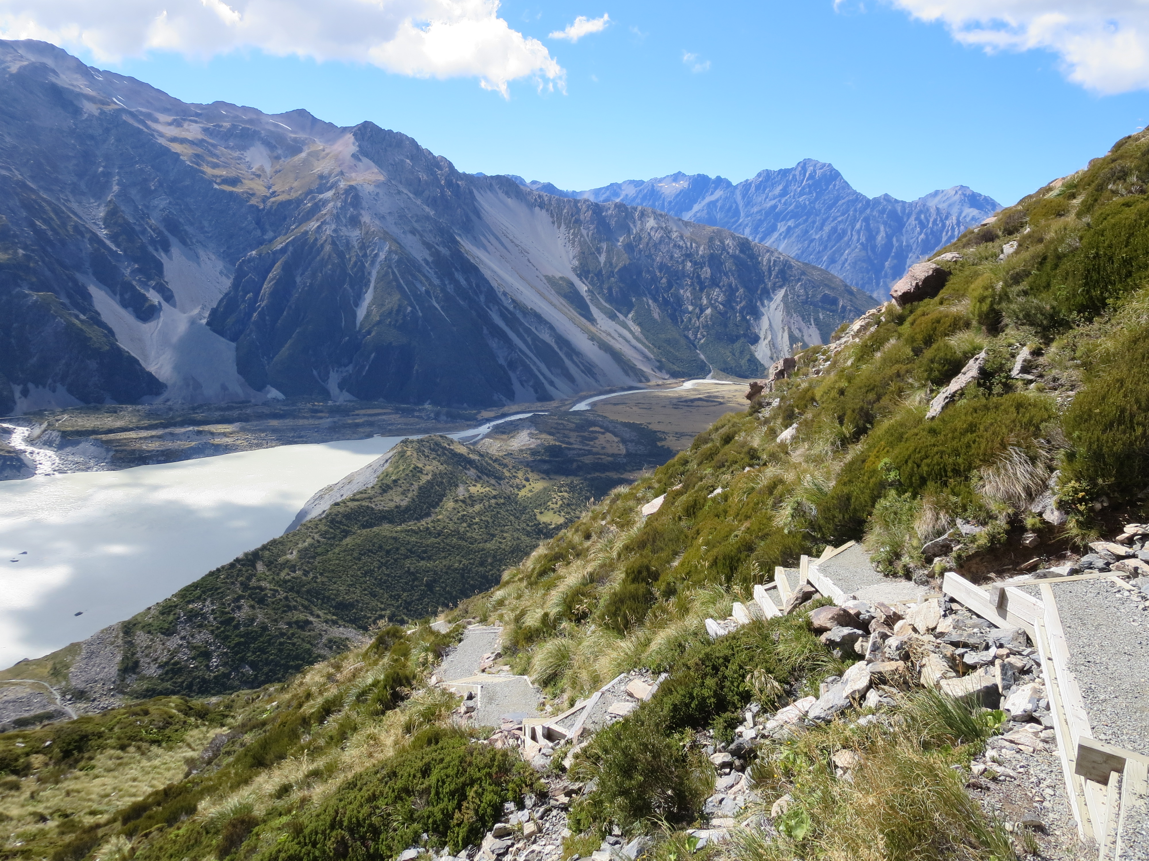
mueller lake
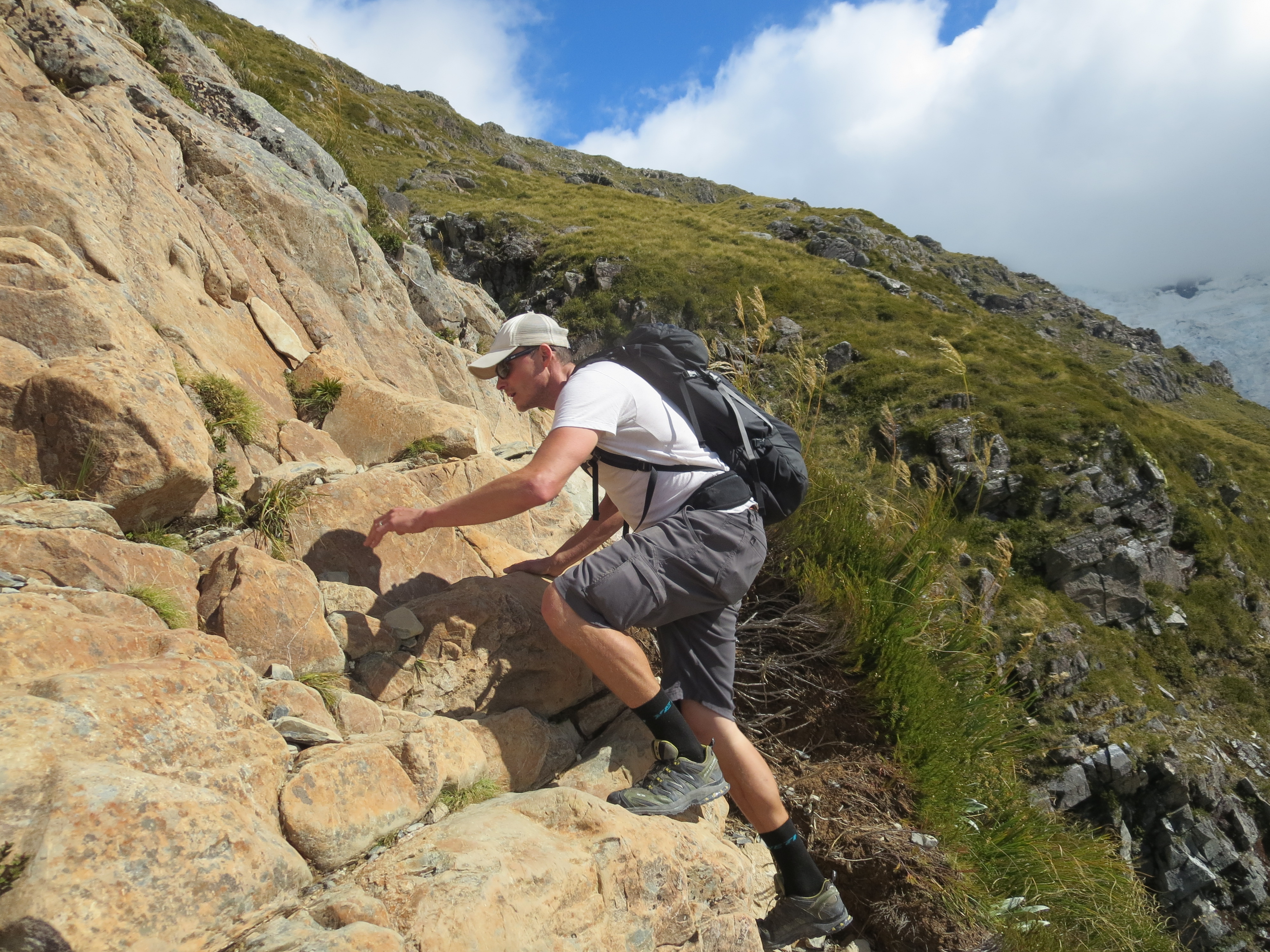
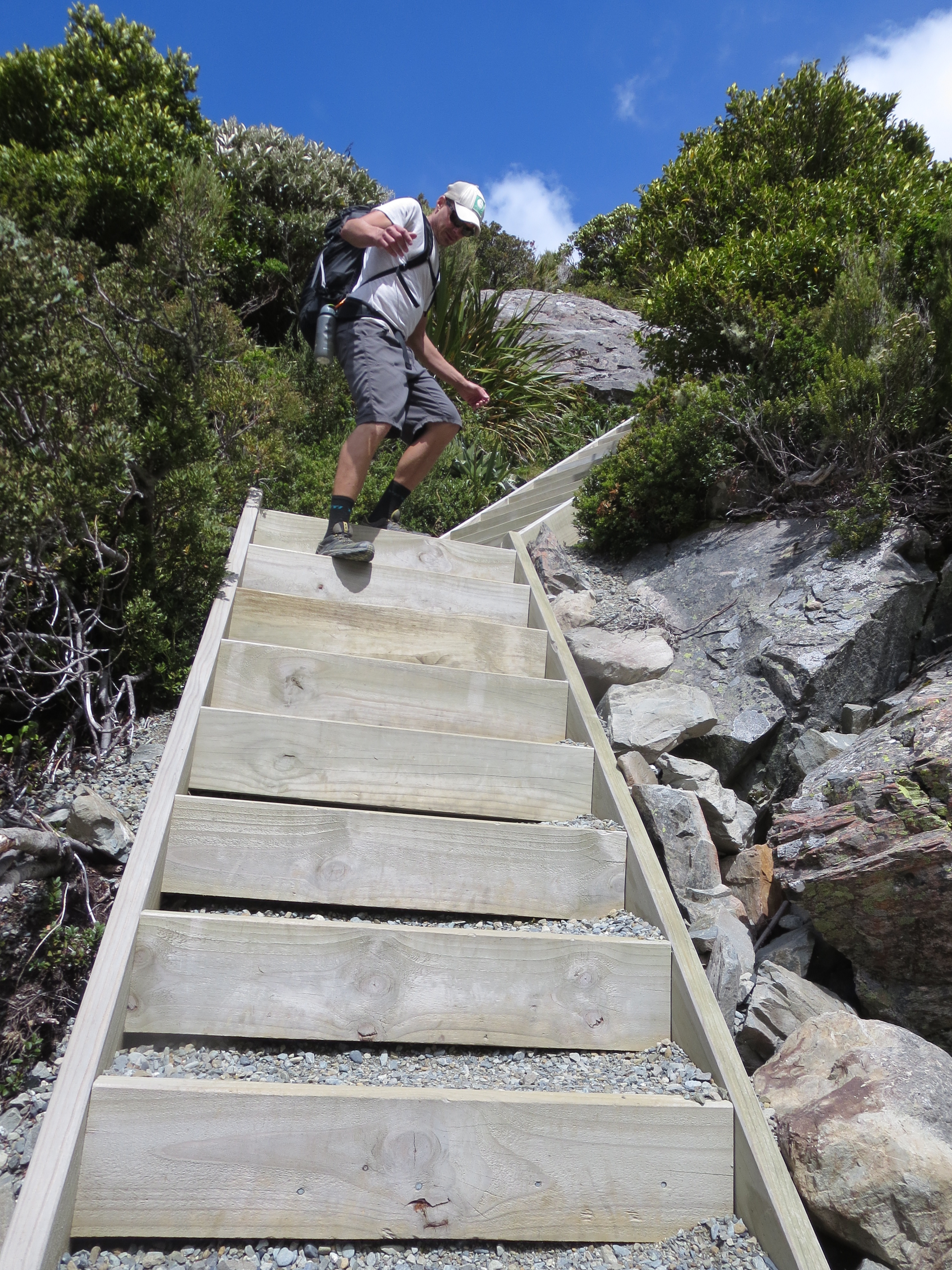
After the Kea Point lookout, the track reaches the foot of the Sealy Range and that is where the steep climbing begins. The first stretch of climbing is up stairs. The stairs have been nicknamed the “Stairway to Heaven”. It’s definitely a quad burner as you make your way up, but it is all worth it for the views.
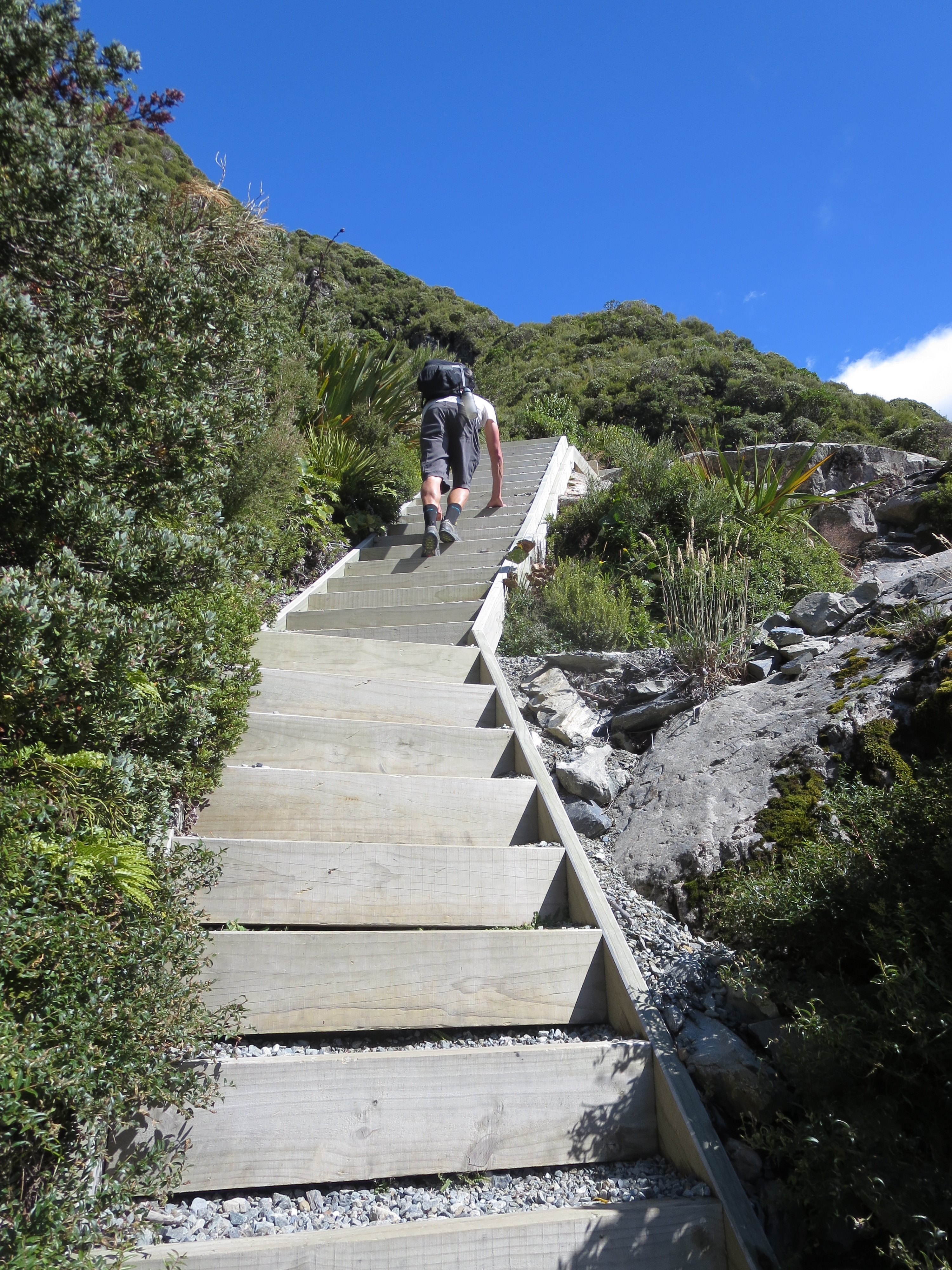
let the stairs begin
so steep that it’s easier on all fours
stopping for a picture (and a quick breather!)
view of the valley below (we can see our campsite down there)

views of mueller lake as we make our ascent
as if the stairs aren’t enough to take your breathe away, the views most certainly will
After over 1800 stairs, we reached Sealy Tarns (small mountain ponds).
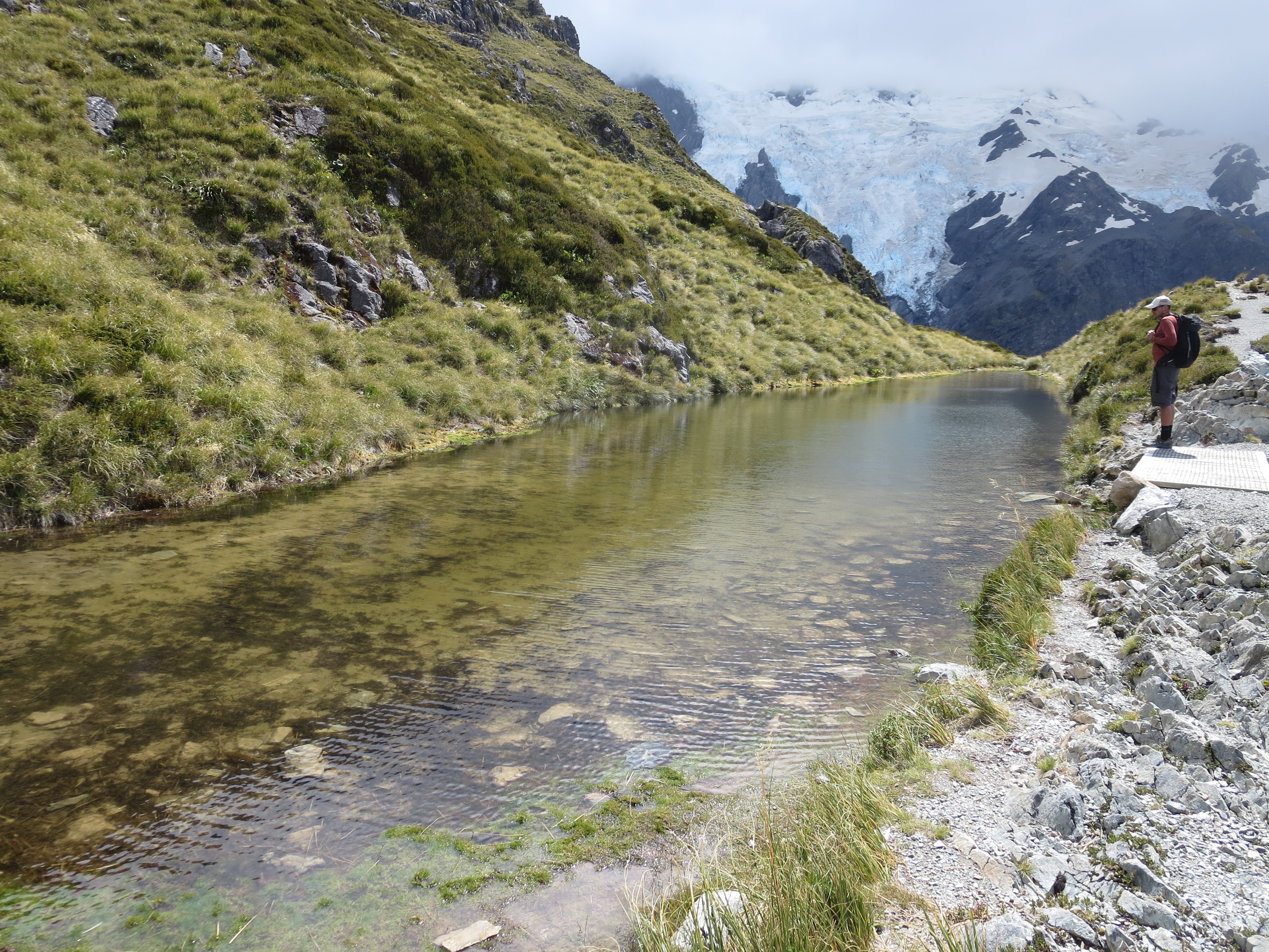
sealy tarns
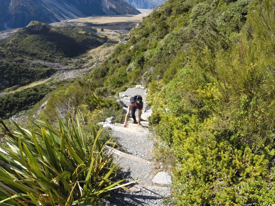
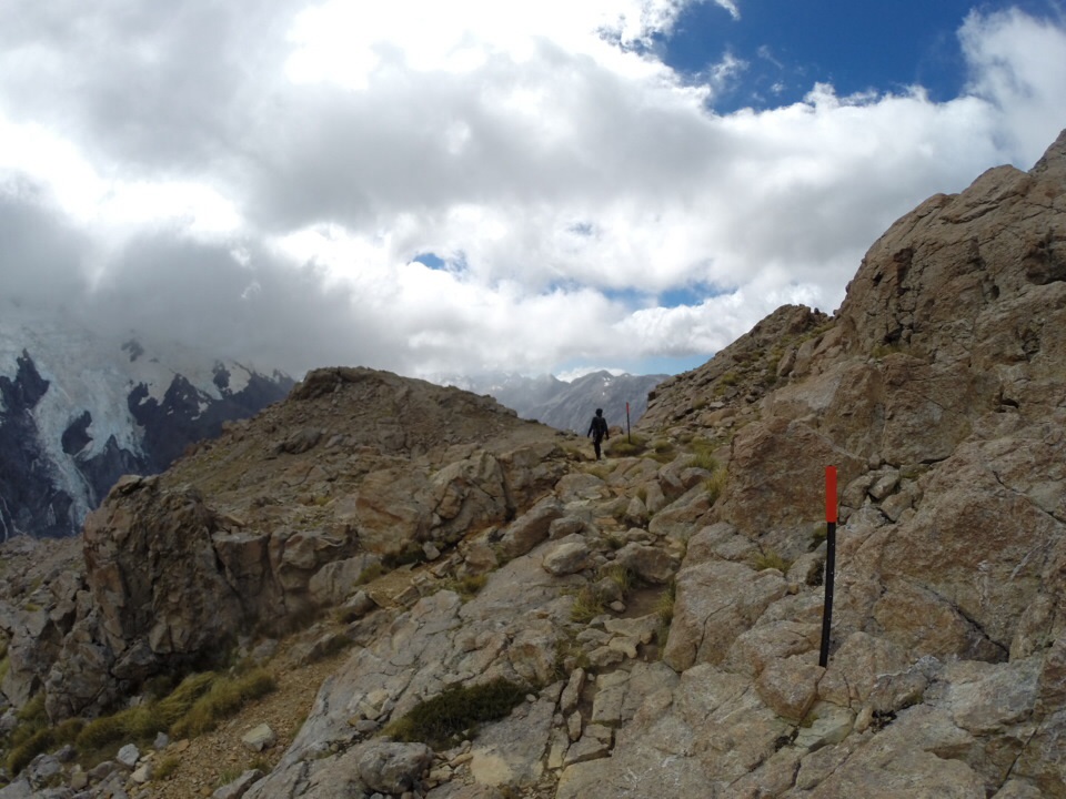
Shortly after Sealy Tarns, the trail becomes an alpine route. No more stairs, just rocks to scramble up. There are orange markers and rock cairns to help keep you on the right track.
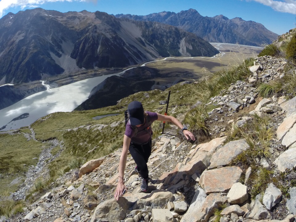
no more stairs, just rocks to climb

lovin’ the views
As we made our way up, people who had stayed in the Mueller Hut overnight were making their way down. Several folks warned us about highs winds on the ridge. One lady told us (oh so eloquently with her British accent), “The winds are a bit playful when you get to the ridge…it’s navigable, but you need to stay low.” The fact that she said “a bit playful” made me laugh, since others had described it to us in not nearly as positive terms.
We continued our ascent. On the east side of the ridge were blue, sunny skies; on the west, it was dark and cloudy. The wind was blowing so hard, at times it felt like it was raining, but it wasn’t raining above us – it was rain blowing over from the other side of the ridge.
the final stretch of scrambling
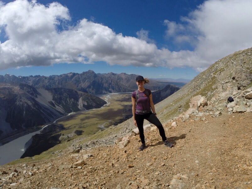
After a long time climbing, we had reached the divide. The views were spectacular. We found a spot out of the wind behind some rocks to stop and eat lunch.
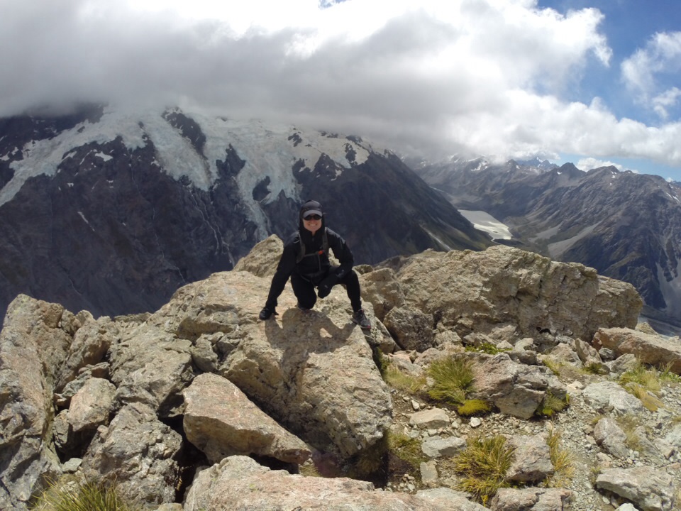
the view from the top – all i can say is…wow!
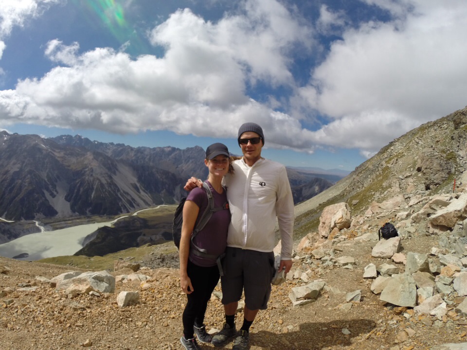
we made it!
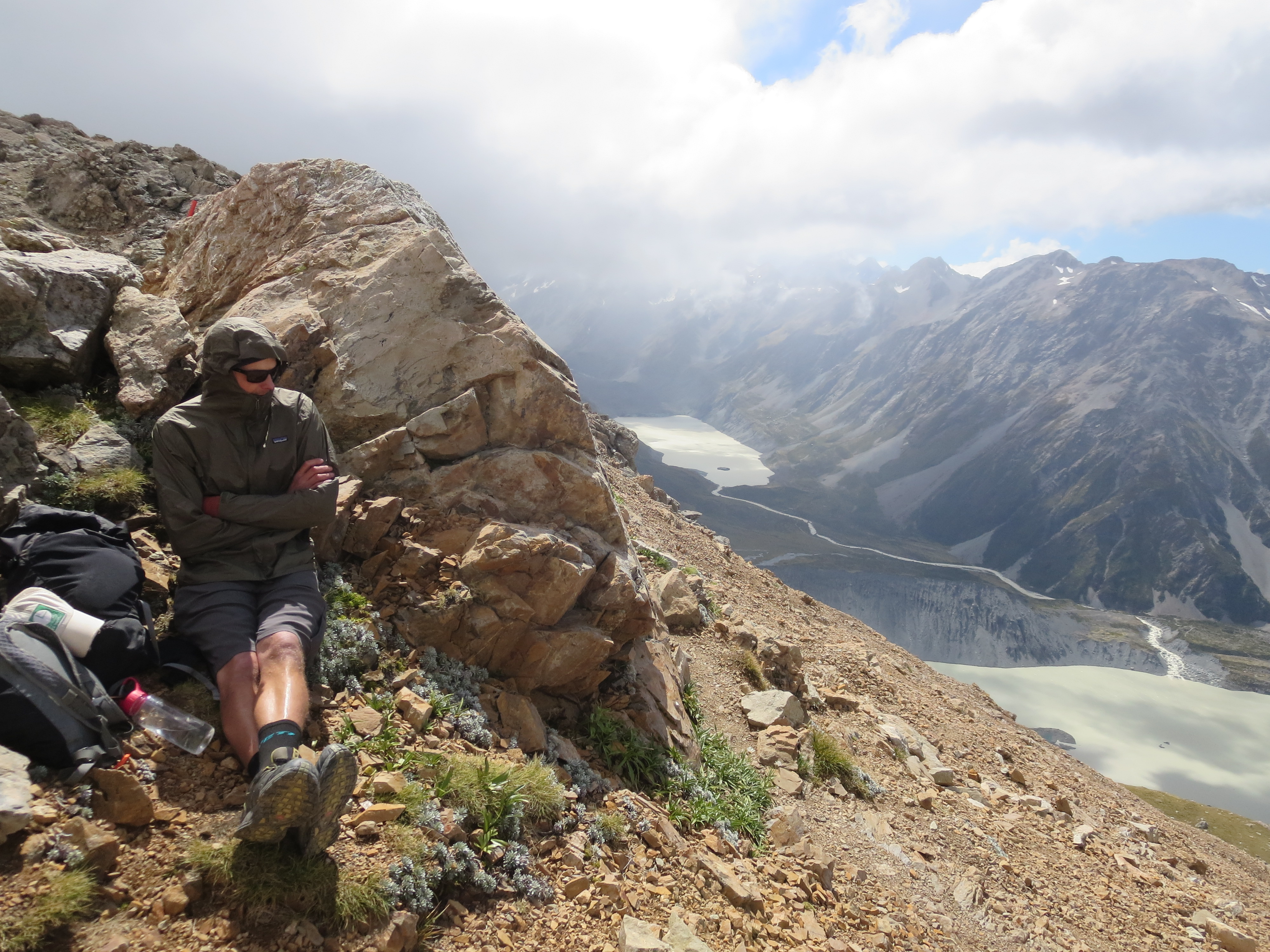
our break spot
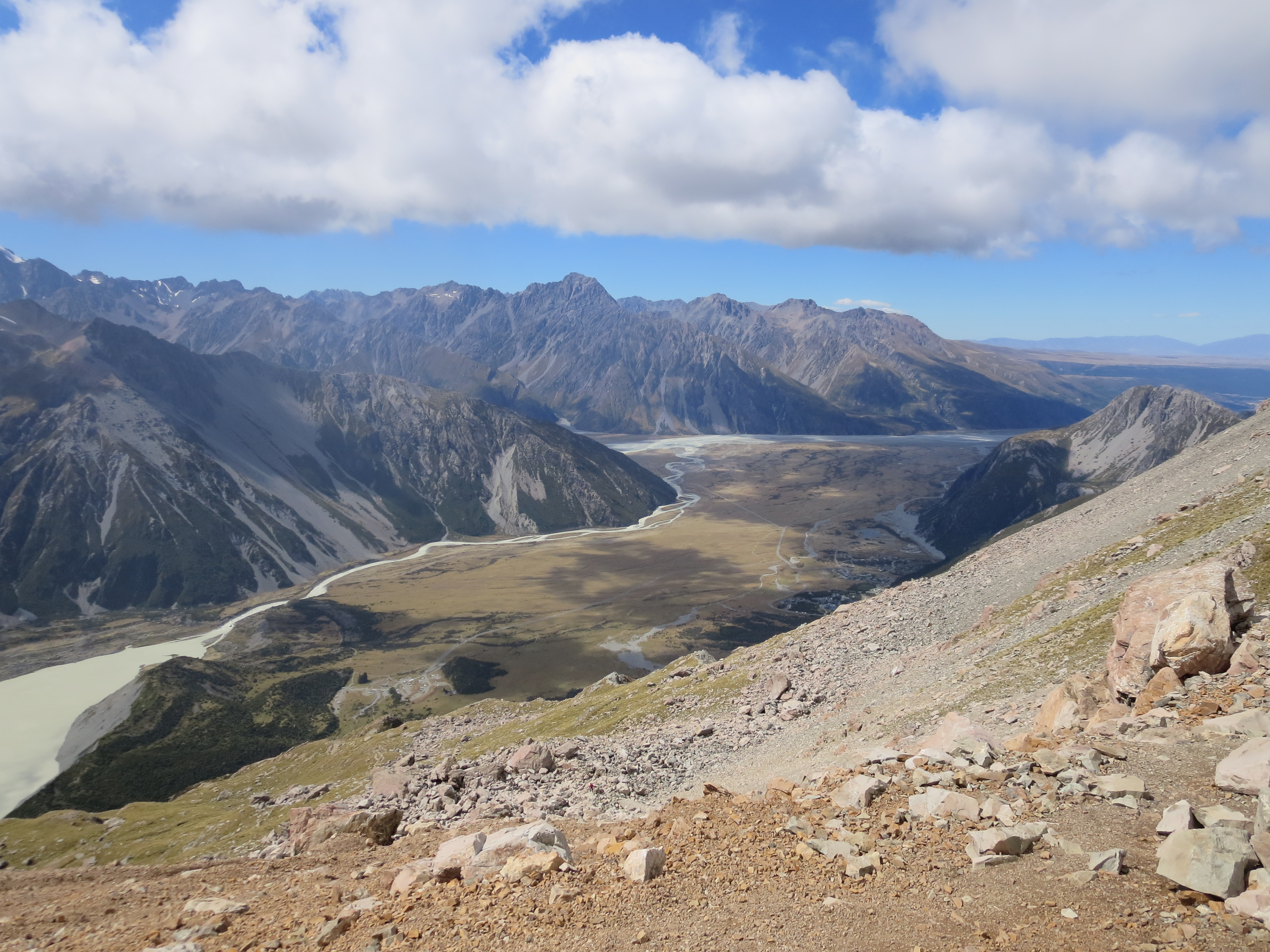
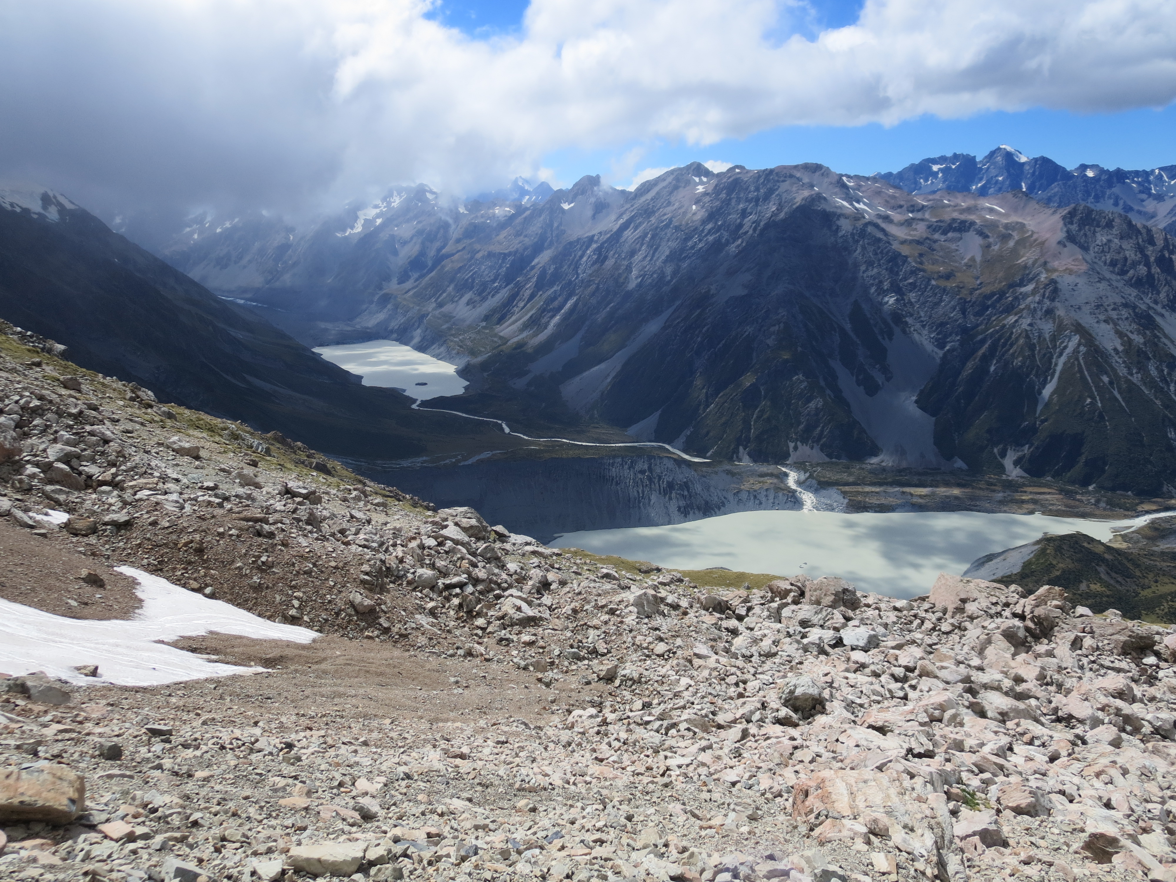
After our short break, we hiked along the ridge to a lookout with sweeping views of the surrounding mountains and glaciers. The Mueller Glacier was in the foreground, and four smaller glaciers ran down the mountainside.
walking along the sealy range ridge
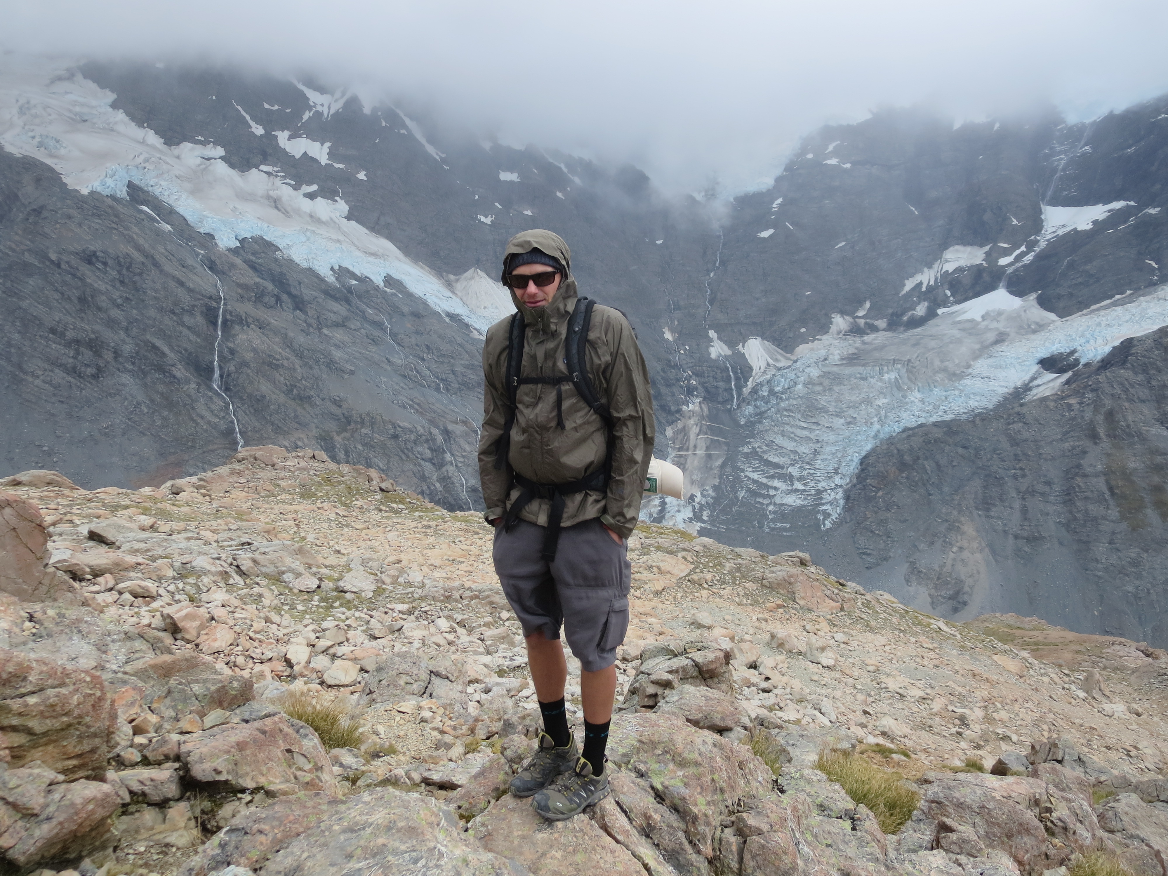
at the glacier lookout
under a mysterious sky…half dark, half sunny
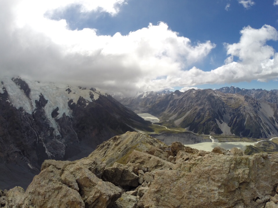
what a view!
Along the ridge were powerful gale force winds. At times, I did get the feeling that the winds were going to knock us over, but we managed to stay on both feet. To get a sense of what it was like, check out these two short videos:
- A 360 panorama from the glacier lookout: http://youtu.be/oiO9g2FqMW0
- Some footage of us hiking along the ridge in gale force winds: http://youtu.be/BjIM6zJlBWs
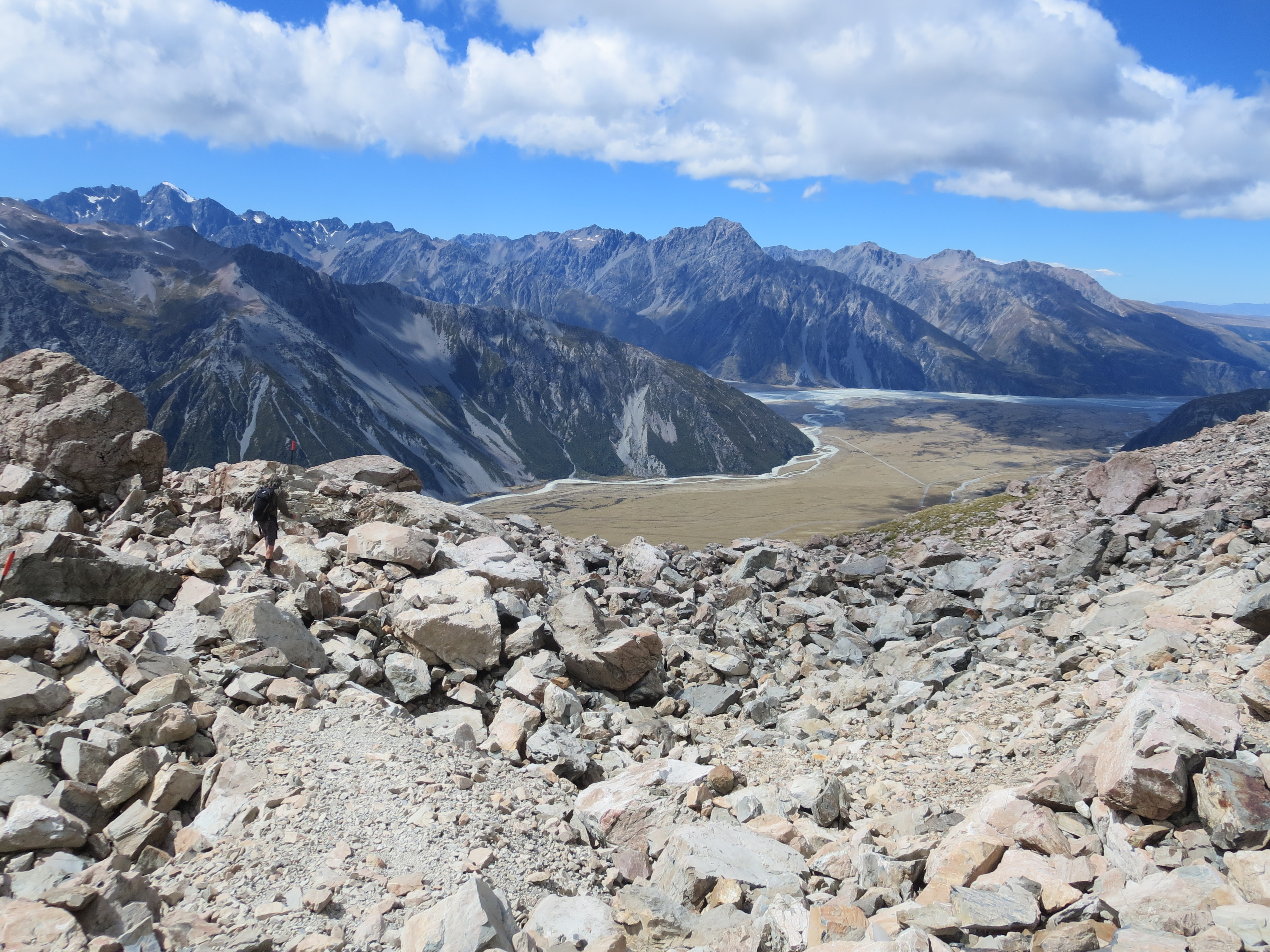
As we made our way off the ridge and back down the mountain, the winds started to subside. The way down was just as hard on the legs, but we were rewarded with non-stop views as we made the descent.
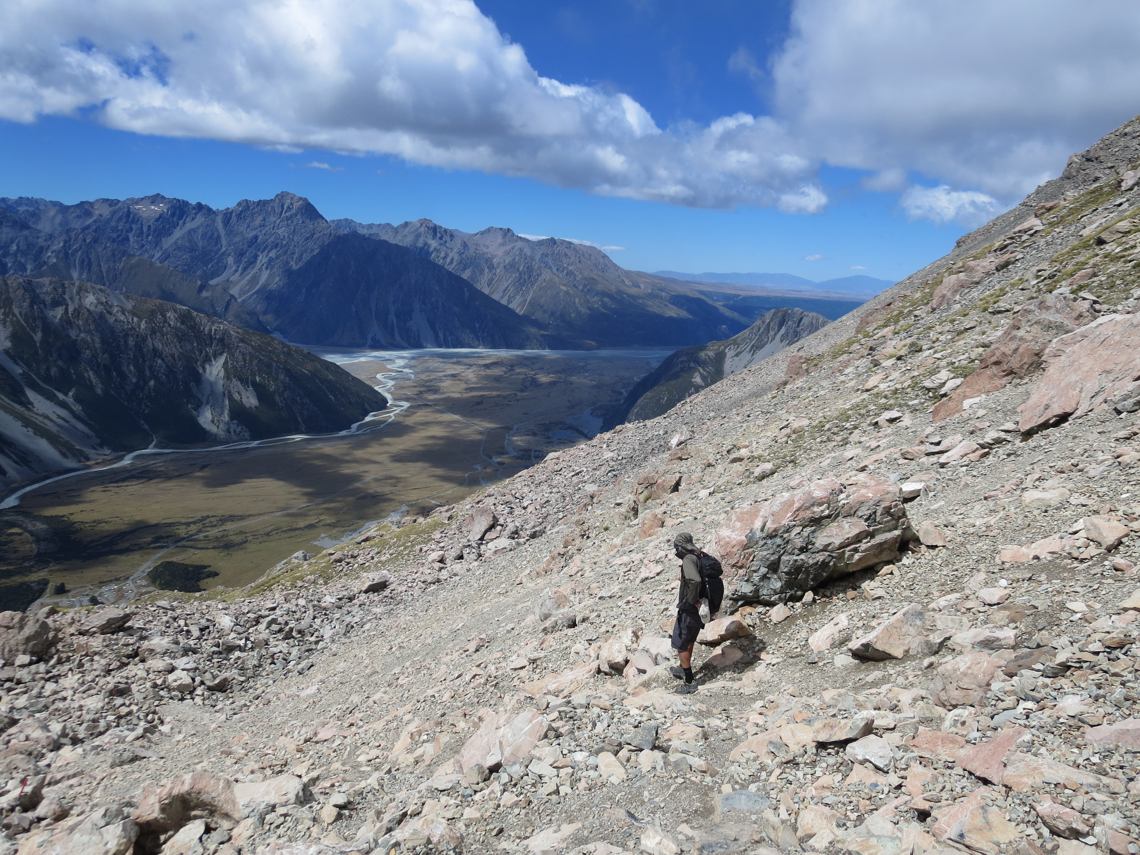
starting our descent
can’t get enough of these views
descending the rock scramble section
it gets less rocky as we make our way down
then we’re back on the stairs for the final stretch of the descent
To sum things up, Mt Cook National Park is one of the most beautiful places I have ever been. We enjoyed ever minute of our time there!
I’ll never forget this moment!

Spectacular views to say the least! I think you guys are lucky to have escaped any sprains or broken bones on all the hikes you took along these trails. I was wondering what it was like to go DOWN those steps that you mentioned were easier to come up on on all fours. How do you manage that?
So very thankful we escaped NZ without any injuries! Going down was easier on the lungs, but harder on the legs. We would change up how we went down (going sideways, switching from left side to right side, etc) and that seemed to help.
You weren’t kidding when you said the “last” views were going to be some of the BEST! Amazing views!! The video of you cracked me up….you look part ninja like you’re sneaking up on somebody and other part just trying to walk without falling over! I bet we only got a small ‘taste’ of how windy it was! Glad you were able to safely navigate all that terrain!
Ooo…love the “ninja like” reference. I feel so stealth! Yep, the views just kept getting better as we made our way through New Zealand. More posts to come!
love it!!