The Routeburn Track is the last of the “Great Walks” we did in New Zealand. The hike starts/ends in different places and can be done in either direction. It is typically done as a point-to-point, with a transportation service used to get you back to where you left your vehicle. The road distance between the two ends of the hike is over 200 miles. We looked into transport options and it was going to take over 5 hours and cost about $150 for the two of us. We decided we didn’t want to spend the better part of a day on bus, nor spend the money, to get transported from one end to the other. So, instead of doing the 20-mile point-to-point route, we did a 29-mile out and back hike, from “The Divide” to the Routeburn Falls Hut and back. We stayed at the Routeburn Falls Hut one night, which split the hike into two relatively equal days.
We camped in Milford Sound the night before. As we made our way to The Divide, we passed through the Homer Tunnel again. Just on the other side of the tunnel, we heard the calls of kea birds. We pulled over and there was a whole flock of them. I was ecstatic as I was hoping just to see one before we left and here we were, surrounded by about 10 of them. The kea is the world’s only alpine parrot and is found only in the mountain areas of New Zealand’s South Island. The name comes from the cries of “keeaa” they make. To me, their cry sounds a bit like a whining toddler. Keas are inquisitive and mischievous birds. We heard stories about how they will eat the rubber off windshield wipers and around vehicle door frames. We also heard stories about how they have learned to open zippers on unattended backpacks to get to any food inside, and even worse, stories of how they sometimes carry people’s stuff off cliffs. As we were pulled over near the tunnel taking pictures of the surrounding kea, after just a few minutes, they were getting increasingly curious about us and their calling was getting increasingly louder. We decided not to stick around long enough to find out what sort of antics they might try on us or the campervan. Besides, we had a long hike ahead of us and needed to get to the trailhead.

kea

kea…the alpine parrots
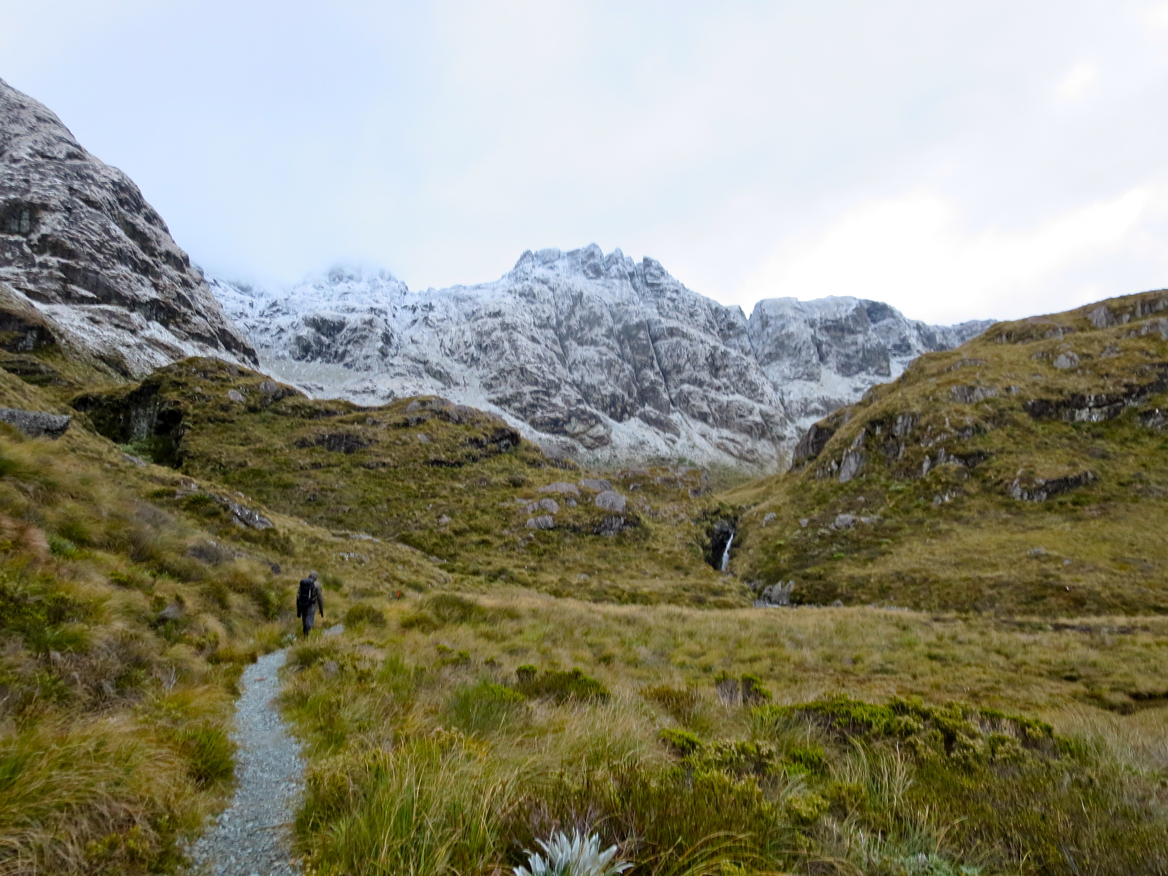
By the time we got parked and on the trail, it was 8AM. The forecast for the day was grim. When we picked up our hut tickets, we were warned it could be blizzard conditions above tree line. No doubt it had snowed quite a bit overnight as fresh snow-covered all the peaks along the road from Milford Sound. It wasn’t raining or snowing as we started the hike.
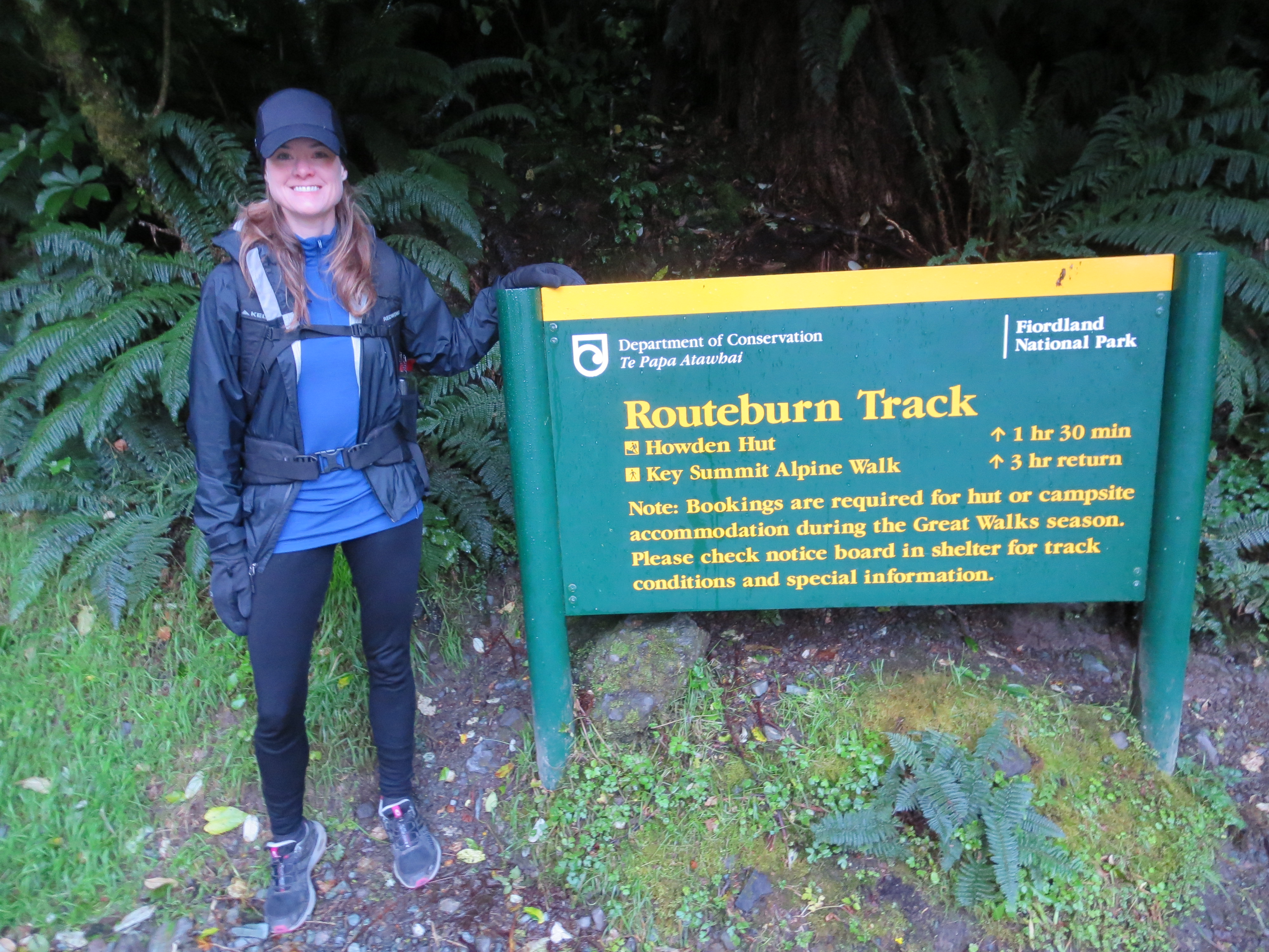
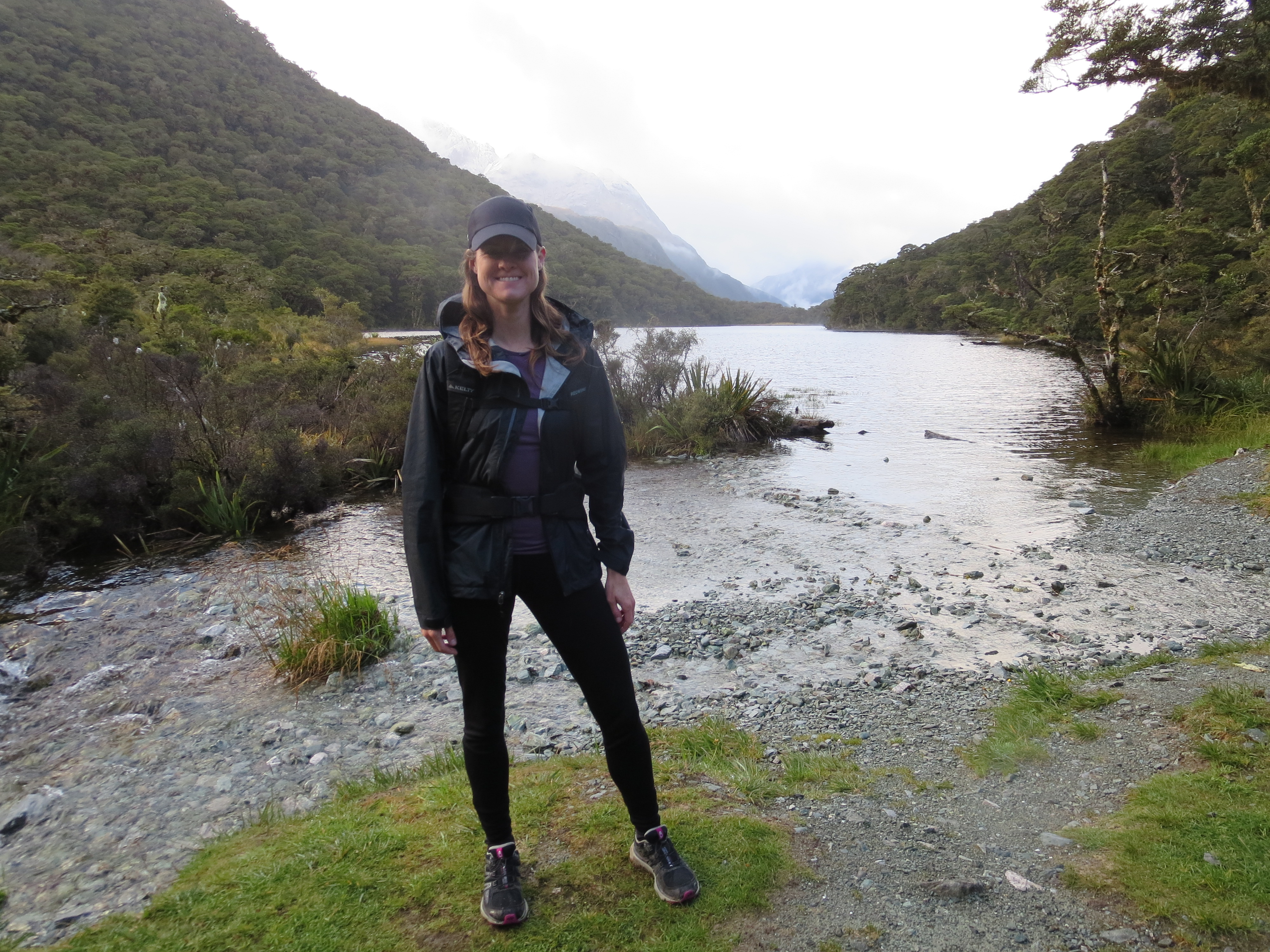
the obligatory pre-hike sign picture
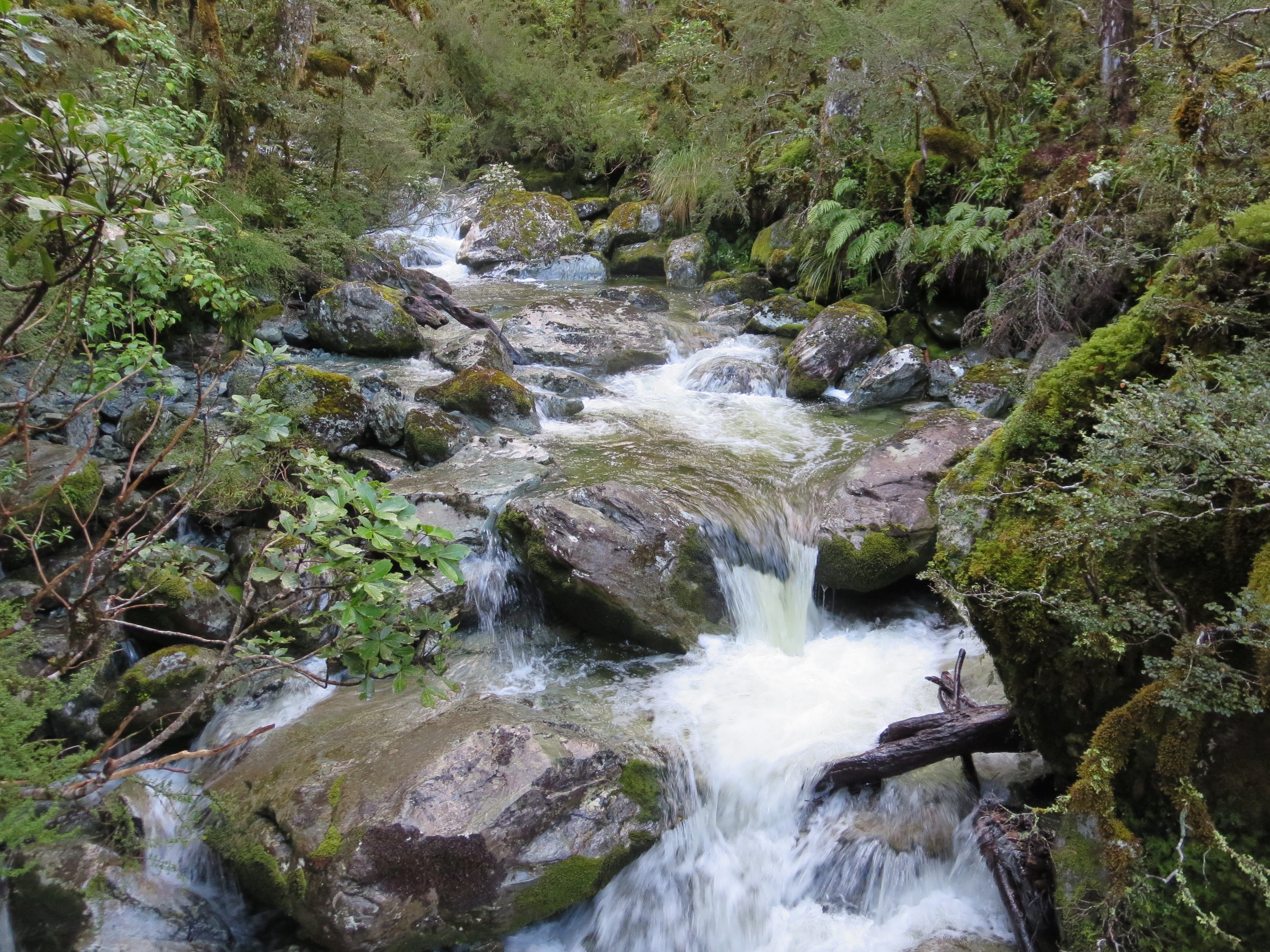
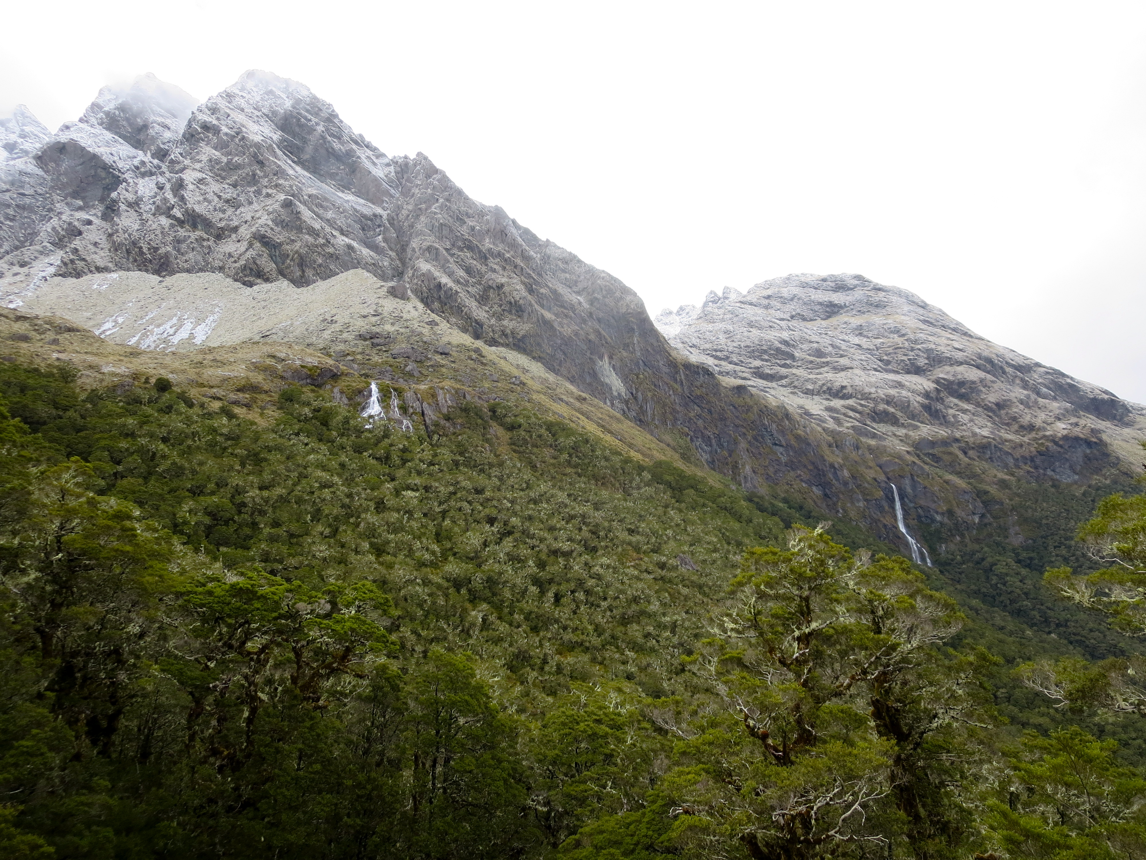
the first of many waterfalls
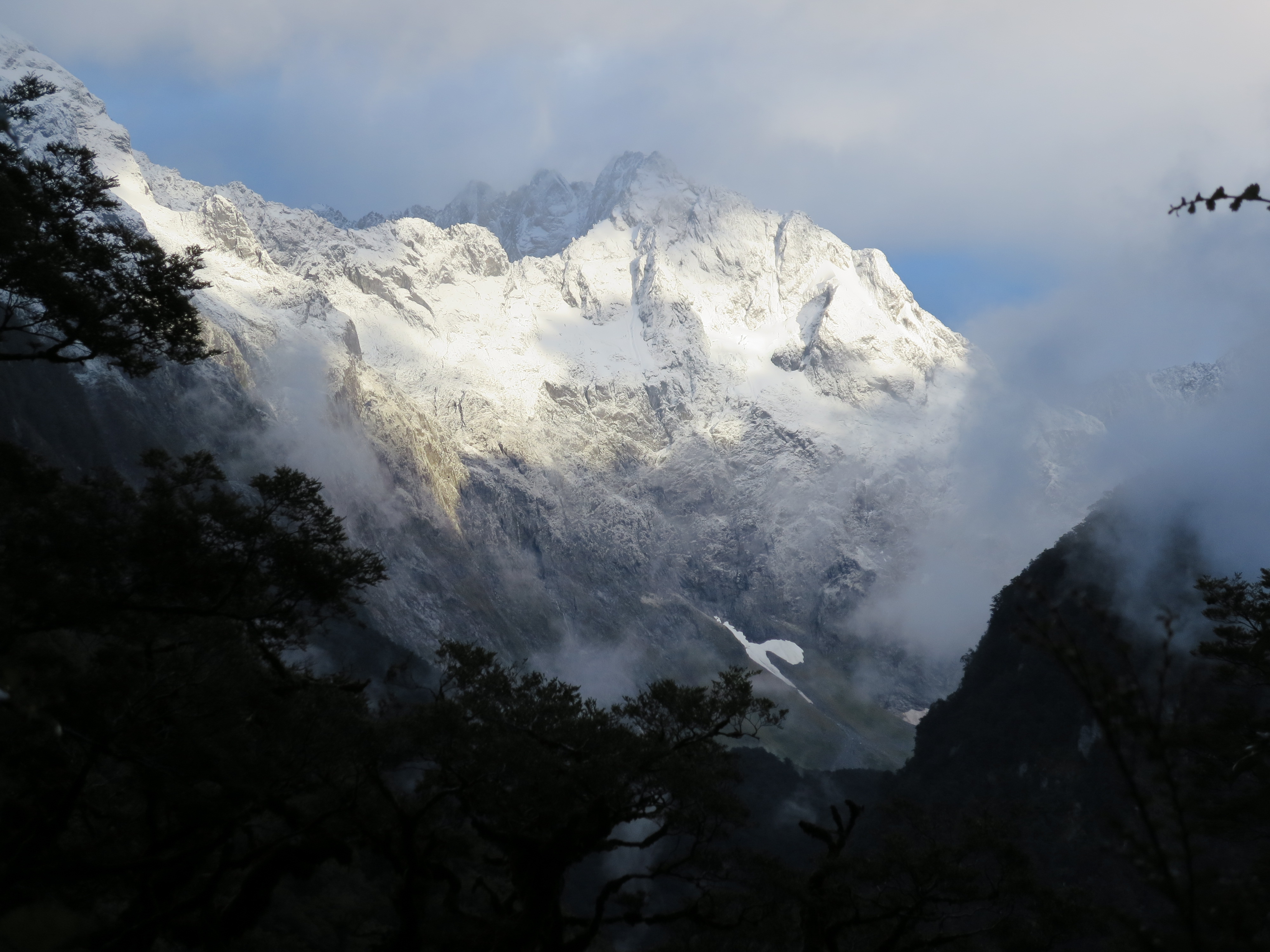
through the forest trees we spotted this beautiful snow-capped mountain
About an hour into the hike, it was still dry. I was so thankful. There were even moments when sun peaked through the clouds – nearly brought tears to my eyes. I will fully admit – I’m a bit of a wimp when it comes to cold weather.
still no rain!
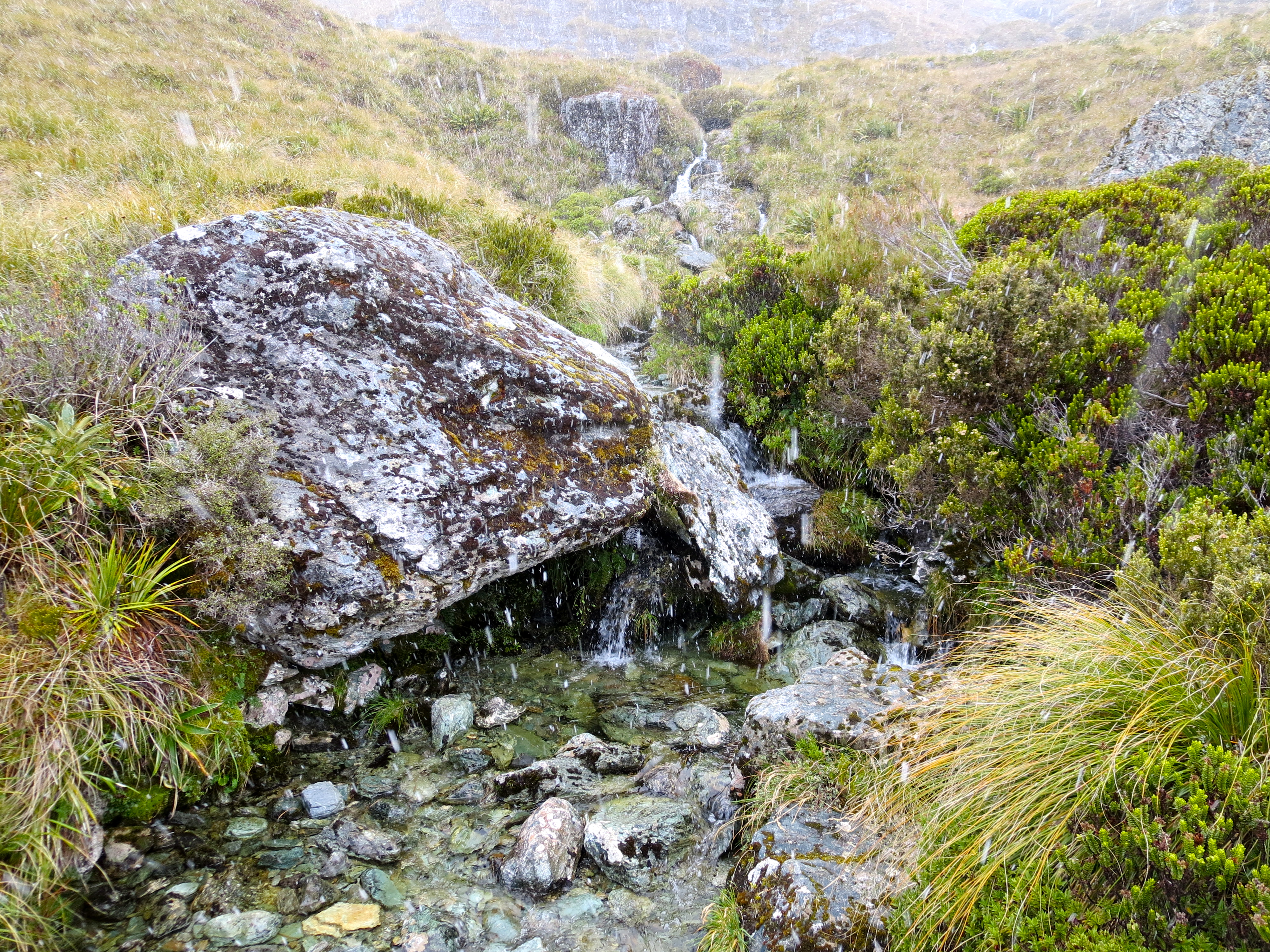
water everywhere
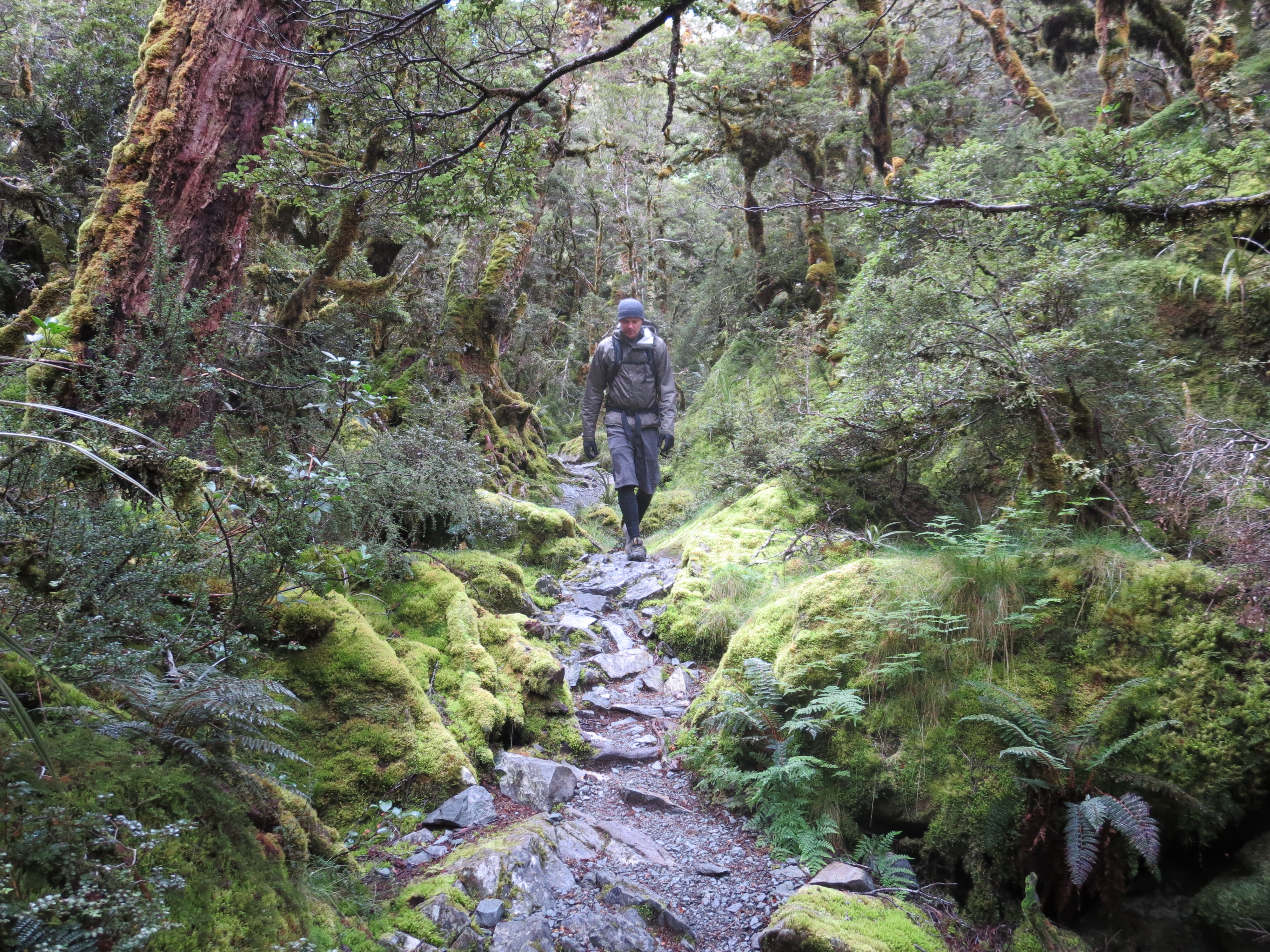
The first section of the hike was a climb through beech forest.
some rain as we hike through the forest
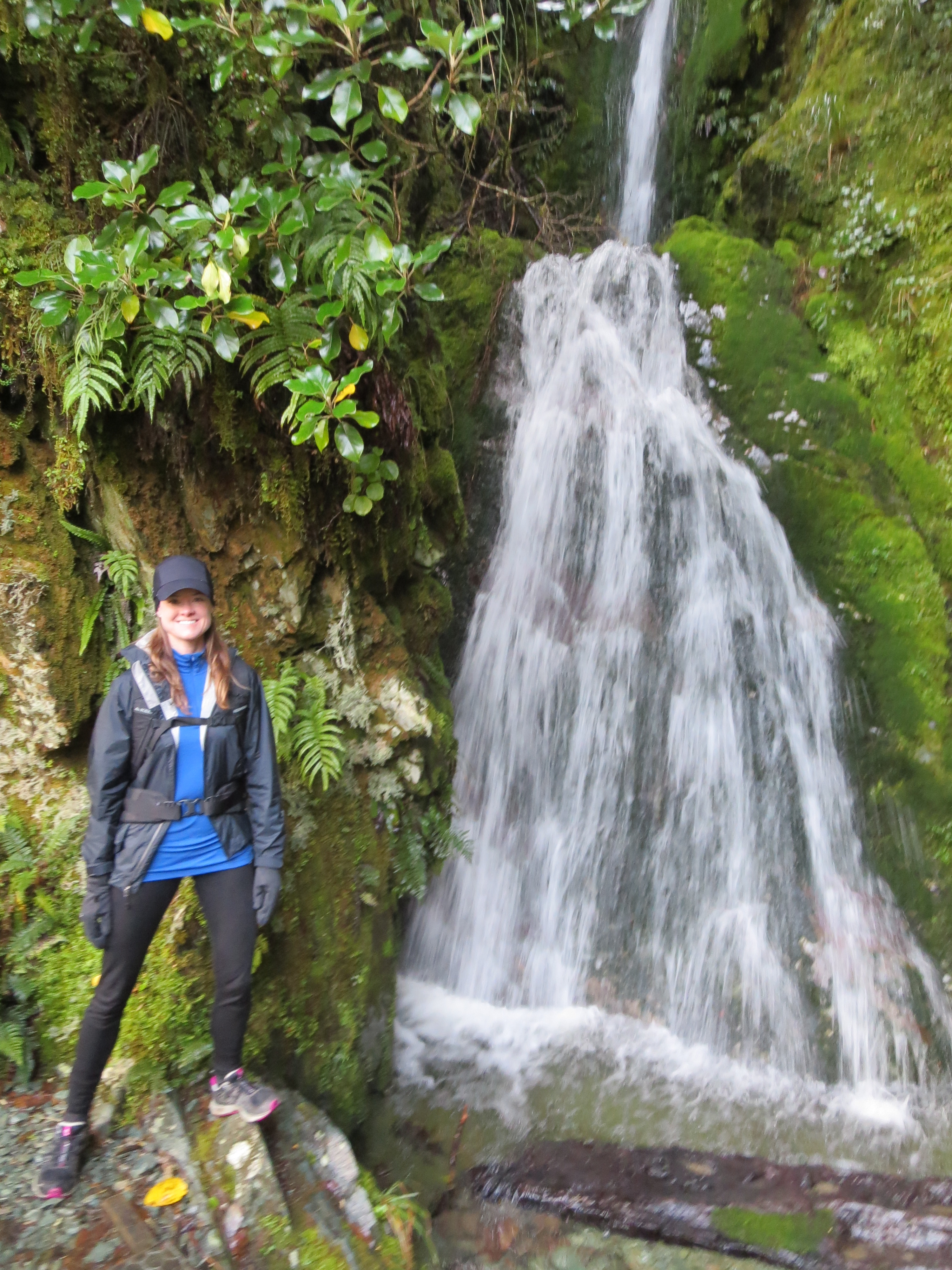
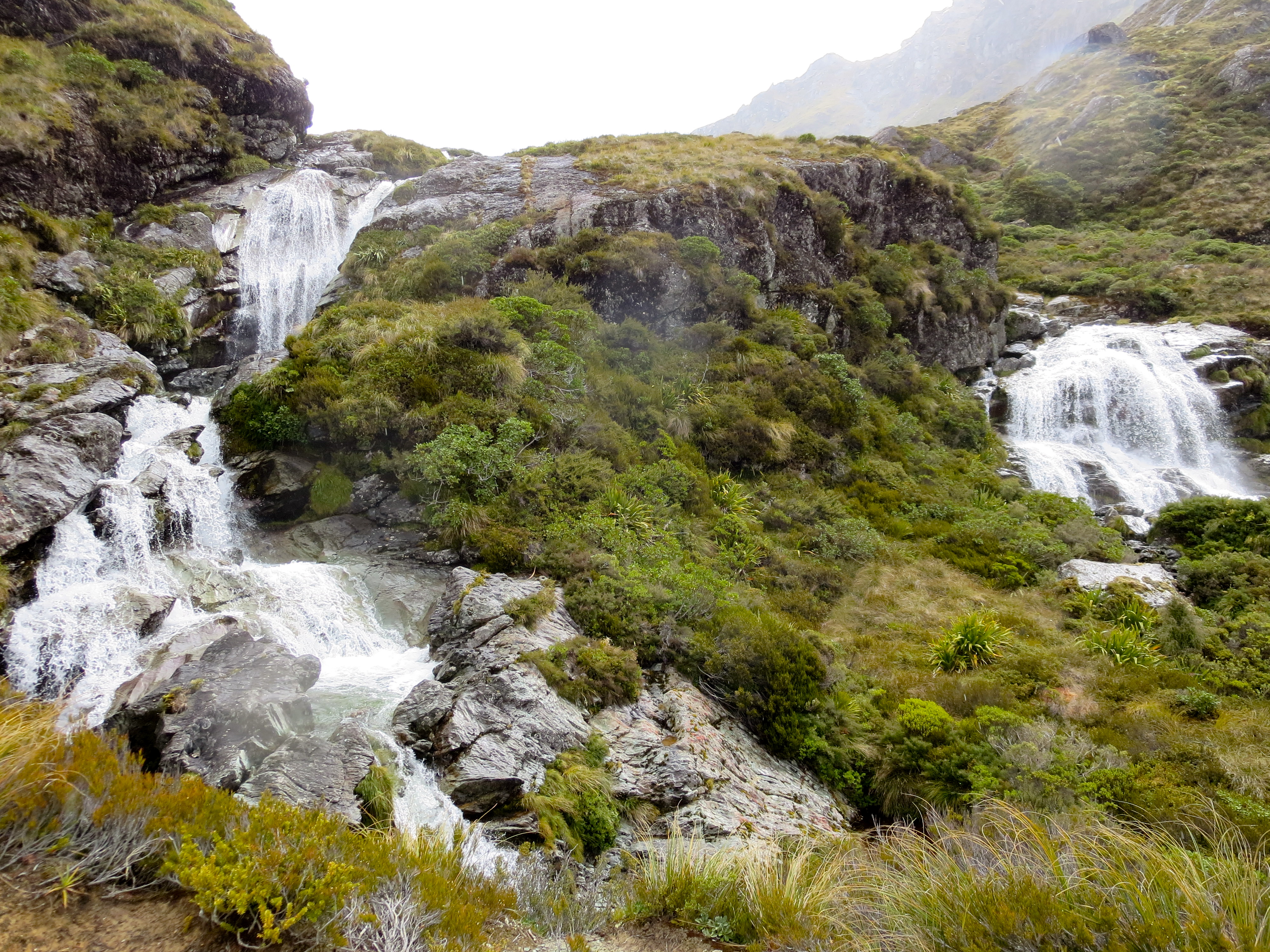
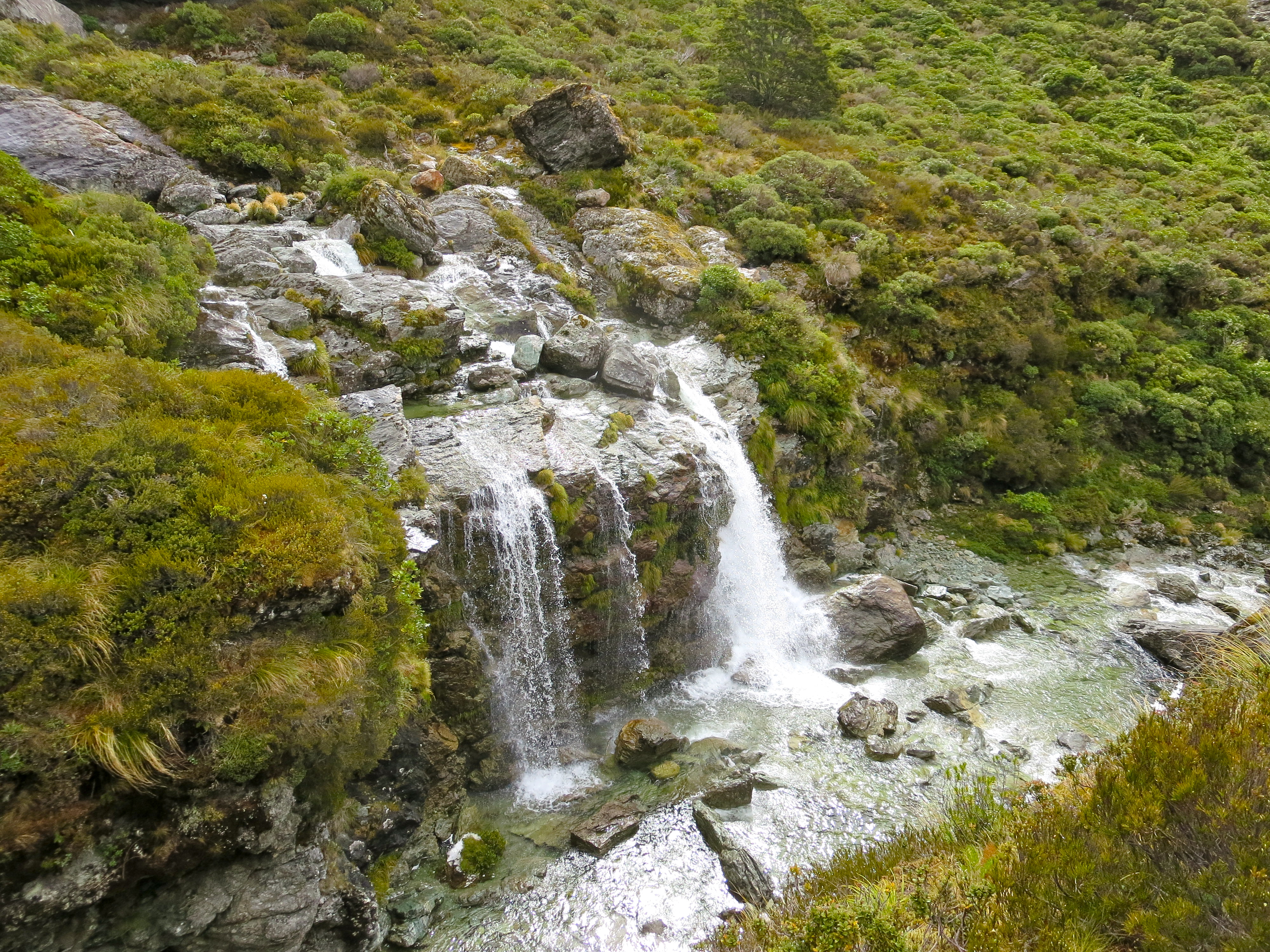
We came across a number of beautiful waterfalls. The most spectacular was Earland Falls. We were just walking along when we turned a corner and all of a sudden, there it was…check out this video we took:
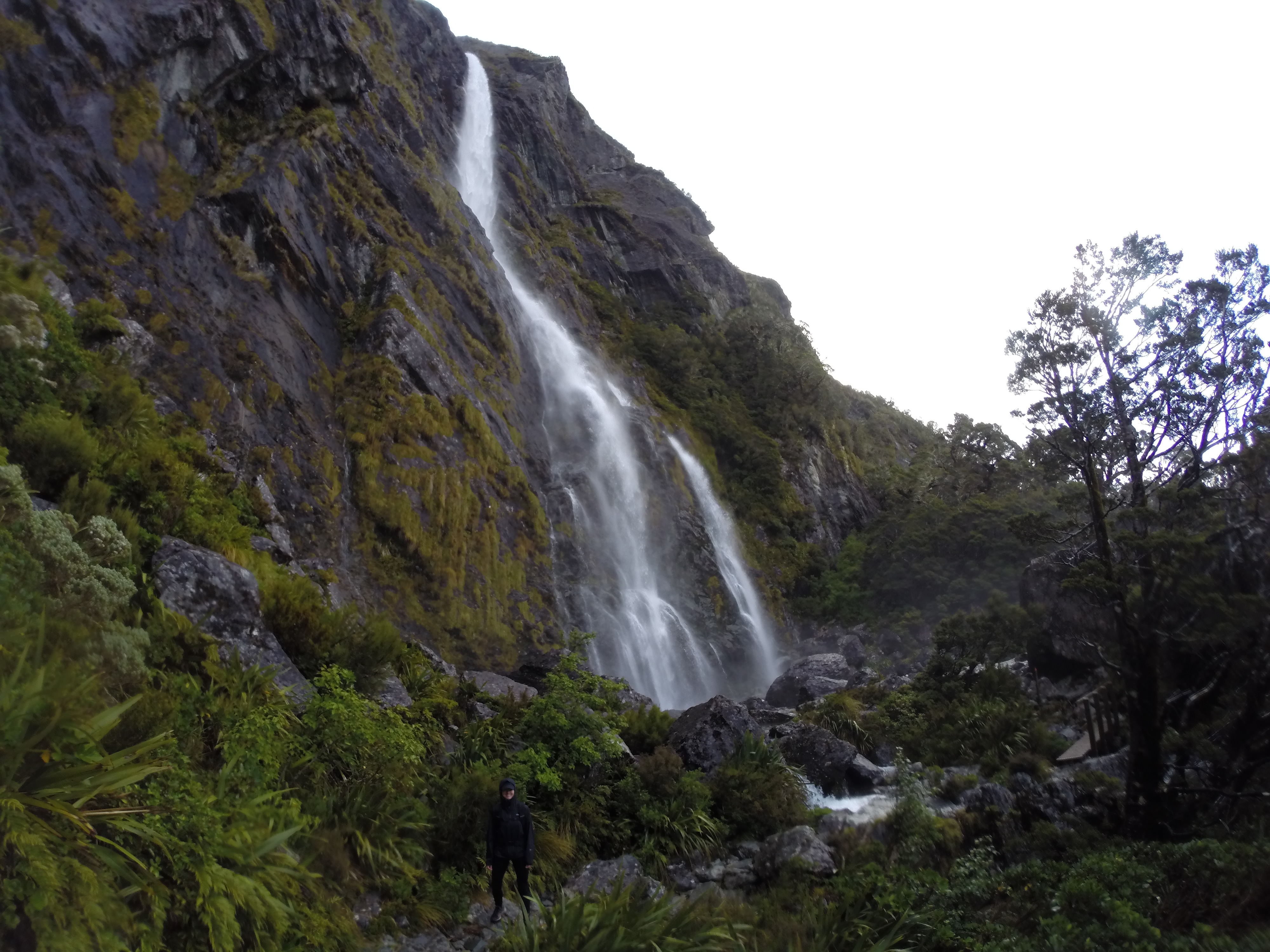
earland falls

you could feel its power
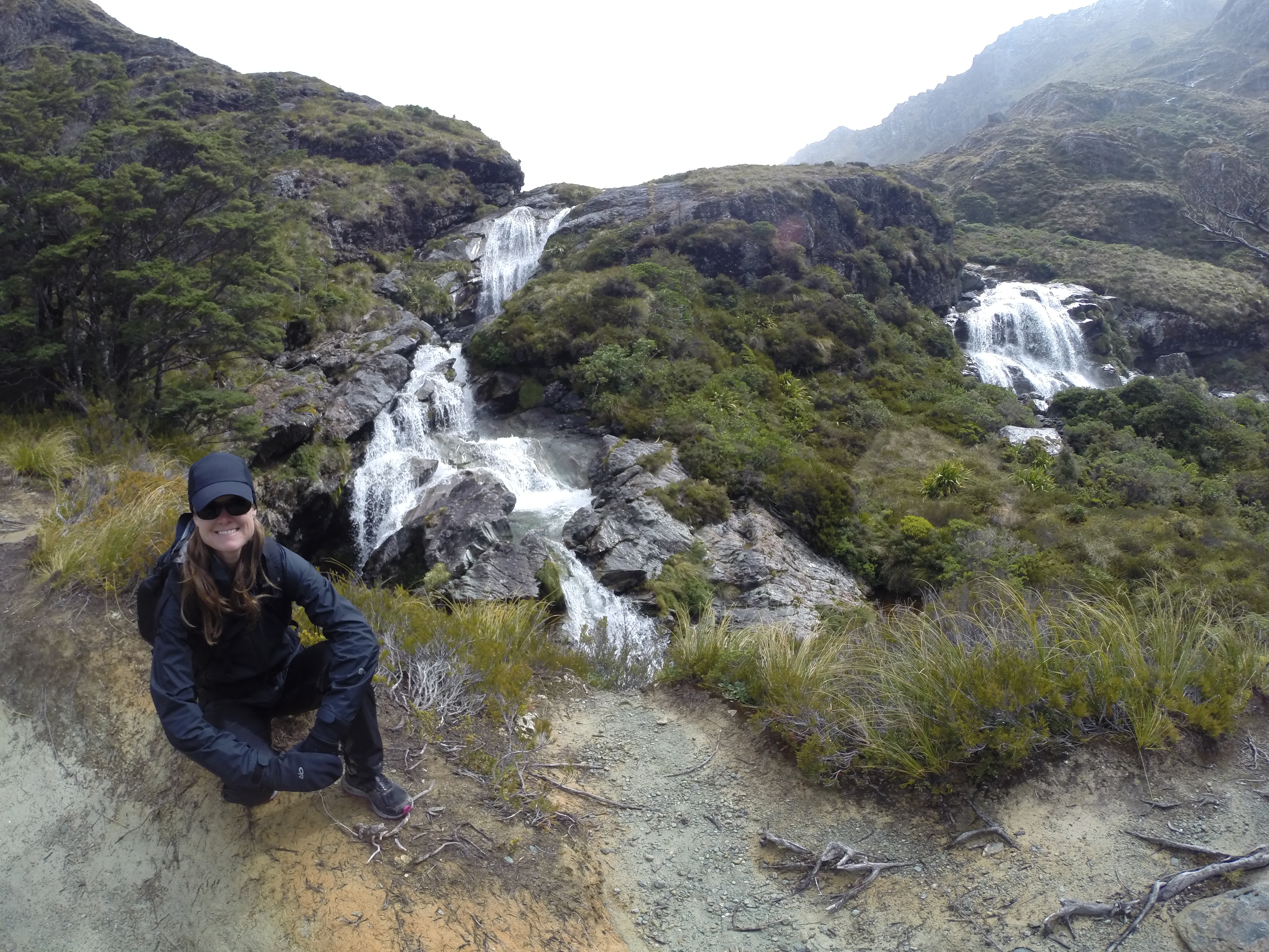
Just past the waterfall was a wide open area called the “Orchard”. A fellow hiker told us the views from that spot were beautiful it brought tears to his eyes.
view from the orchard – so many waterfalls coming down the mountainside

another view from the orchard – mountain tops peeking out from behind the clouds
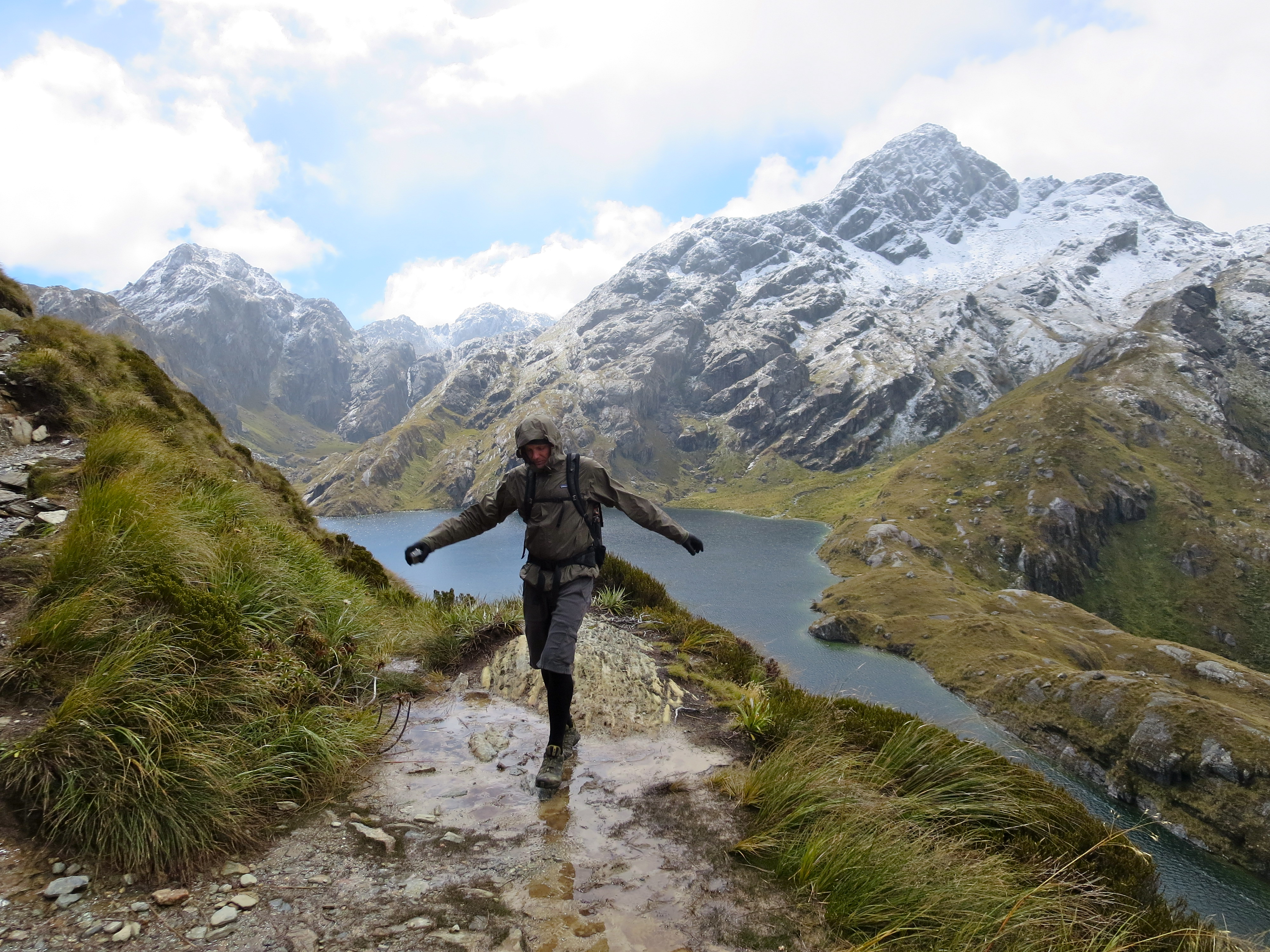
As we continued up, the trail got wetter and muddier. Where there was a choice to either get wet or get muddy, I chose muddy. But most of the time, there was no choice.

walking past a small waterfall…the water just flows down the trail
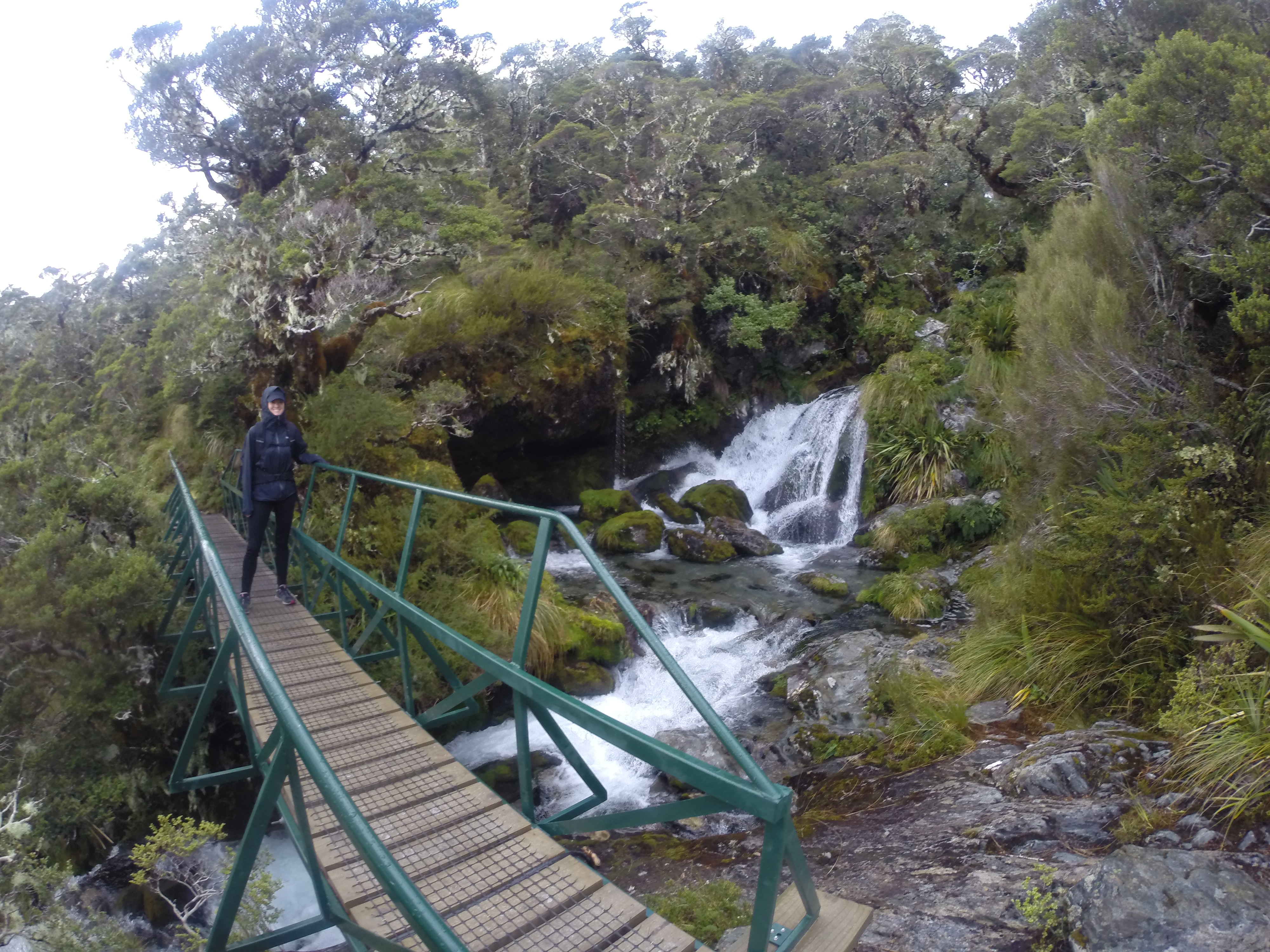
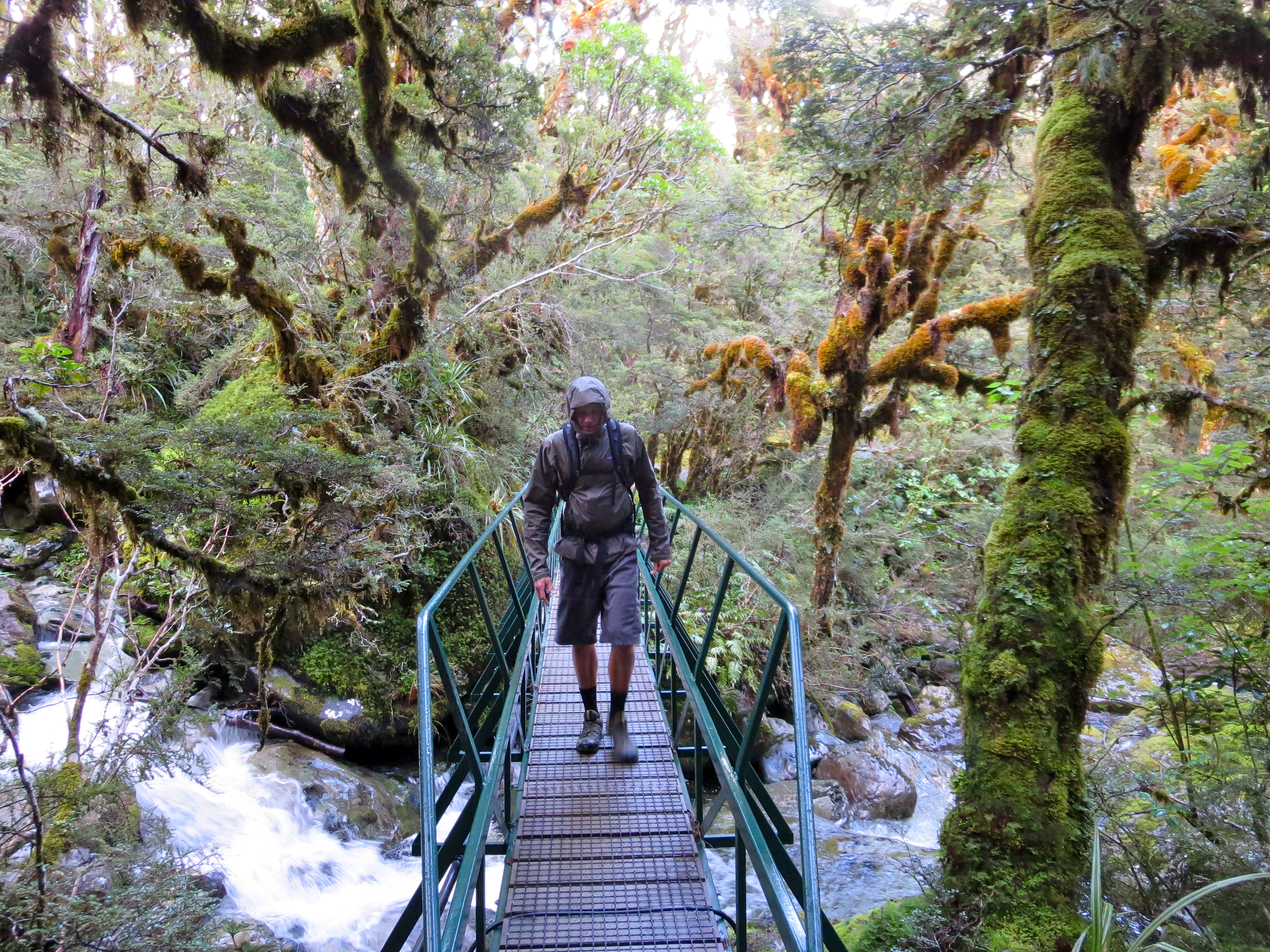
thankful there is a bridge over this one
About 3.5 hours into the hike, we reached the Lake Mackenzie Hut. We stopped there to eat lunch.

almost to the lake mackenzie hut…so happy to have the sun shining down on us!
lake mackenzie
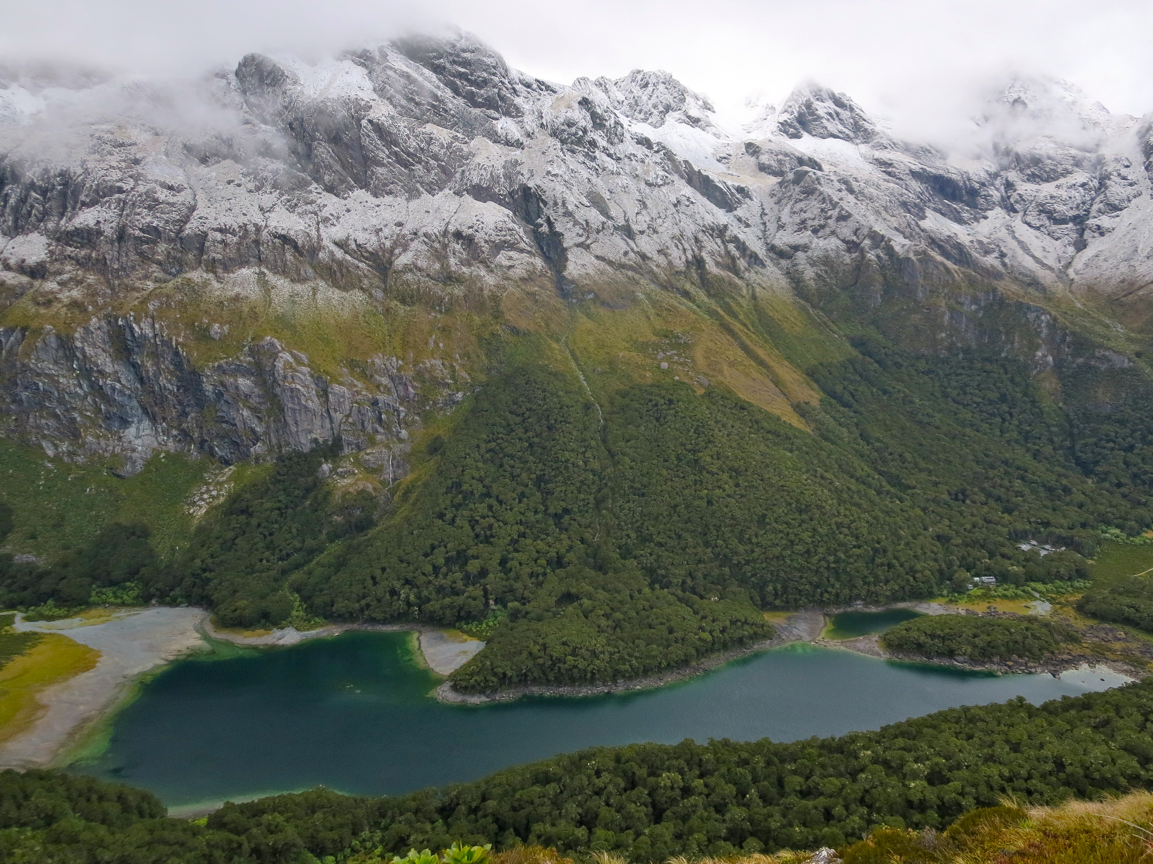
After leaving the Lake Mackenzie hut, the climb continued. This time, our climb would quickly take us above tree line. As we emerged from tree line, there were fantastic views of Lake Mackenzie below.

above lake mackenzie

on the trail above lake mackenzie
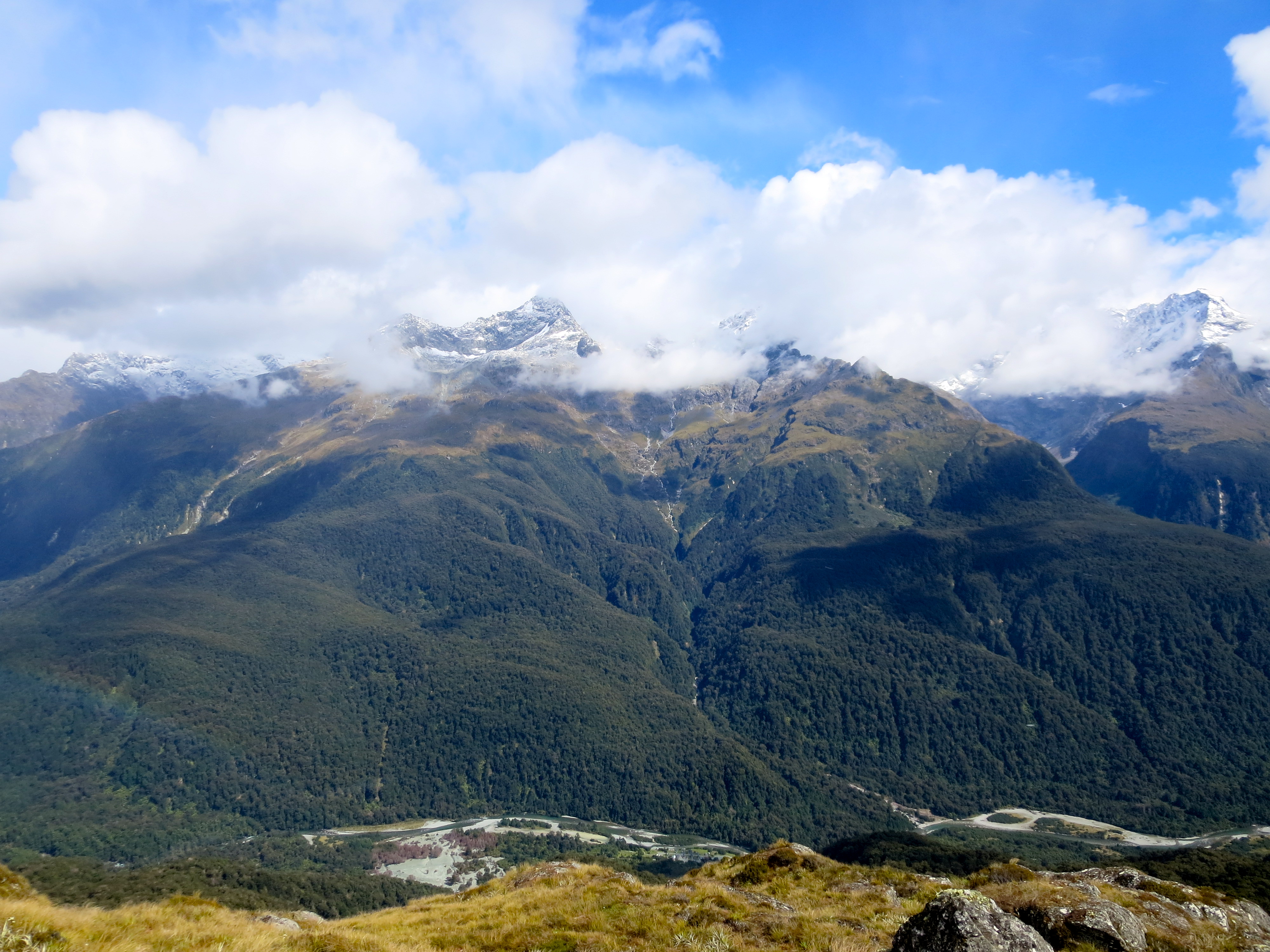
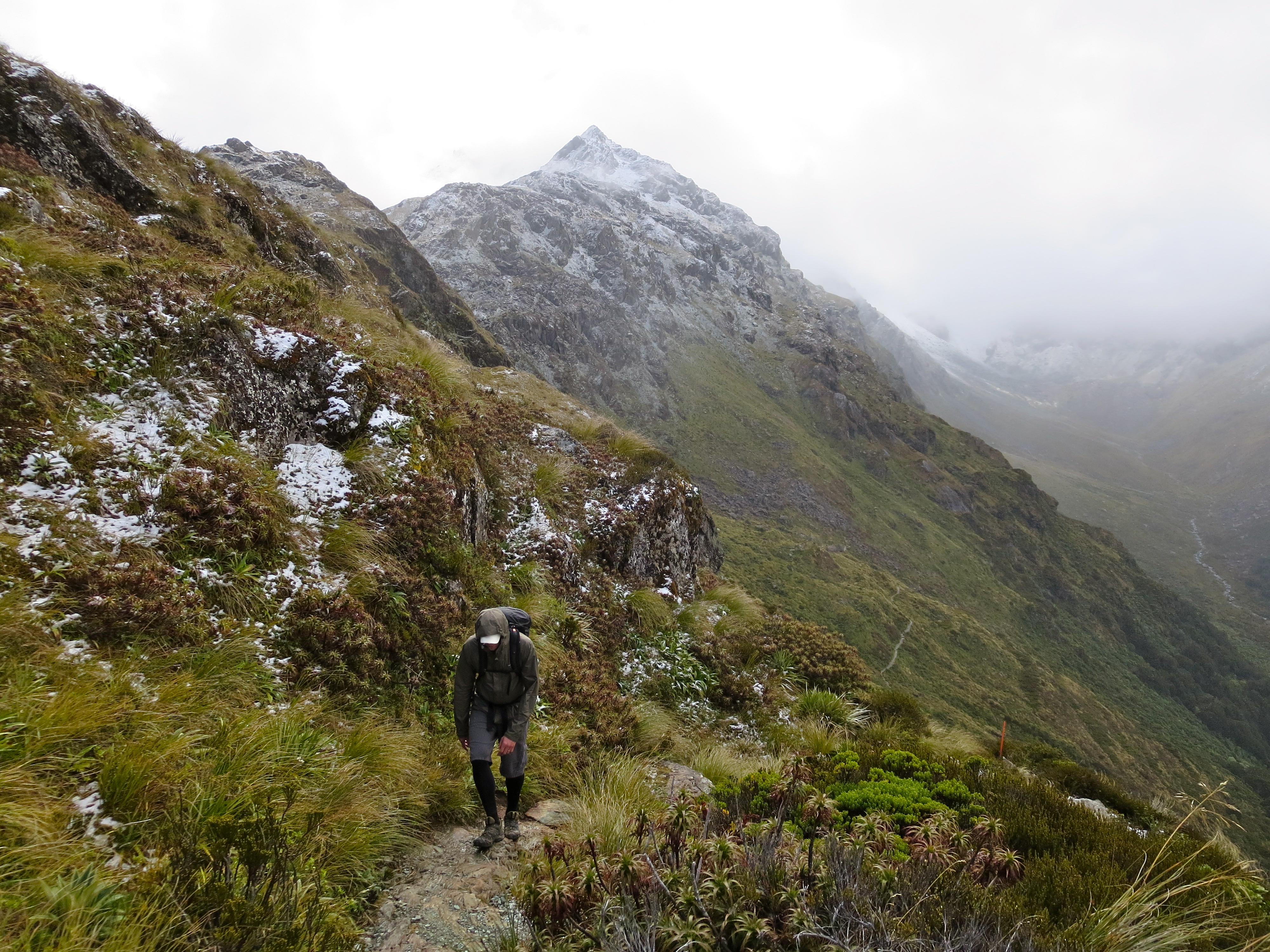
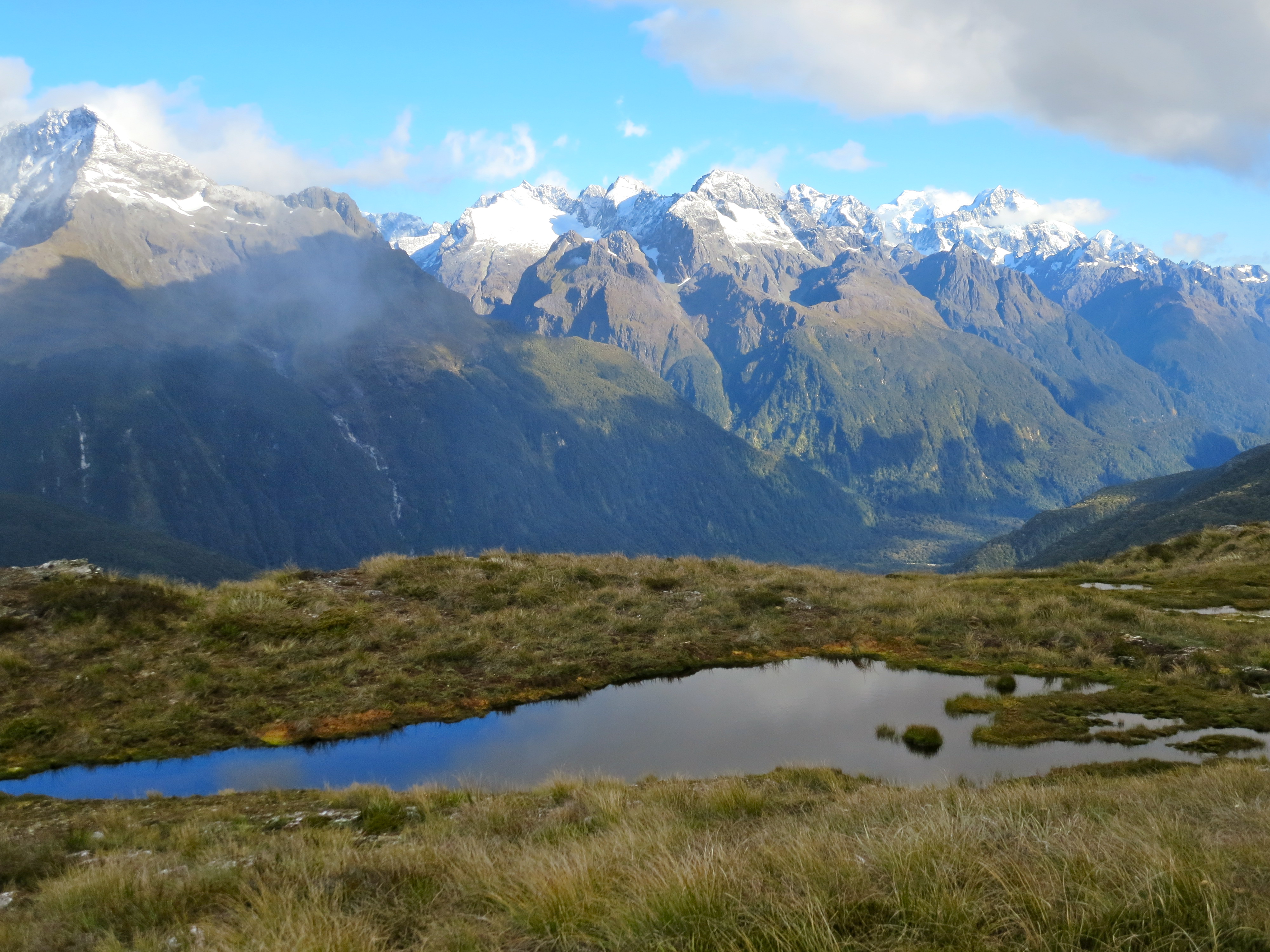
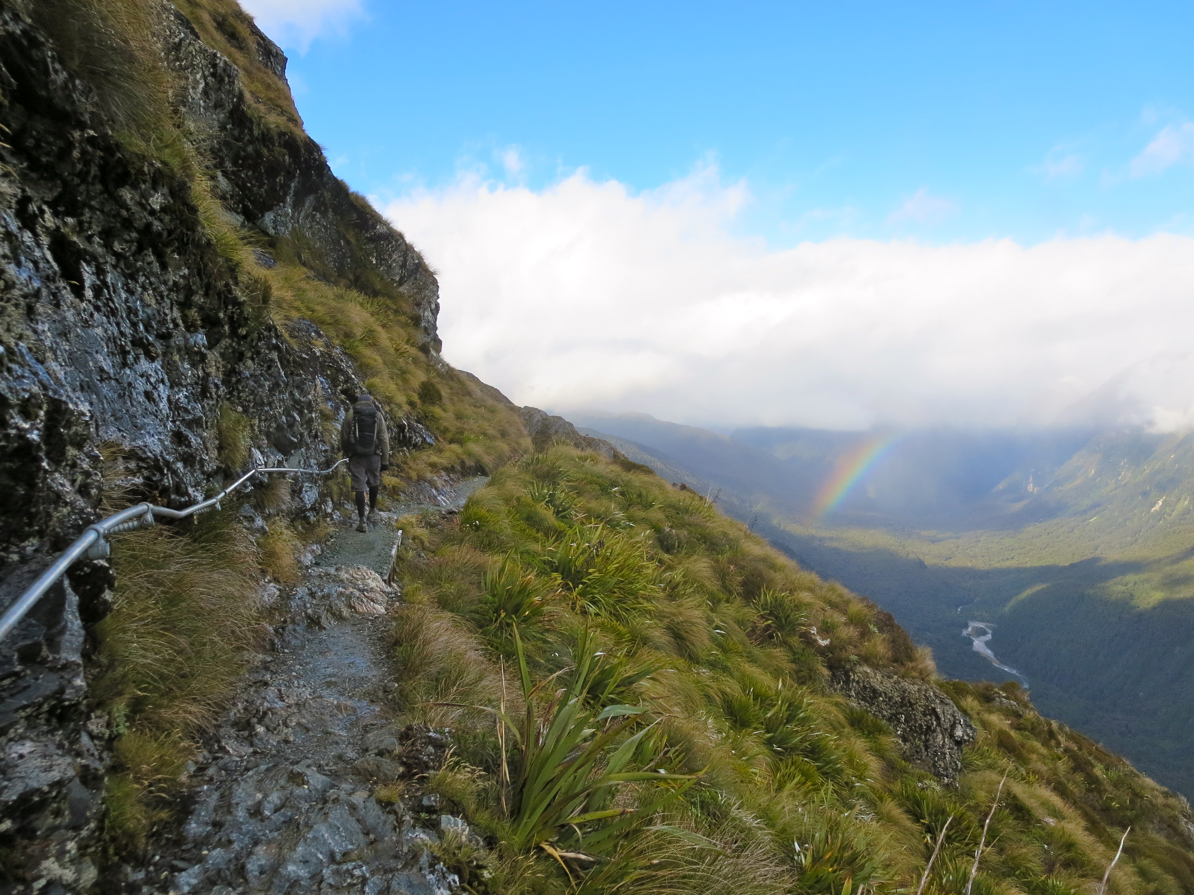
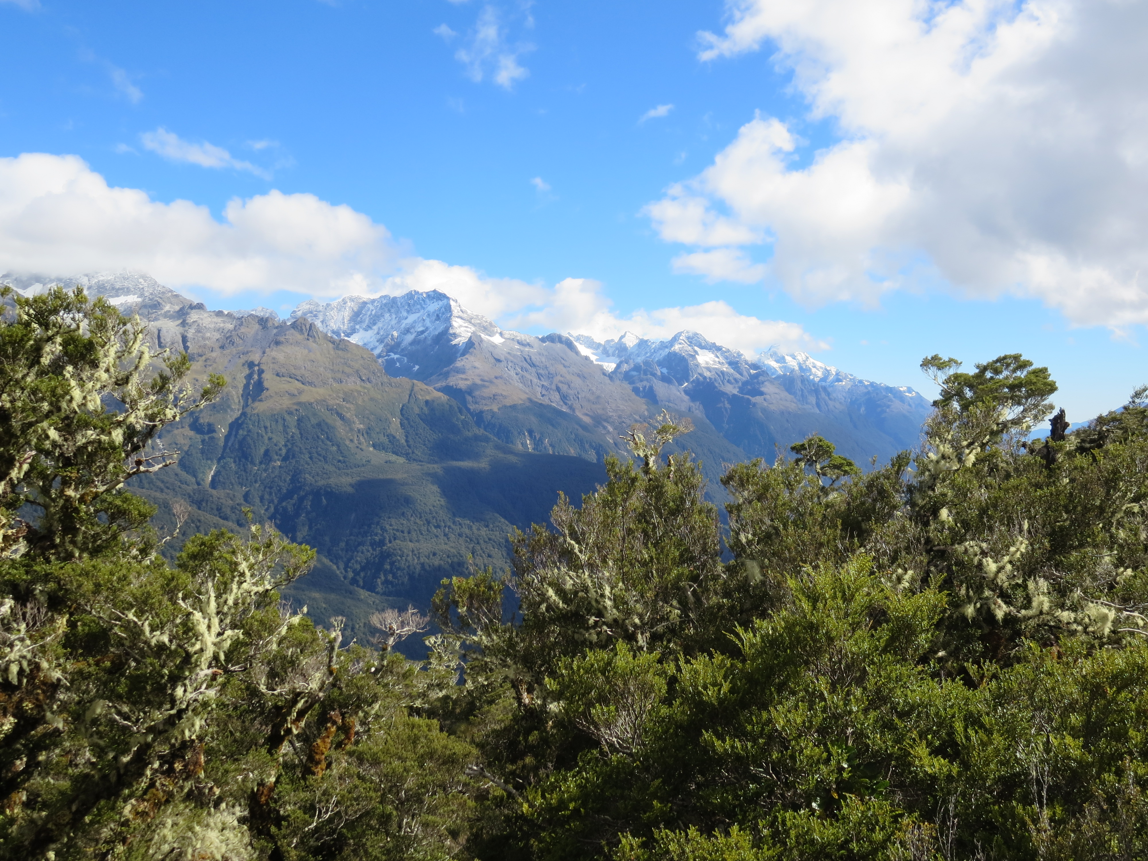
The next section of the hike climbed up to a ridge. There was a long stretch of trail along the exposed Hollyford Face. There were a lot of clouds in the sky, but we still had expansive views of the Darran Mountains.

the darran mountains come into view

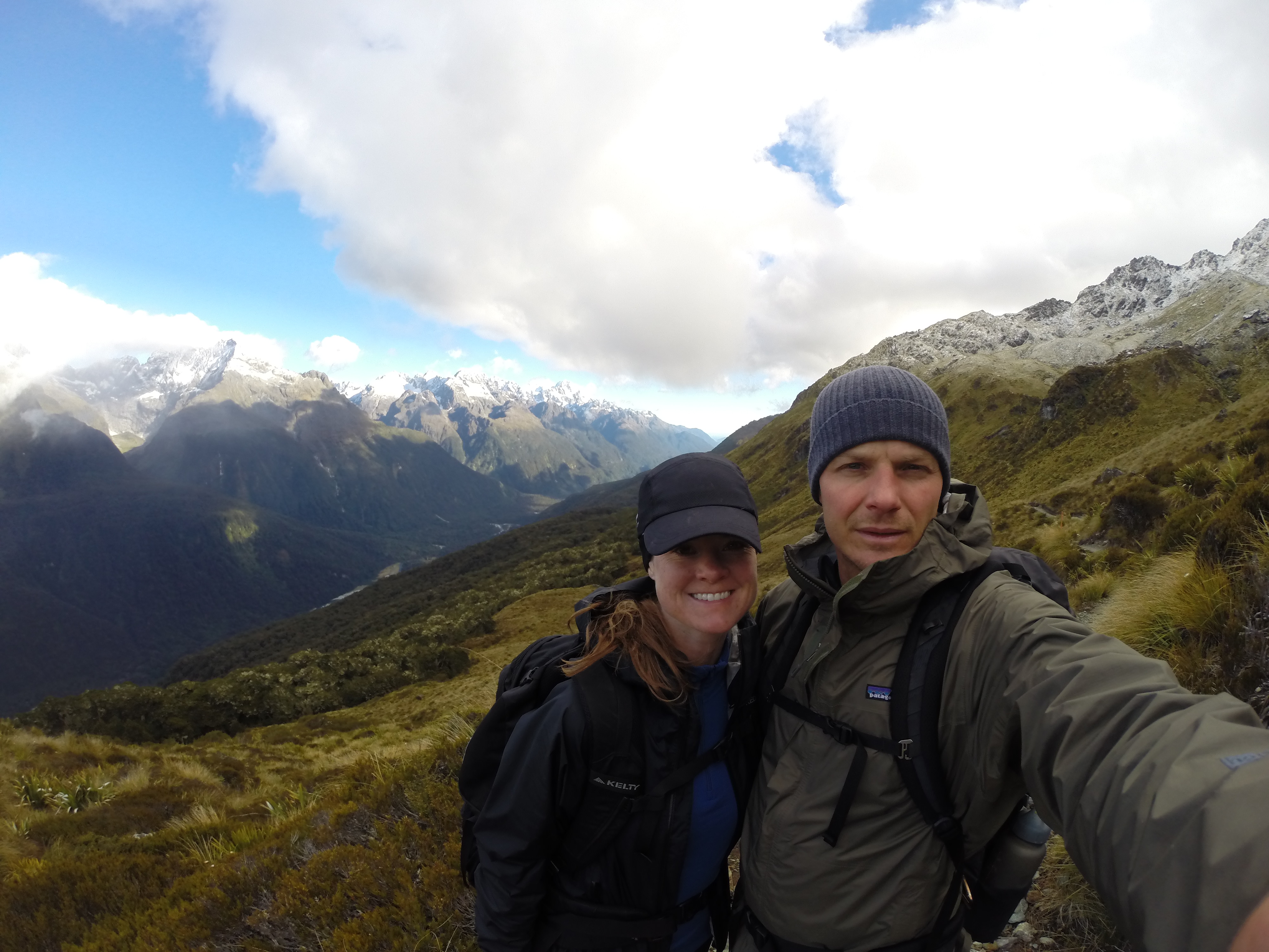
couple shot
the darran mountains
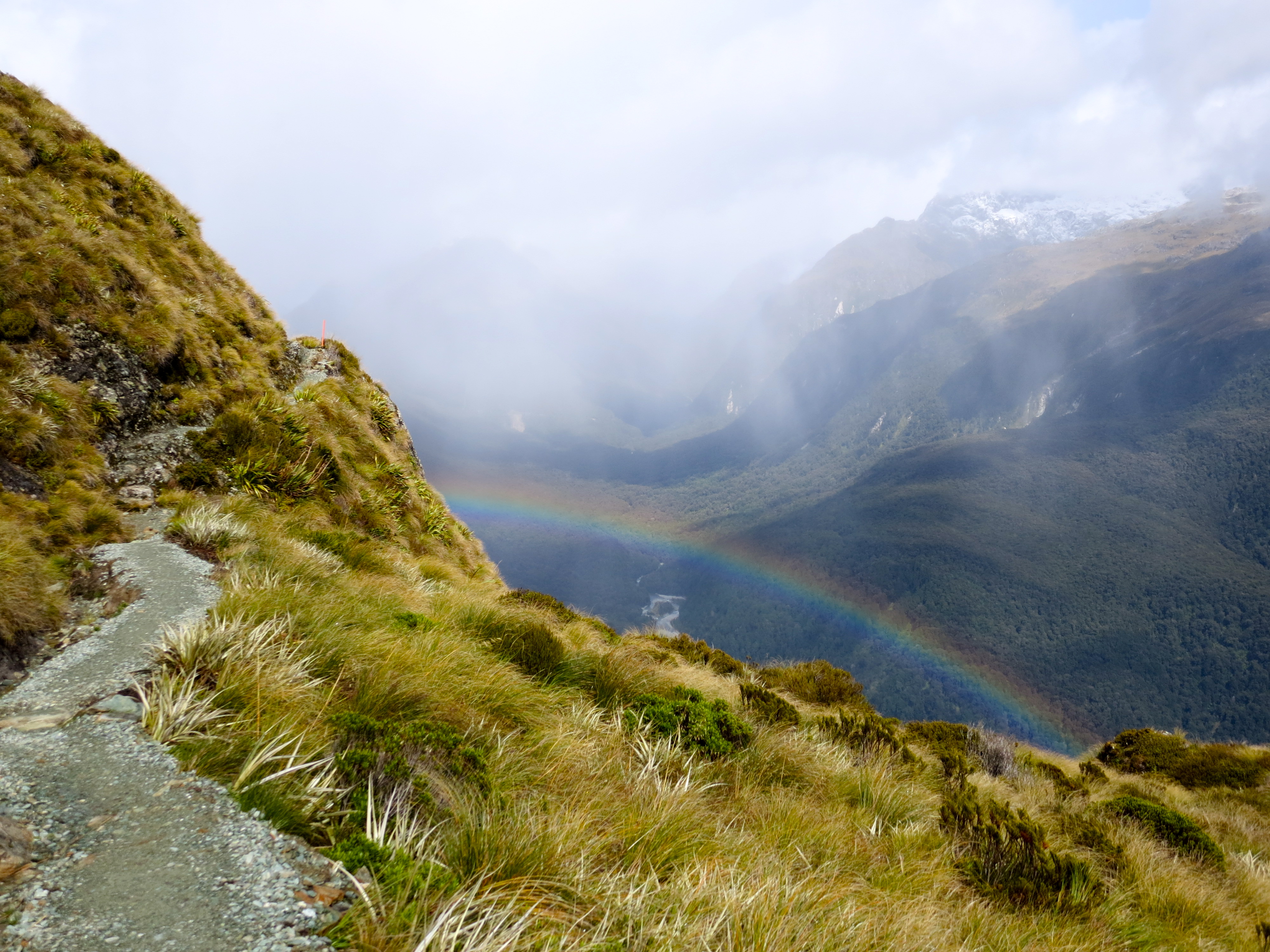
a rainbow!
Pretty much the entire time we were above tree line, it was snowing. But it was a light snow and so much better than hiking in cold rain.
light snow
see the snow coming down?
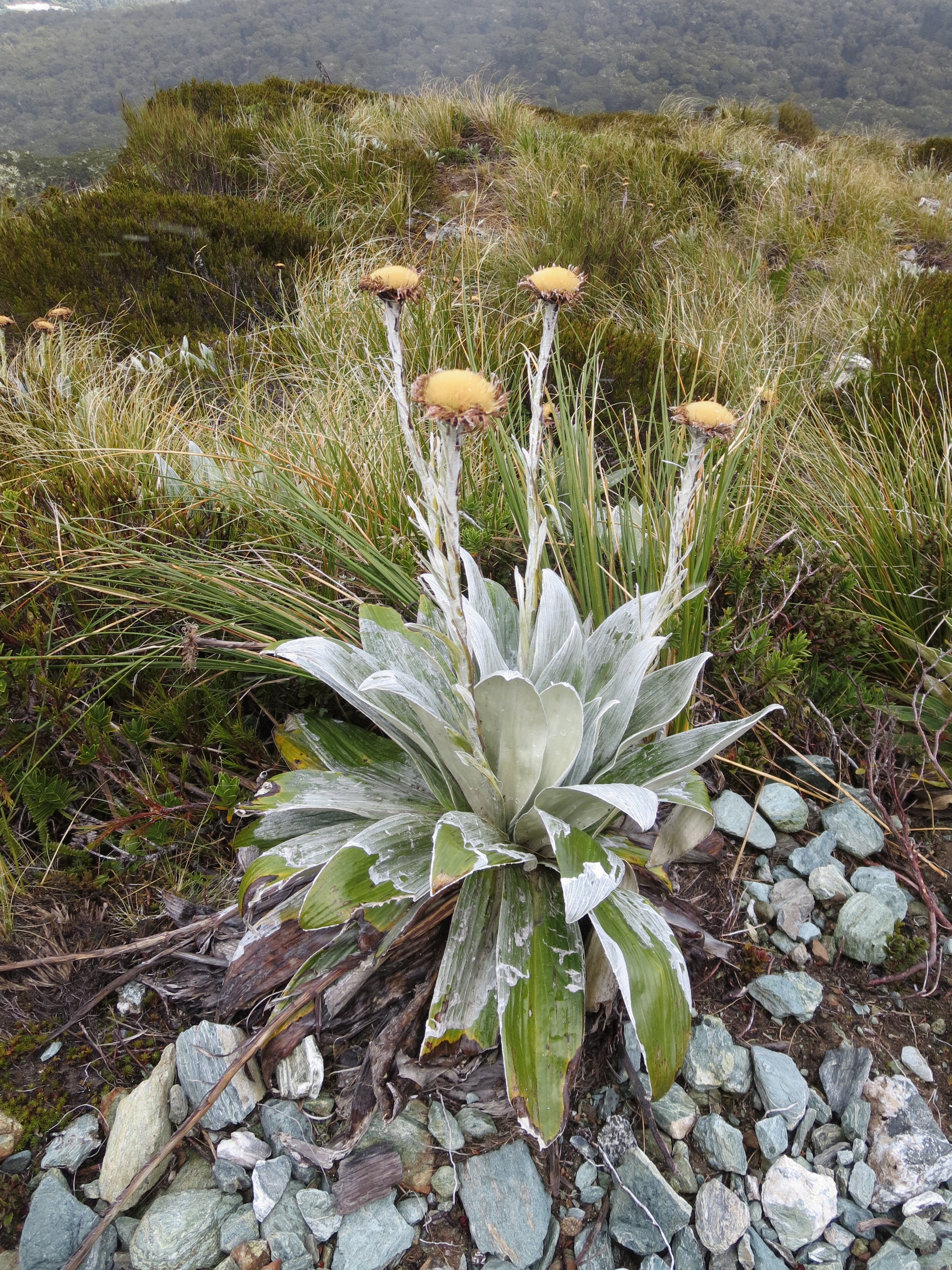
alpine flowers
About six hours into the hike, we reached the Harris Saddle, the highest point on the track. The Harris Saddle is located on the boundary between Fiordland National Park and Mt Aspiring National Park.

as we approach the saddle, the sun comes back out

traversing the saddle
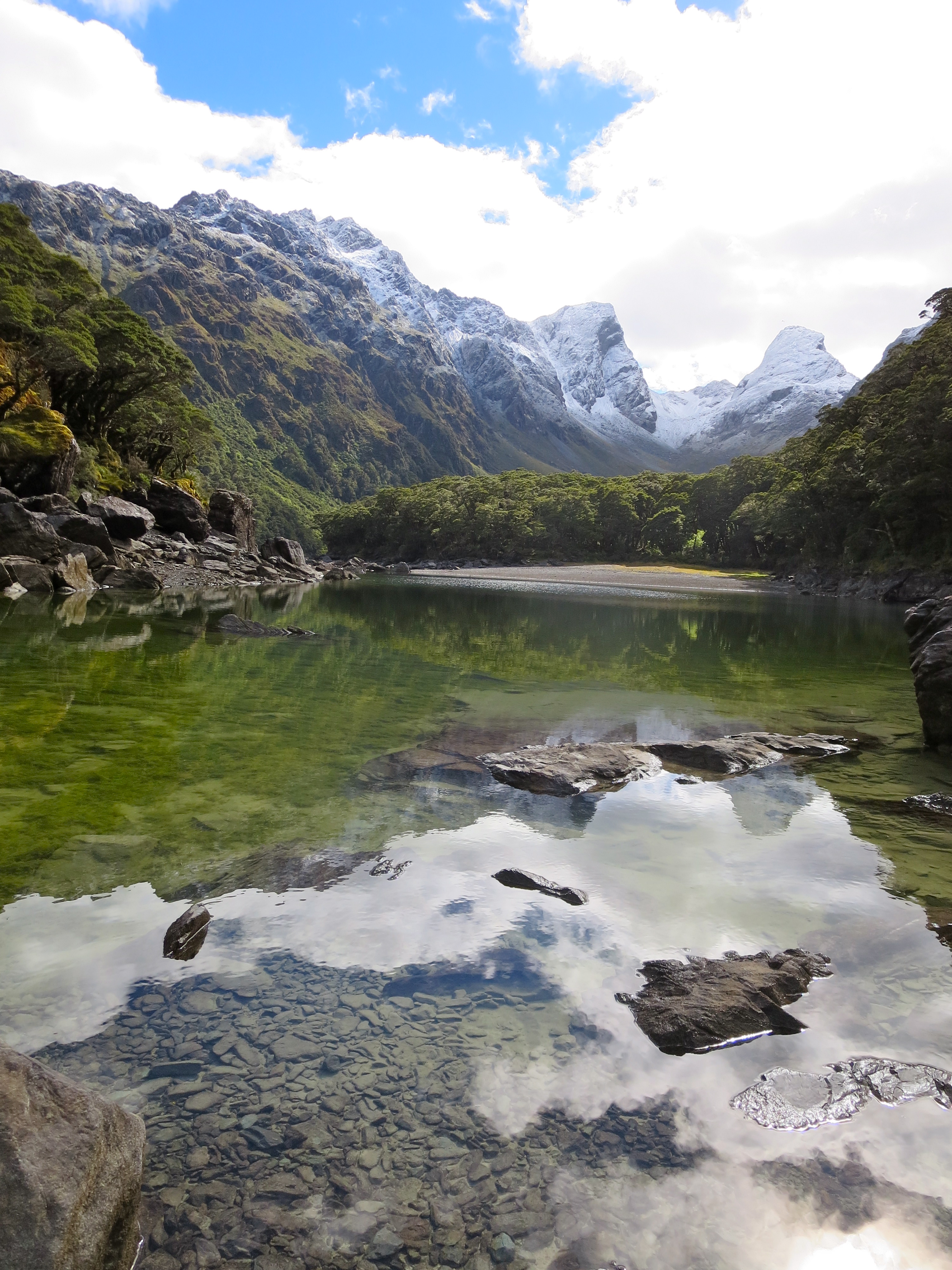
On the Mt Aspiring side of the saddle, we were rewarded with spectacular views of Lake Harris. The sky had even cleared a little, providing some really nice views.
lake harris

stunning

looking out over the valley below
it’s a wet, rocky trail above lake harris

looking back at lake harris

stopping for a picture
From Lake Harris, we made our descent through the valley to the Routeburn Falls Hut, where we would be staying the night.

we passed under a really cool rock formation
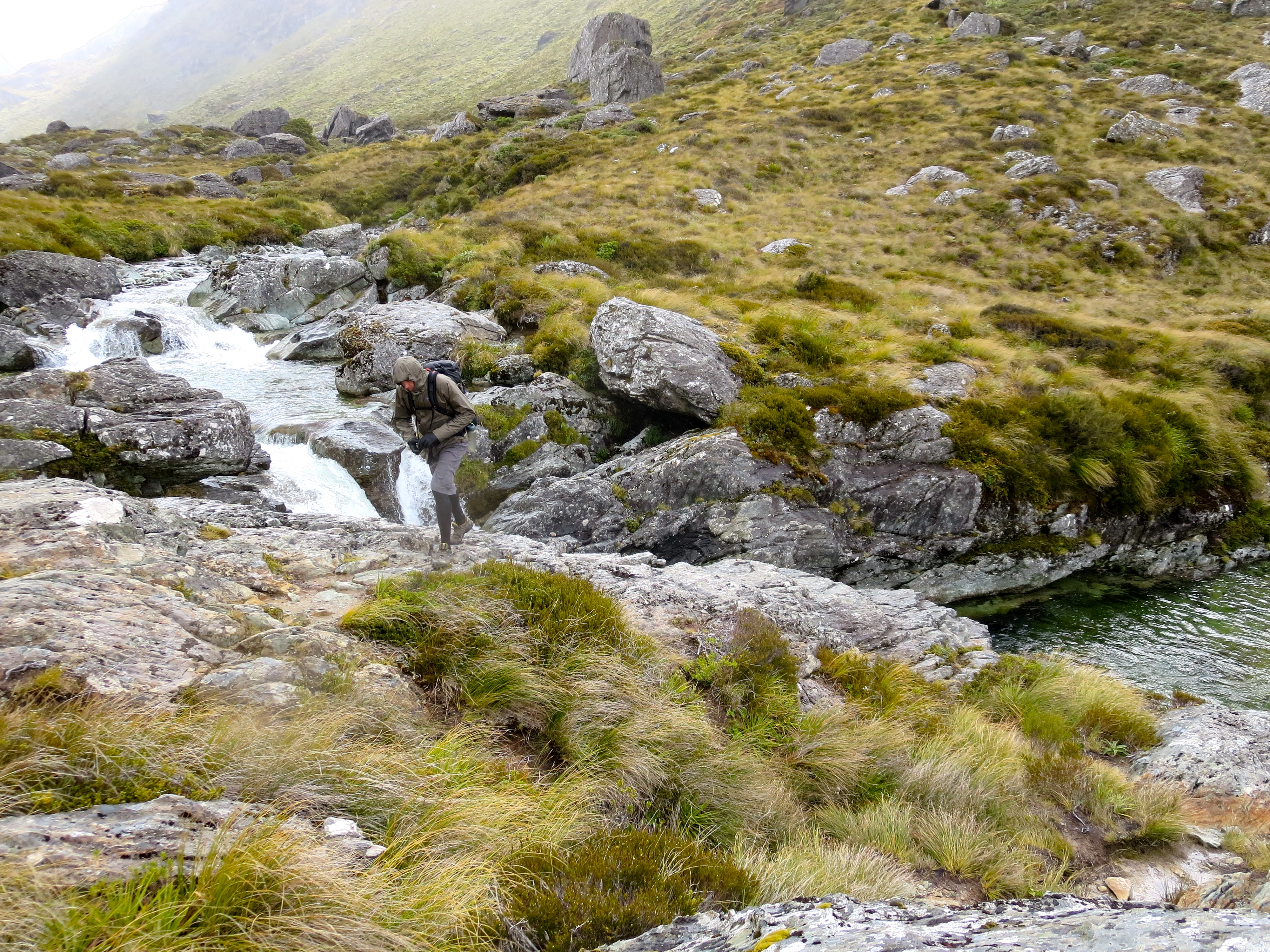
water flowing down through the valley

a perfect water feature, handcrafted by nature
The Routeburn Falls Hut sits at the base of the Routeburn Falls (hence the name). Enjoying the views of the falls was the perfect way to end the day. The hut ranger told us that in the wintertime, the Routeburn Falls are frozen solid and absolutely silent. I can only imagine.

we can see the hut below!
routeburn falls
majestic

jay hiked down to soak his legs in the freezing water
routeburn falls
First order of business upon arrival at the hut was signing in. It was a full house that night! We got two of the last bunks near each other. Not really a surprise that we were one of the last to arrive as we were the only ones who had hiked in all the way from the trailhead at The Divide. It had taken us 7.5 hrs to hike the 14.5 miles. Also on the message board was the much-anticipated weather forecast. It was COLD with strong, cold winds. It was about 40 degrees Fahrenheit when we reached the hut. We spent the evening sitting by the wood stove and chatting with fellow travelers.

message board

bunk sign-in…it’s gonna be a full house
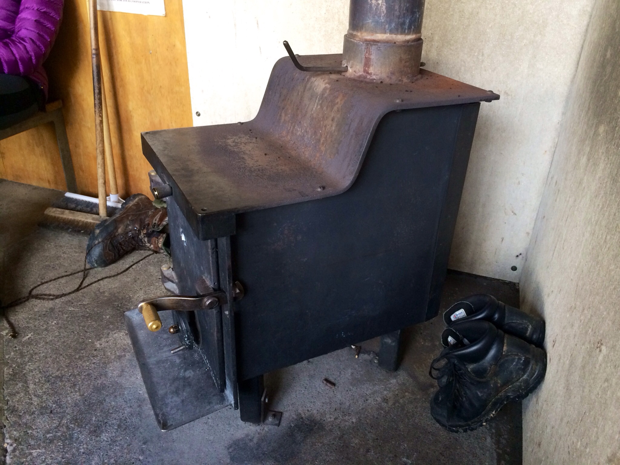
so thankful for the warmth from this little stove

hanging out around the stove
The bunkrooms were in a separate area without any heat or insulation and they were quite cold. It was so cold, I wasn’t sure I’d be able to fall asleep given that we were traveling light and did not have proper sleeping bags for conditions this cold. We put on every piece of clothing we had with us – including our rain jackets, waterproof pants, hats and gloves. Before going to bed, Jay had me fill my water bottle with boiling hot water and put it in my sleeping bag with me. I had heard about this trick, but never tried it before. It really does help keep you warm. I managed to sleep pretty well until the early hours of the morning when the water bottle went cold.
We were the first ones up in the morning. We wanted to get an early start as we had a long day of hiking ahead of us to get back to the trailhead. It was completely dark when we started hiking, and needless to say, freezing cold. Thankfully, the first couple hours were all up hill, so that warmed us up. As the sun began to rise, we could see snow covering the landscape all around us. It was absolutely stunning to see the landscape change before our eyes as the sun made its way further into the sky.
making our way up the valley

the sun comes up
We ran into the hut ranger. He had already been up to the Harris Saddle before the sun came up and was now on his way back to the hut. I was a little surprised to see him wearing shorts, given how cold it was; nonetheless, he is a local and this is their summer. We asked him how much the conditions were higher up. He looked at what we were wearing and said we would be fine. We chatted with him for a bit and he gave us some insight into the landscape around us and pointed out some of the native plants.
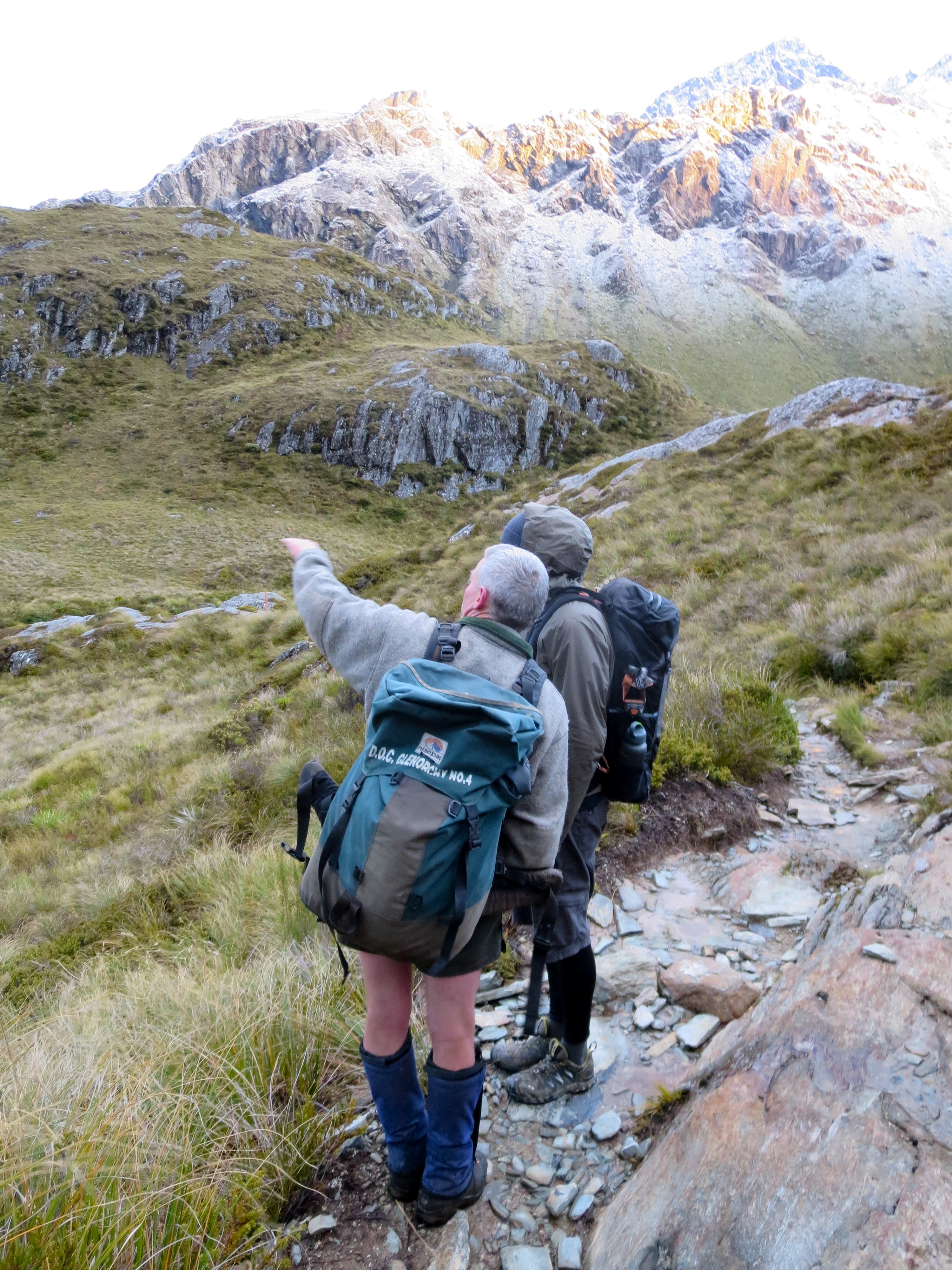
talking with the ranger
We continued up the valley, making our way to Lake Harris.

back through the cool rock formation
wow

making our way to the lake
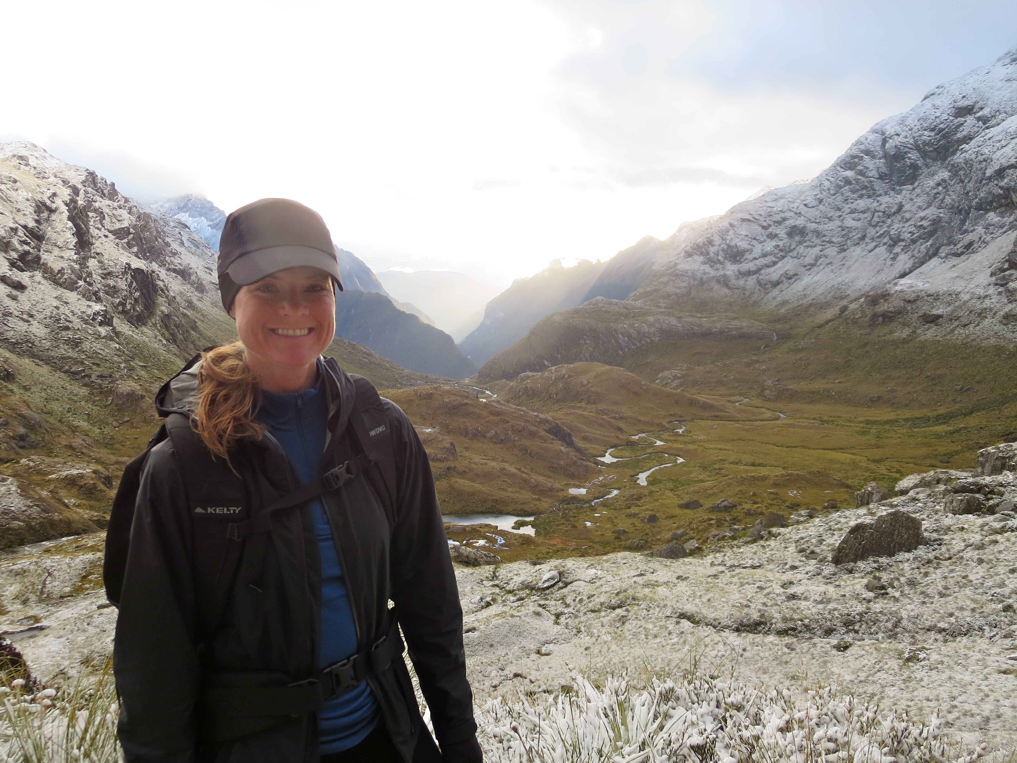
a happy moment
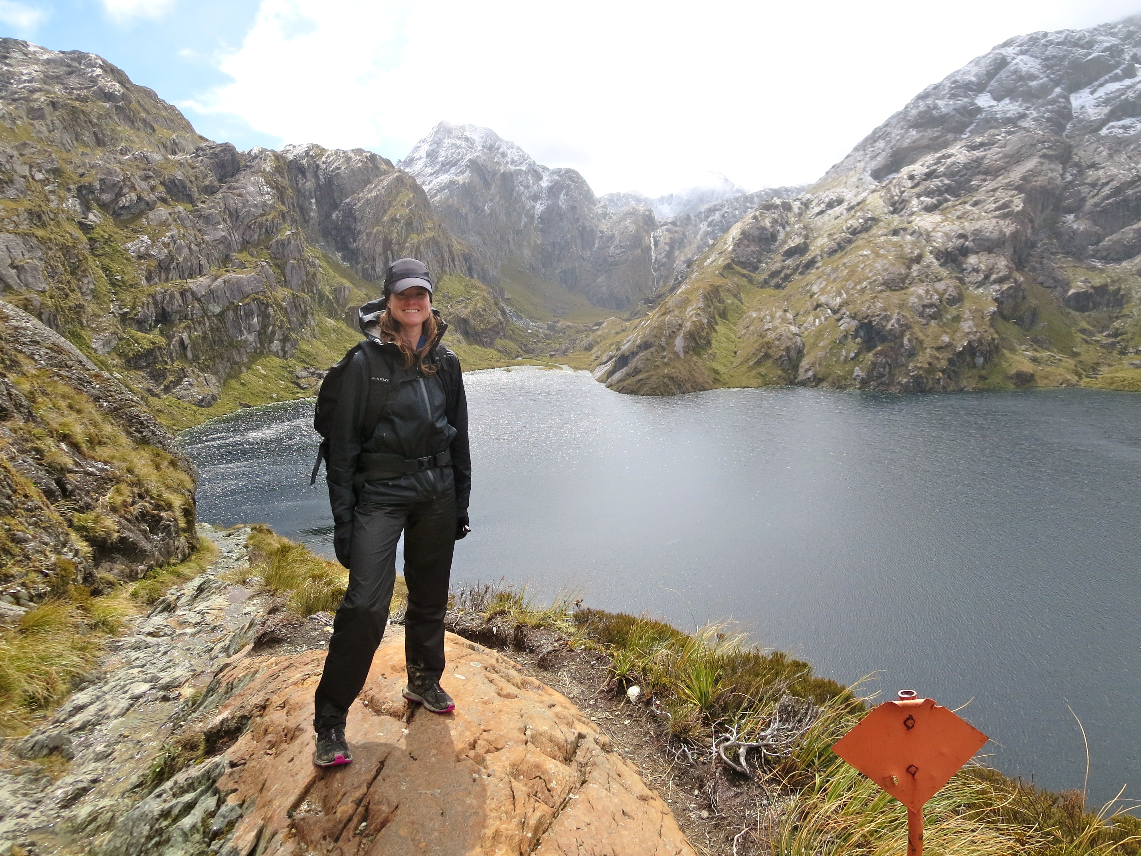
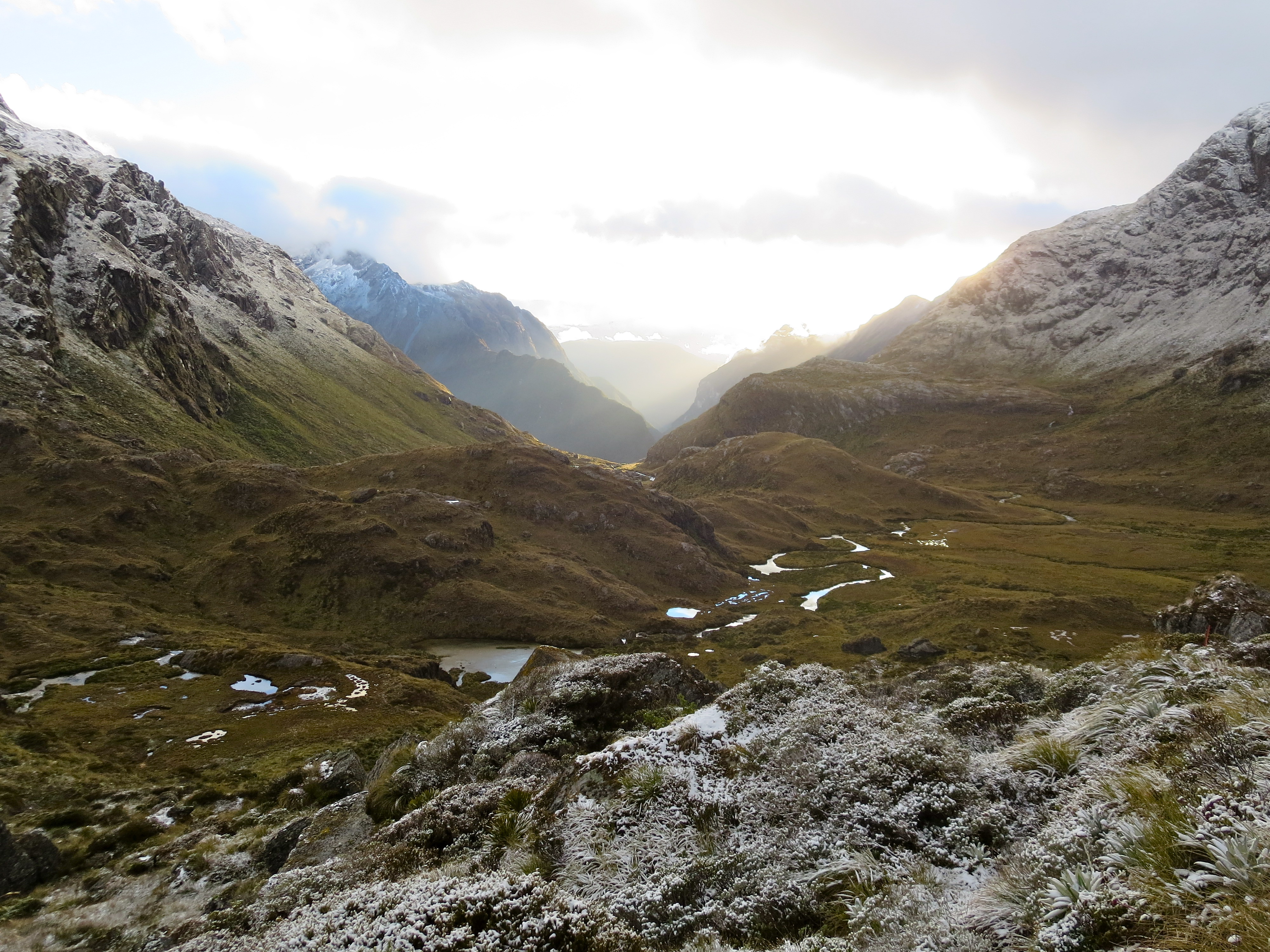
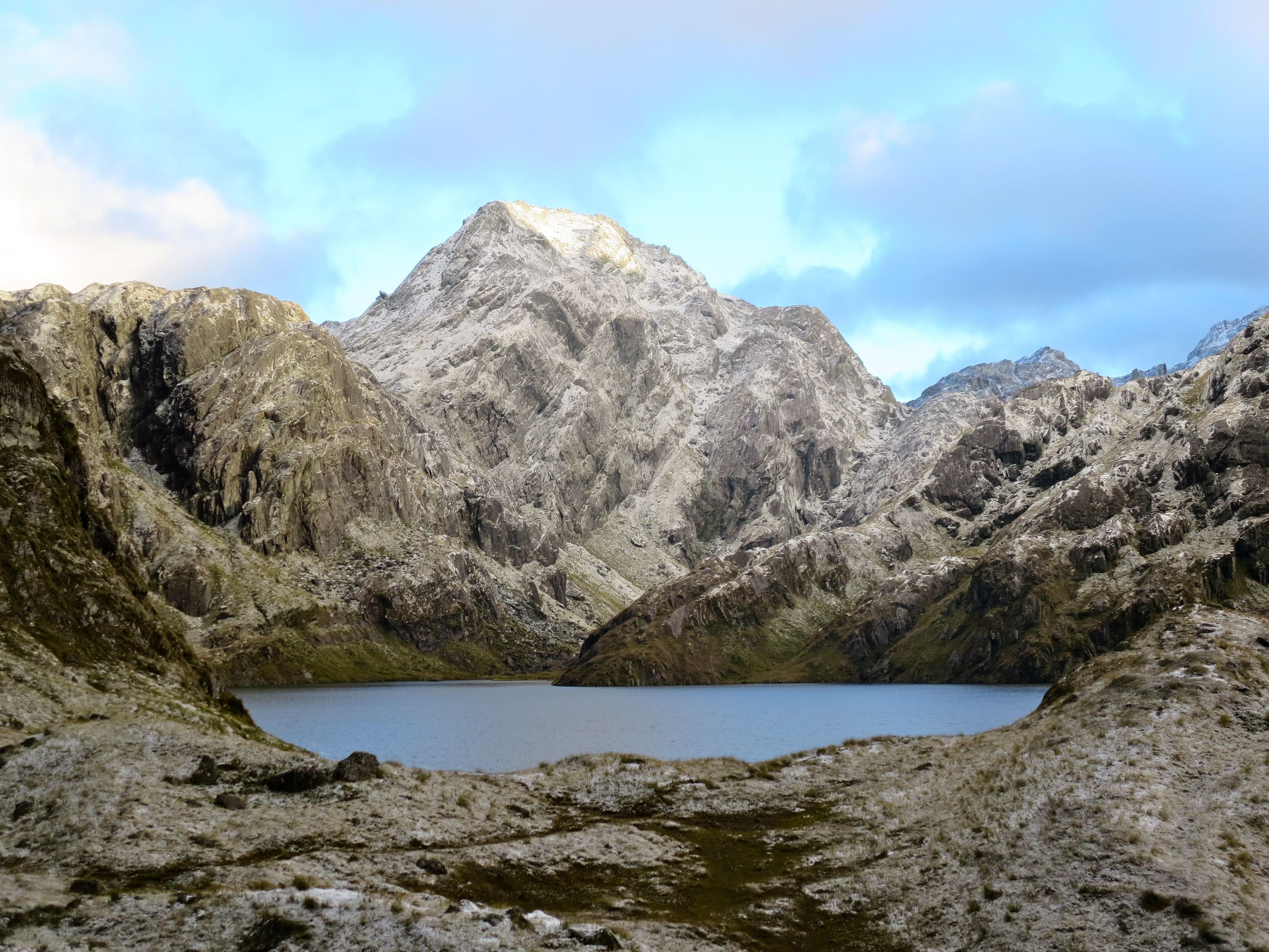
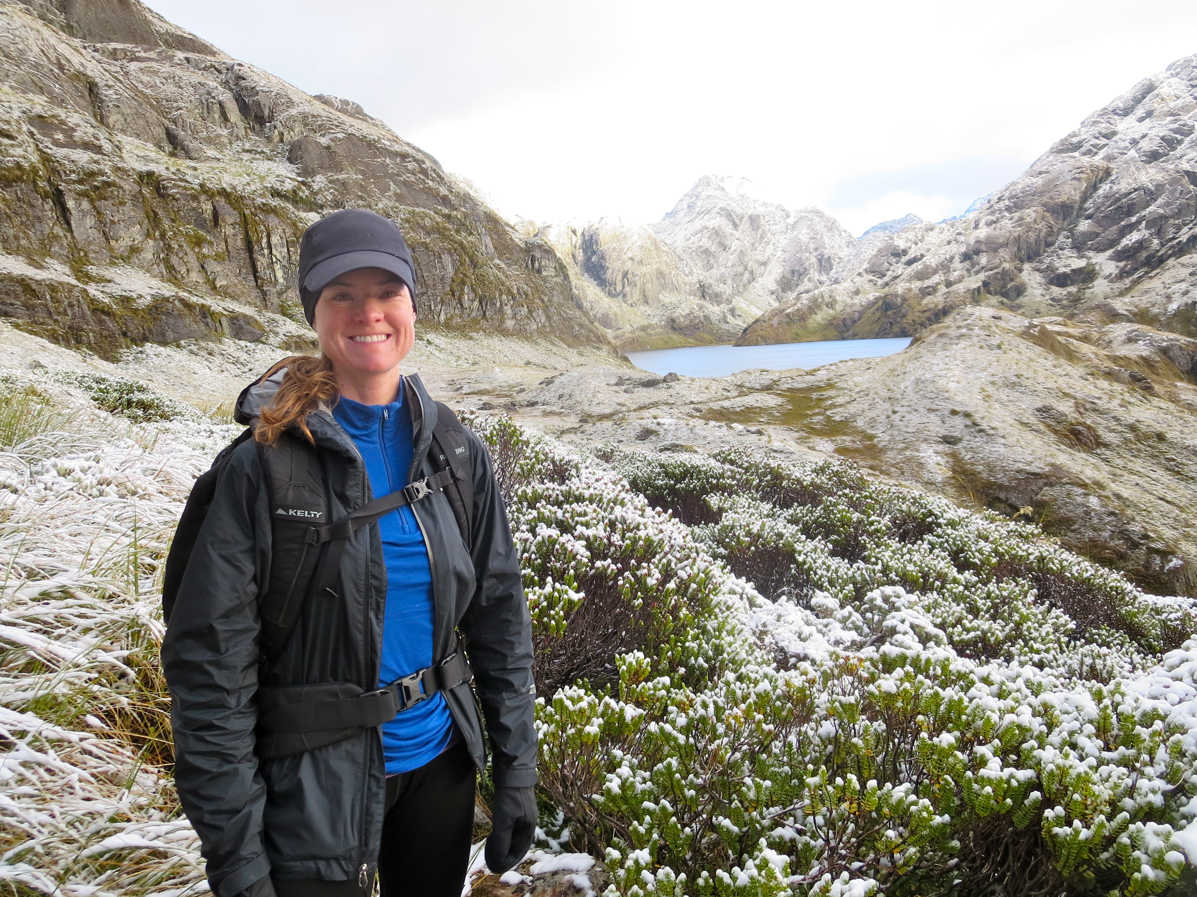
When we reached Lake Harris, the whole area was beautifully draped in snow.
lake harris

alpine flowers covered in snow
a backdrop coated in snow
making our way to the lake
peaks covered in fresh snow
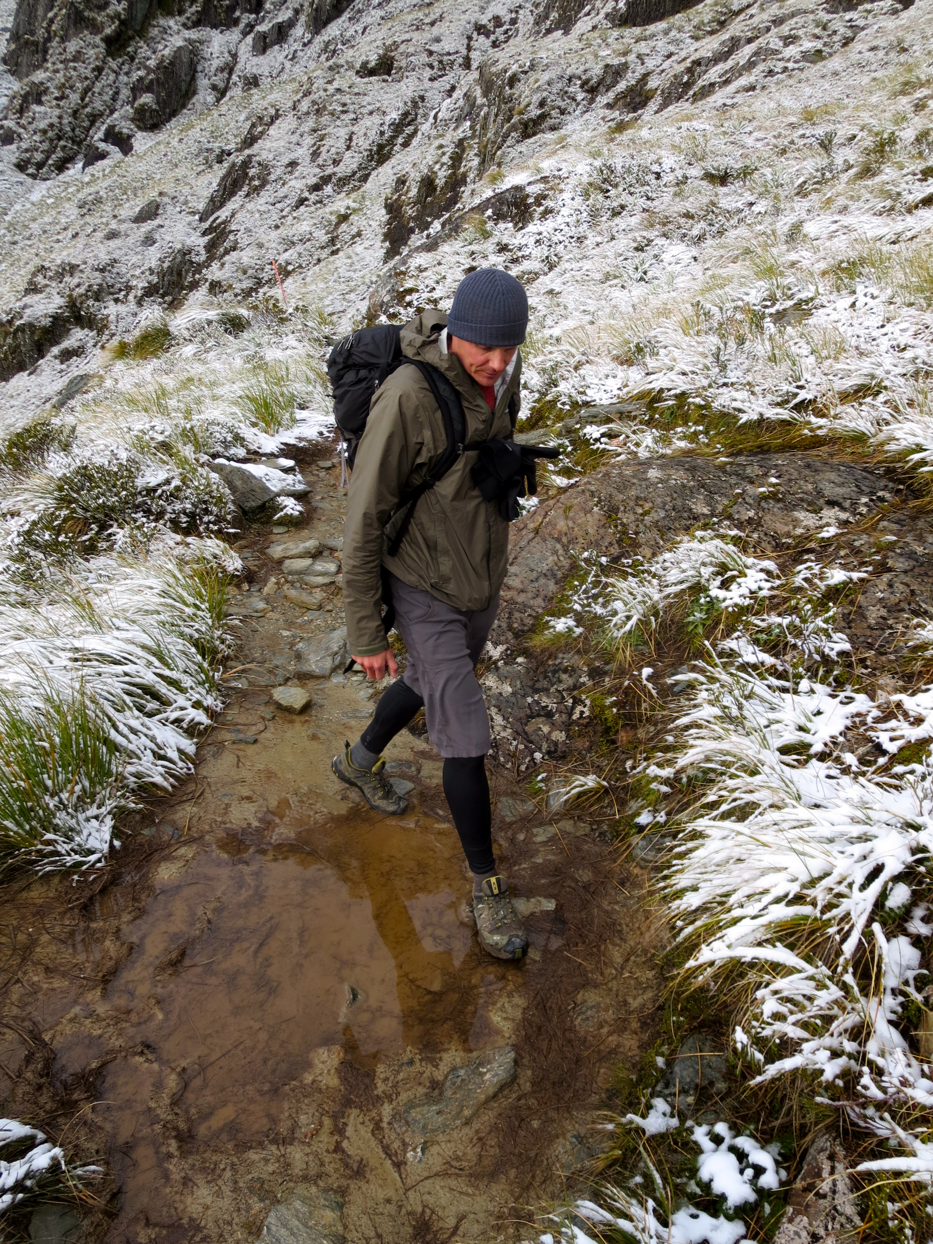
a wet and muddy trail

lake harris

perfect spot for a picture
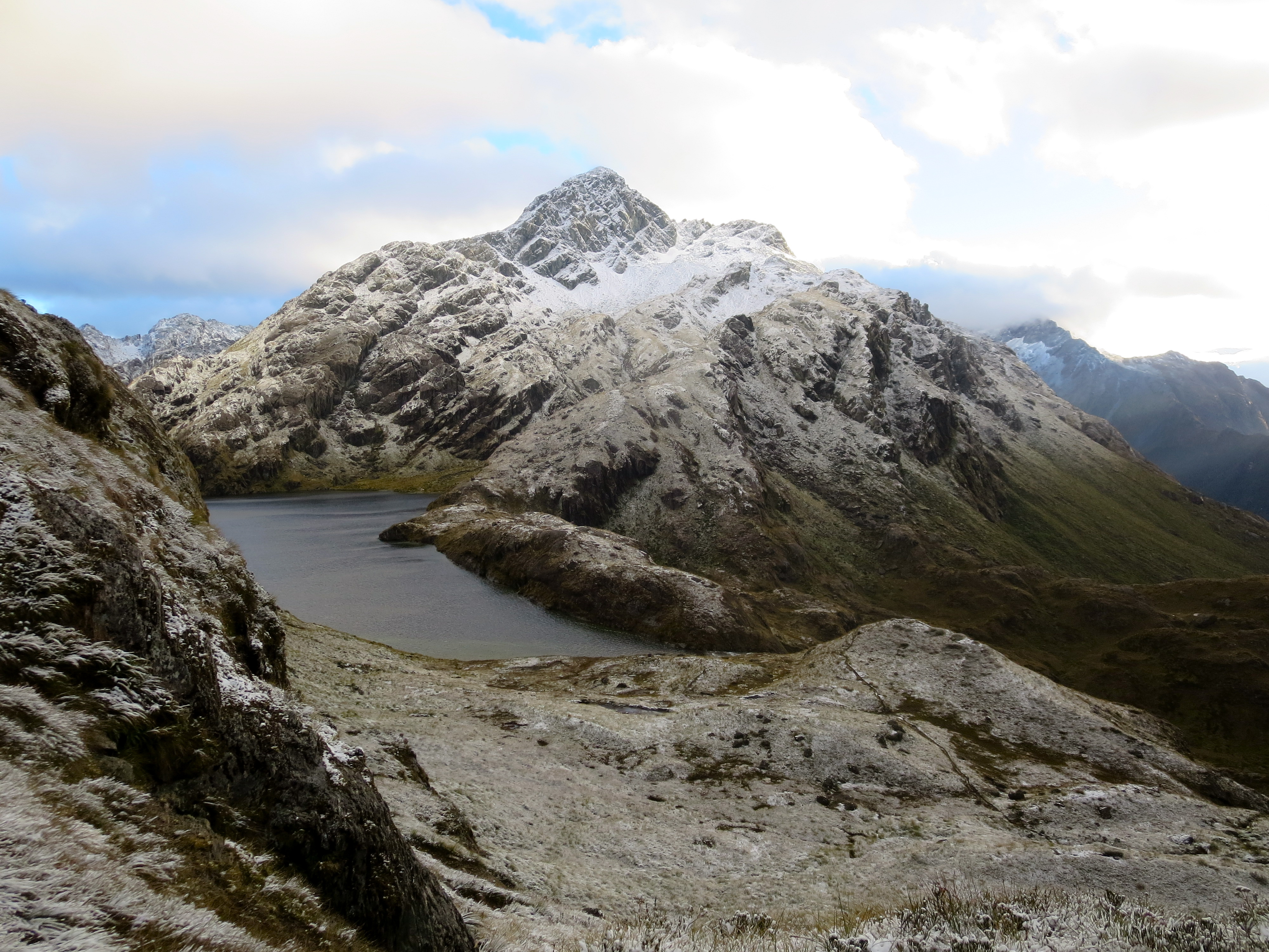
We hiked for almost 3 hours before we saw anyone else on the trail. We absolutely loved the serenity of being alone with nature and not having another person in sight for miles and miles. It was so quiet and peaceful. When we crossed over the saddle, we were thrilled to see the mountain vista before us. Yesterday, the peaks of these mountains were hiding behind clouds. But today, it was clearer and the views were spectacular.

harris saddle
a clear view of the darran mountains today
and another rainbow
couple shot
We hiked for quite some time on the lengthy stretch of trail that winded along the Hollyford Face. Eventually, we could see beautiful Lake Mackenzie below.

approaching lake mackenzie
lake mackenzie

someone pinch me…doesn’t seem real
Next, the trail started to descend, and after some time, we were back in the trees. The entire forest was covered in green moss. Everything is so lush because of the very high rainfall in this area – up to 9 meters (324 inches) fall each year. That’s more than 10 times the annual rainfall where we live (Boulder averages about 25 inches a year).
back below tree line

moss covered trees
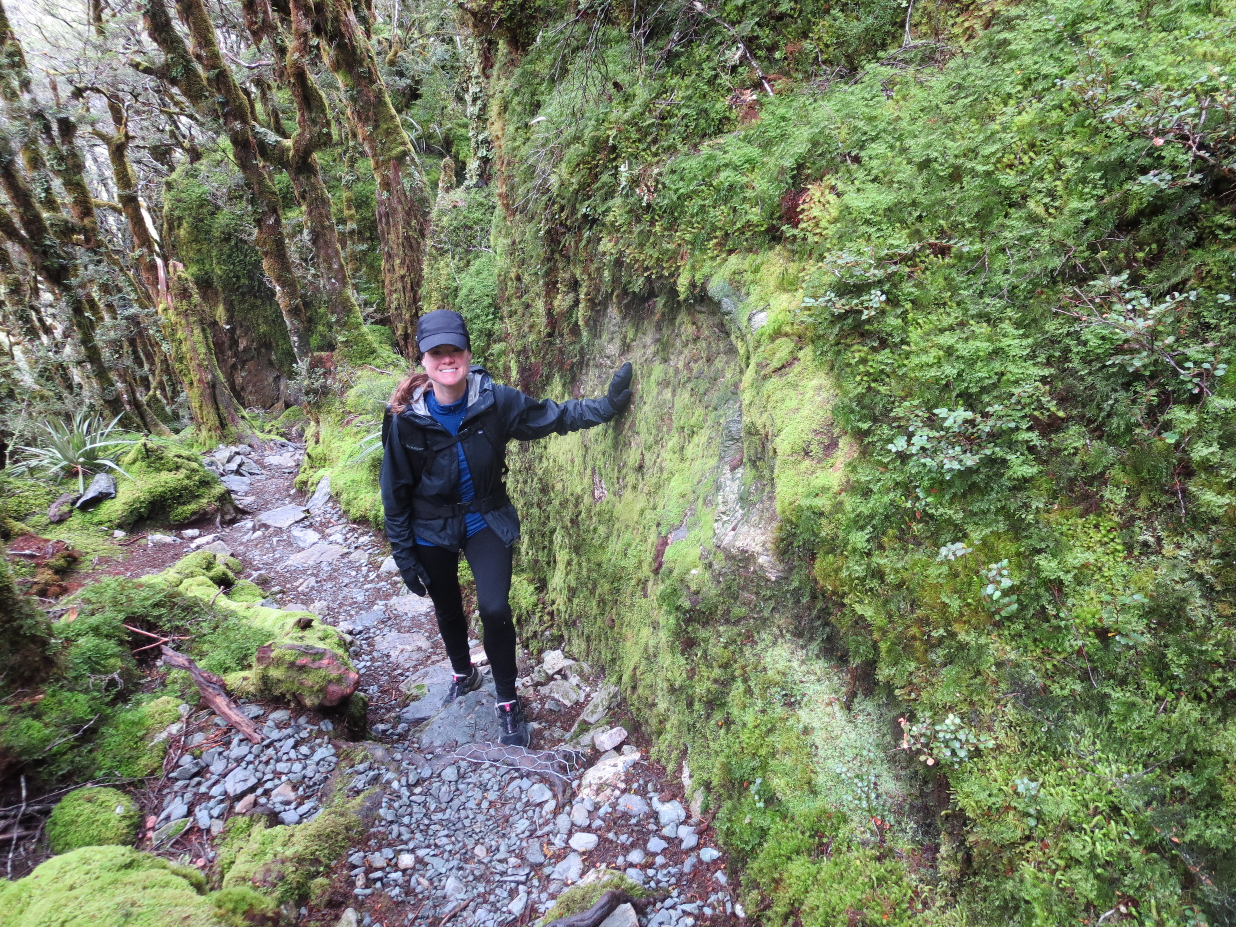
moss covered rock
We stopped at the Lake Mackenzie Hut to eat lunch, then continued on toward Earland Falls, and eventually, made our way back to the trailhead where we started the morning before. The second day took us as long as the first – 7.5 hours to cover 14.5 miles. In total, it took us 15 hours of hiking to do the 29-mile out and back.
so much clearer than yesterday

endless views on this hike

back at beautiful earland falls

long stretches of muddy trail
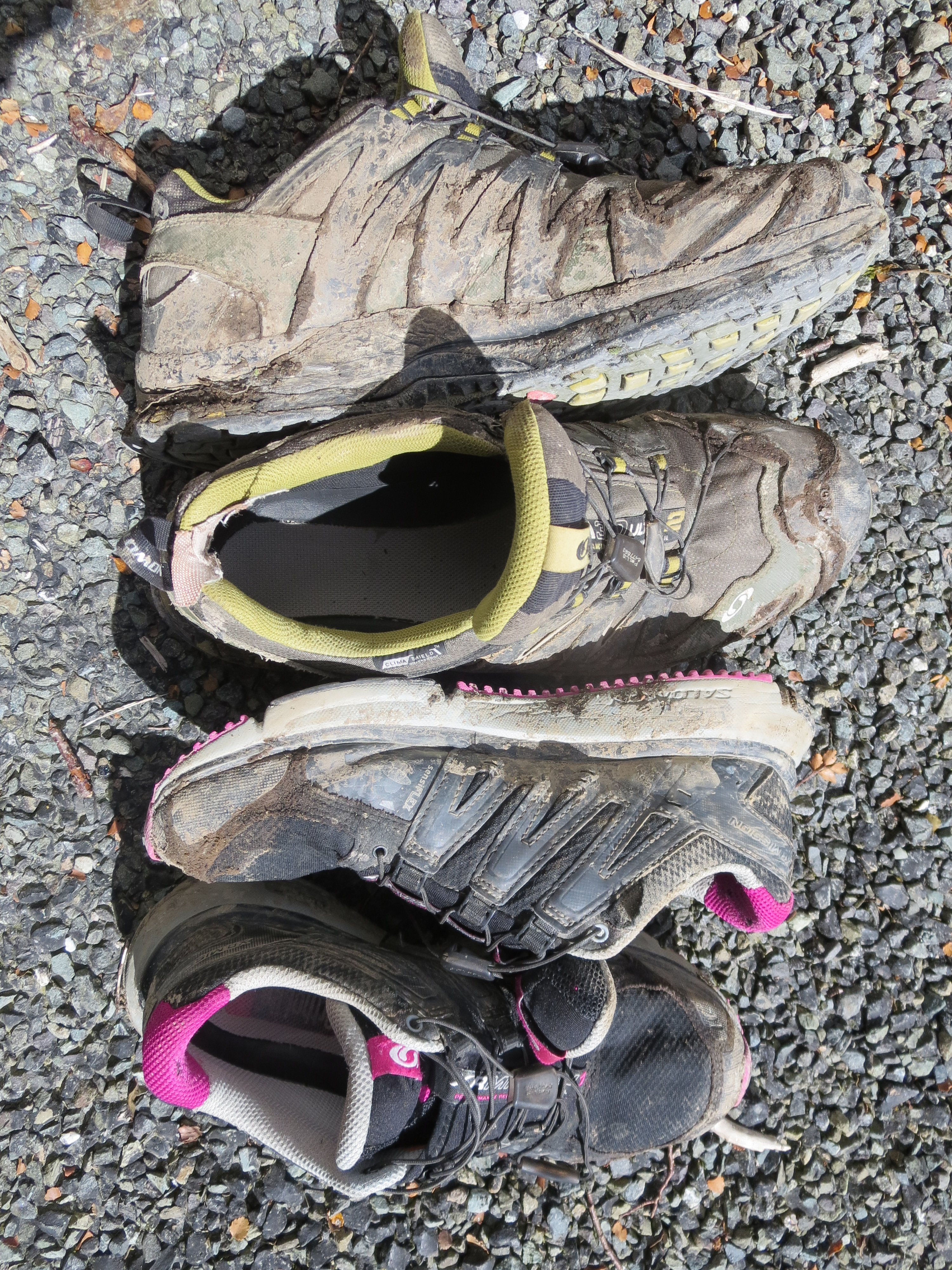
after two long days of hiking, it felt good to take these off
The Routeburn Track ended up being our favorite hike in New Zealand. It has a little bit of everything…lush forests, stunning waterfalls, beautiful mountain vistas, alpine lakes. The weather also had a little bit of everything – rain, snow, sunshine…cloudy skies then clear skies. We experienced all four seasons during our two-day trek. If there were one season it felt the least like, that would be summer (but it was, in fact, summer).
As we reached the campervan the feeling was bittersweet. It was our last “Great Walk” in New Zealand and we had just three days left before flying back to the states.

WOW! That was some spectacular scenery! I’m jealous but to old and lazy to try to do it myself. :>)
Dad
So awesome. Beautiful photos. Glad you have the photos to remember this experience.
I’d say you worked for your reward on that hike. Simply beautiful. It appears as if the decision to make a two-day hike out of it really paid off in the change of scenery. So great when it turns out that way. I bet you will frame at least one of these photos!